Central Banat District
Central Banat District Средњoбанатски округ | |
|---|---|
   .jpg)   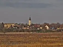 %252C_near_Toma%C5%A1evac.jpg) Images from the Central Banat District | |
 Location of district in Serbia | |
| Coordinates: 45°22′N 20°23′E / 45.367°N 20.383°E | |
| Country | |
| Province | |
| Administrative center | Zrenjanin |
| Government | |
| • Commissioner | Predrag Rađenović |
| Area | |
• Total | 3,256 km2 (1,257 sq mi) |
| Population (2022) | |
• Total | 157,711 |
| • Density | 48/km2 (130/sq mi) |
| ISO 3166 code | RS-02 |
| Municipalities | 4 and 1 city |
| Settlements | 55 |
| - Cities and towns | 4 |
| - Villages | 51 |
| Website | www |
The Central Banat District (Serbian: Средњобанатски округ, romanized: Srednjobanatski okrug, pronounced [srêdɲoːbǎnaːtskiː ôkruːɡ]) is one of administrative districts of Serbia. It lies in the geographical region of Banat. According to the 2022 census, the Central Banat District has a population of 157,711 inhabitants. The administrative center is the city of Zrenjanin.
Cities and municipalities

The Central Banat District encompasses the territories of one city and four municipalities:
- Zrenjanin (city)
- Novi Bečej (municipality)
- Nova Crnja (municipality)
- Sečanj (municipality)
- Žitište (municipality)
Demographics
| Year | Pop. | ±% |
|---|---|---|
| 1948 | 218,821 | — |
| 1953 | 221,667 | +1.3% |
| 1961 | 229,812 | +3.7% |
| 1971 | 231,486 | +0.7% |
| 1981 | 230,962 | −0.2% |
| 1991 | 221,353 | −4.2% |
| 2002 | 208,456 | −5.8% |
| 2011 | 187,667 | −10.0% |
| 2022 | 157,711 | −16.0% |
| Source: [1] | ||
Towns
There are two towns with over 10,000 inhabitants.
- Zrenjanin: 67,129
- Novi Bečej: 10,967
Ethnic structure
| Ethnicity | Population[2] | Percentage |
|---|---|---|
| Serbs | 115,815 | 73.4% |
| Hungarians | 15,765 | 10% |
| Roma | 5,959 | 3.7% |
| Romanians | 3,264 | 2% |
| Slovaks | 1,597 | 1% |
| Others | 4,618 | 2.9% |
| Undeclared/Unknown | 10,693 | 6.8% |
See also
References
- ^ "2011 Census of Population, Households and Dwellings in the Republic of Serbia" (PDF). stat.gov.rs. Statistical Office of the Republic of Serbia. Retrieved 16 January 2017.
- ^ "ETHNICITY. Data by municipalities and cities" (PDF). publikacije.stat.gov.rs. Archived from the original (PDF) on 2025-07-06. Retrieved 2025-07-17.
External links
Wikimedia Commons has media related to Central Banat District.