Chikoy (river)
| Chikoy | |
|---|---|
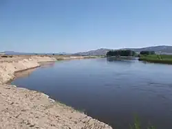 View of the Chikoy River near Povorot village | |
 Location in Buryatia, Russia | |
| Location | |
| Countries | Russia, Mongolia |
| Federal subjects | Transbaikal Krai, Buryatia |
| Physical characteristics | |
| Source | |
| • location | Chikokon Range |
| • coordinates | 49°37′41″N 109°56′23″E / 49.62806°N 109.93972°E |
| • elevation | ca 1,800 m (5,900 ft) |
| Mouth | Selenga |
• coordinates | 51°3′28″N 106°39′4″E / 51.05778°N 106.65111°E |
• elevation | 535 m (1,755 ft) |
| Length | 769 km (478 mi) |
| Basin size | 46,200 km2 (17,800 sq mi) |
| Basin features | |
| Progression | Selenga→ Lake Baikal→ Angara→ Yenisey→ Kara Sea |
The Chikoy (Russian: Чикой; Mongolian: Цѳх гол, Tsökh gol; Buryat: Сүхэ гол, Sükhe gol) is a river in Zabaykalsky Krai and the Buryat Republic in Russia, which partially flows along the Russia-Mongolia border. It is a right tributary of the Selenga. The length of the Chikoy is 769 kilometres (478 mi). The area of its basin is 46,200 square kilometres (17,800 sq mi).[1]
Course
The Chikoy has its source in the Chikokon Range, in the northern slopes of the Bystrinsky Golets peak.[2] Its valley forms the northwestern limit of the Khentei-Daur Highlands.[3] The river usually freezes over in late October or early November and stays icebound until April or early May. Its largest tributary is the Menza.[4]
 |
See also
References
- ^ Russian State Water Register - Chikoy River
- ^ Быстринский Голец, Small Encyclopedia of Transbaikalia
- ^ Khentey, Small Encyclopedia of Transbaikalia
- ^ This article includes content derived from the Great Soviet Encyclopedia, 1969–1978, which is partially in the public domain.
External links
 Media related to Chikoy River at Wikimedia Commons