Dégagnac
Dégagnac | |
|---|---|
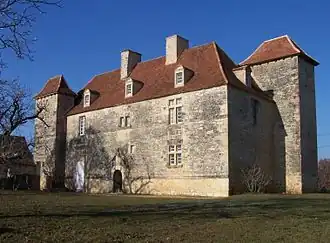 The Château de Lantis, in Dégagnac | |
Location of Dégagnac | |
 Dégagnac  Dégagnac | |
| Coordinates: 44°39′57″N 1°19′00″E / 44.6658°N 1.3167°E | |
| Country | France |
| Region | Occitania |
| Department | Lot |
| Arrondissement | Gourdon |
| Canton | Gourdon |
| Intercommunality | Cazals-Salviac |
| Government | |
| • Mayor (2020–2026) | Didier Pugnet[1] |
Area 1 | 37.9 km2 (14.6 sq mi) |
| Population (2022)[2] | 637 |
| • Density | 17/km2 (44/sq mi) |
| Time zone | UTC+01:00 (CET) |
| • Summer (DST) | UTC+02:00 (CEST) |
| INSEE/Postal code | 46087 /46340 |
| Elevation | 140–306 m (459–1,004 ft) (avg. 185 m or 607 ft) |
| 1 French Land Register data, which excludes lakes, ponds, glaciers > 1 km2 (0.386 sq mi or 247 acres) and river estuaries. | |
Dégagnac (French pronunciation: [deɡaɲak]; Occitan: Deganhac) is a commune in the Lot department in south-western France.
Geography
The river Céou forms all of the commune's north-eastern border.
See also
References
- ^ "Répertoire national des élus: les maires" (in French). data.gouv.fr, Plateforme ouverte des données publiques françaises. 4 May 2022.
- ^ "Populations de référence 2022" (in French). The National Institute of Statistics and Economic Studies. 19 December 2024.
Wikimedia Commons has media related to Dégagnac.