Gammersgill
| Gammersgill | |
|---|---|
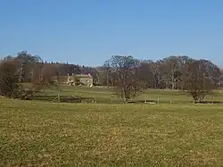 Looking over pastureland to Gammersgill | |
.svg.png) Gammersgill Location within North Yorkshire | |
| Civil parish | |
| Unitary authority | |
| Ceremonial county | |
| Region | |
| Country | England |
| Sovereign state | United Kingdom |
| Police | North Yorkshire |
| Fire | North Yorkshire |
| Ambulance | Yorkshire |
Gammersgill is a hamlet in Coverdale in the Yorkshire Dales, North Yorkshire, England.[1][2] It is about 7 miles (11 km) south-west of Leyburn.
The toponym is of Old Norse origin, from Gamall, a personal name, and skali 'hut', so means 'hut of a man named Gamel'.[3]
From 1974 to 2023 it was part of the district of Richmondshire, it is now administered by the unitary North Yorkshire Council.
See also
References
- ^ Ordnance Survey: Landranger map sheet 98 Wensleydale & Upper Wharfedale (Map). Ordnance Survey. 2009. ISBN 9780319231586.
- ^ "Ordnance Survey: 1:50,000 Scale Gazetteer" (csv (download)). www.ordnancesurvey.co.uk. Ordnance Survey. 1 January 2016. Retrieved 18 February 2016.
- ^ Smith, A. H. (1928). The Place-names of the North Riding of Yorkshire (PDF). Cambridge University Press. p. 254.
External links
![]() Media related to Gammersgill at Wikimedia Commons
Media related to Gammersgill at Wikimedia Commons