Hainer See
| Hainer See | |
|---|---|
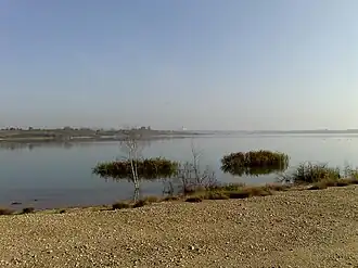 View of Hainer See Lake | |
 Hainer See | |
| Location | Saxony |
| Coordinates | 51°10′12.13″N 12°28′0.87″E / 51.1700361°N 12.4669083°E |
| Basin countries | Germany |
| Surface area | 4 km2 (1.5 sq mi) |
| Max. depth | 49 m (161 ft) |
| Water volume | 73,000,000 m3 (2.6×10⁹ cu ft) |
| Shore length1 | 12 km (7.5 mi) |
| Surface elevation | 126 m (413 ft) |
| Settlements | Borna |
| 1 Shore length is not a well-defined measure. | |
Hainer See is a lake near Borna, Saxony, Germany. At an elevation of 126 m, its surface area is 4 km2 (2 sq mi). The lake is a part of the Central German Lake District.