Hochneukirchen-Gschaidt
Hochneukirchen-Gschaidt | |
|---|---|
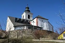 Hochneukirchen parish church | |
 Coat of arms | |
 Hochneukirchen-Gschaidt Location within Austria  Hochneukirchen-Gschaidt Hochneukirchen-Gschaidt (Austria) | |
| Coordinates: 47°27′00″N 16°12′00″E / 47.45000°N 16.20000°E | |
| Country | Austria |
| State | Lower Austria |
| District | Wiener Neustadt-Land |
| Government | |
| • Mayor | Friedrich Beiglböck (ÖVP) |
| Area | |
• Total | 35.13 km2 (13.56 sq mi) |
| Elevation | 769 m (2,523 ft) |
| Population (2018-01-01)[2] | |
• Total | 1,633 |
| • Density | 46/km2 (120/sq mi) |
| Time zone | UTC+1 (CET) |
| • Summer (DST) | UTC+2 (CEST) |
| Postal code | 2852 |
| Area code | 02648 |
| Vehicle registration | WB |
| Website | www.hochneukirchen-gschaidt.at |
Hochneukirchen-Gschaidt is an Austrian market town in the district of Wiener Neustadt-Land. The municipality was formed by merging the former municipalities of Hochneukirchen and Gschaidt.
References
- ^ "Dauersiedlungsraum der Gemeinden Politischen Bezirke und Bundesländer - Gebietsstand 1.1.2018". Statistics Austria. Retrieved 10 March 2019.
- ^ "Einwohnerzahl 1.1.2018 nach Gemeinden mit Status, Gebietsstand 1.1.2018". Statistics Austria. Retrieved 9 March 2019.
