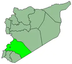
Jubb al-Safa (Arabic: جب الصفا; also spelled Jeb Safa) is a village in southern Syria, administratively part of the Markaz Rif Dimashq District of the Rif Dimashq Governorate, located just east of Damascus. Nearby localities include al-Buwaydah to the southeast, al-Masmiyah to the south, Ghabaghib to the southwest, Kanakir to the west, Khan Dannun to the northwest, Deir Ali to the north and Khirbet al-Ward to the northeast. According to the Syria Central Bureau of Statistics (CBS), Beit Sawa had a population of 2,499 in the 2004 census.[1]
References
External links
|
|---|
|
|---|
Kiswah
Subdistrict | |
|---|
Babbila
Subdistrict | |
|---|
Jaramana
Subdistrict | |
|---|
Malihah
Subdistrict | |
|---|
Kafr Batna
Subdistrict | |
|---|
Arbin
Subdistrict | |
|---|
|
| |
|
|---|
Douma
Subdistrict | |
|---|
Harasta
Subdistrict | |
|---|
Sabe Biyar
Subdistrict | |
|---|
Dumayr
Subdistrict | |
|---|
Nashabiyeh
Subdistrict | |
|---|
Ghazlaniyeh
Subdistrict | |
|---|
Harran al-Awamid
Subdistrict | |
|---|
|
|
|
|---|
Qutayfah
Subdistrict | |
|---|
Jayrud
Subdistrict | |
|---|
Maloula
Subdistrict | |
|---|
Raheiba
Subdistrict | |
|---|
|
|
|
|---|
Al-Tall
Subdistrict | |
|---|
Sednaya
Subdistrict | |
|---|
Rankous
Subdistrict | |
|---|
|
|
|
|---|
Yabroud
Subdistrict | |
|---|
Assal al-Ward
Subdistrict | |
|---|
|
|
|
|---|
An-Nabek
Subdistrict | |
|---|
Deir Atiyeh
Subdistrict | |
|---|
Qara
Subdistrict | |
|---|
|
|
|
|---|
Al-Zabadani
Subdistrict | |
|---|
Madaya
Subdistrict | |
|---|
Serghaya
Subdistrict | |
|---|
|
|
|
|---|
Qatana
Subdistrict | |
|---|
Beit Jann
Subdistrict | |
|---|
Sa'sa
Subdistrict | |
|---|
|
|
|
|---|
Darayya
Subdistrict | |
|---|
Sahnaya
Subdistrict | |
|---|
Hajar al-Aswad
Subdistrict | |
|---|
|
|
|
|---|
Qudsaya
Subdistrict | |
|---|
ad-Dimas
Subdistrict | |
|---|
Ein al-Fijeh
Subdistrict | |
|---|
|
|