Kazennyi Torets
| Kazennyi Torets Казенний Торець | |
|---|---|
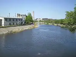 The river near Kramatorsk | |
| Location | |
| Country | |
| Physical characteristics | |
| Source | |
| • location | Lozuvatske, Donetsk Oblast, Ukraine |
| • coordinates | 48°16′12″N 37°30′37″E / 48.27000°N 37.51028°E |
| Mouth | |
• location | Siverskyi Donets |
• coordinates | 48°53′40″N 37°45′35″E / 48.89444°N 37.75972°E |
| Length | 129 km (80 mi) |
| Basin size | 5,410 km2 (2,090 sq mi) |
| Basin features | |
| Progression | Donets→ Don→ Sea of Azov |
| River system | Don Basin |
The Kazennyi Torets[1] (Ukrainian: Казенний Торець; Russian: Казённый Торец) is a river in eastern Ukraine. The river travels in the Kramatorsk and Pokrovsk Districts in the Donetsk Oblast, and is a right tributary of the Siverskyi Donets.
Characteristics
The river has a total length of 88 kilometres (55 mi), and a basin size of 1,590 square kilometres (610 sq mi). The river begins in the village of Lozuvatske, near the city of Pokrovsk.[2]
The river flows through the cities of Druzhkivka, Kramatorsk, and Sloviansk before flowing into the Siverskyi Donets in the town of Raihorodok.