La Vieux-Rue
La Vieux-Rue | |
|---|---|
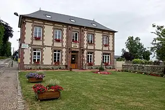 The town hall in La Vieux-Rue | |
Location of La Vieux-Rue | |
 La Vieux-Rue  La Vieux-Rue | |
| Coordinates: 49°29′37″N 1°14′57″E / 49.4936°N 1.2492°E | |
| Country | France |
| Region | Normandy |
| Department | Seine-Maritime |
| Arrondissement | Rouen |
| Canton | Le Mesnil-Esnard |
| Government | |
| • Mayor (2020–2026) | Thierry Vanderpert[1] |
Area 1 | 5.51 km2 (2.13 sq mi) |
| Population (2022)[2] | 576 |
| • Density | 100/km2 (270/sq mi) |
| Time zone | UTC+01:00 (CET) |
| • Summer (DST) | UTC+02:00 (CEST) |
| INSEE/Postal code | 76740 /76160 |
| Elevation | 124–176 m (407–577 ft) (avg. 164 m or 538 ft) |
| 1 French Land Register data, which excludes lakes, ponds, glaciers > 1 km2 (0.386 sq mi or 247 acres) and river estuaries. | |
La Vieux-Rue (French pronunciation: [la vjø ʁy]) is a commune in the Seine-Maritime department in the Normandy region in northern France.
Geography
La Vieux-Rue (literally, "The Old Street") is a farming village situated some 9 miles (14 km) northeast of Rouen, at the junction of the D15 and the D61 roads.
Population
| Year | Pop. | ±% p.a. |
|---|---|---|
| 1968 | 196 | — |
| 1975 | 249 | +3.48% |
| 1982 | 311 | +3.23% |
| 1990 | 374 | +2.33% |
| 1999 | 407 | +0.94% |
| 2007 | 449 | +1.24% |
| 2012 | 522 | +3.06% |
| 2017 | 571 | +1.81% |
| Source: INSEE[3] | ||
Places of interest
- The church of St. Martin, dating from the thirteenth century.
- The chateau, dating from the seventeenth century.
- The sixteenth-century manorhouse of Saint-Saire.
See also
References
- ^ Liste des maires du département de la Seine-Maritime, 10 August 2020
- ^ "Populations de référence 2022" (in French). The National Institute of Statistics and Economic Studies. 19 December 2024.
- ^ Population en historique depuis 1968, INSEE
External links
Wikimedia Commons has media related to La Vieux-Rue.
- Website of the Mairie (in French)
- Website of a local association Archived 2010-06-02 at the Wayback Machine (in French)