List of listed buildings in Edinburgh/4
This is a list of listed buildings in Edinburgh, Scotland.
List
| Name | Location | Date Listed | Grid Ref. [note 1] | Geo-coordinates | Notes | LB Number [note 2] | Image |
|---|---|---|---|---|---|---|---|
| 15-17A (Odd Nos) Dundas Street, Including Railings | 55°57′24″N 3°11′55″W / 55.956632°N 3.198512°W | Category B | 28704 |  Upload Photo | |||
| 79-85 (Odd Nos) Dundas Street And 34B Cumberland Street, Including Railings | 55°57′32″N 3°11′59″W / 55.958838°N 3.199814°W | Category B | 28711 | Upload Photo | |||
| 22 And 22A Dundas Street, And 37 Northumberland Street, Including Railings | 55°57′25″N 3°11′58″W / 55.956973°N 3.199436°W | Category B | 28716 | Upload Photo | |||
| 1-7 (Odd Nos) Dundonald Street, And 1 And 3 Cumberland Street, Including Railings And Lamp | 55°57′32″N 3°11′50″W / 55.958972°N 3.197143°W | Category A | 28723 | Upload Photo | |||
| Dean Street 33-41 And 1 Raeburn Street | 55°57′30″N 3°12′44″W / 55.958295°N 3.212147°W | Category B | 28641 | Upload Photo | |||
| Dean Terrace 2-6A | 55°57′28″N 3°12′34″W / 55.957871°N 3.20957°W | Category A | 28642 | Upload Photo | |||
| Dean Terrace 7-10A | 55°57′27″N 3°12′36″W / 55.957445°N 3.210038°W | Category B | 28643 | Upload Photo | |||
| Dean Terrace 11-15A And 1, 1A Carlton Street | 55°57′27″N 3°12′37″W / 55.957372°N 3.210148°W | Category A | 28644 | Upload Photo | |||
| Dean Terrace 16-21 And 2 Carlton Street And 1 Danube Street | 55°57′24″N 3°12′41″W / 55.956561°N 3.211307°W | Category A | 28645 |  | |||
| Dean Terrace Upper 1-6 | 55°57′22″N 3°12′42″W / 55.956134°N 3.211759°W | Category A | 28647 |  | |||
| 1-9C (Inclusive Nos) Doune Terrace, Including Railings And Lamp, With 8-11 (Inclusive Nos) Gloucester Square | 55°57′21″N 3°12′28″W / 55.95594°N 3.207668°W | Category A | 28659 | Upload Photo | |||
| 1-10 (Inclusive Nos) Drummond Place, And 70-76 (Even Nos) Dublin Street And 31 And 31A Nelson Street, Including Railings And Lamps With Dublin Meuse | 55°57′29″N 3°11′40″W / 55.958019°N 3.194471°W | Category A | 28665 | Upload Photo | |||
| 21-30 (Inclusive Nos) Drummond Place, And 2 And 2A-D Scotland Street And 2-6 (Even Nos) Dundonald Street(Includes 1,2,3,13 And 14 West Scotland Street Lane), Including Railings And Lamps | 55°57′33″N 3°11′43″W / 55.959133°N 3.195386°W | Category A | 28668 | Upload Photo | |||
| 37-42 (Inclusive Nos) Drummond Place, And 77 Dublin Street And 1-3A (Odd Nos) London Street, Including Railings And Lamps With 2 And 3 Dublin Street Lane North | 55°57′31″N 3°11′36″W / 55.958497°N 3.19338°W | Category A | 28670 | Upload Photo | |||
| 1, 2, 3, Riverside And 10,11,12,13,14 And 15 Cramond Village | 55°58′48″N 3°18′02″W / 55.979903°N 3.30052°W | Category A | 28606 | Upload Photo | |||
| 16 Cramond Glebe Road, Cramond Manse Including Former Stables, Boundary Wall, Gatepiers And Gates | 55°58′39″N 3°17′58″W / 55.977427°N 3.299331°W | Category B | 28608 | Upload Photo | |||
| 59-73 (Odd Nos) Cumberland Street, Including Railings | 55°57′29″N 3°12′06″W / 55.958181°N 3.201796°W | Category B | 28611 | Upload Photo | |||
| 4-34A (Even Nos) Cumberland Street And 1-12B Cumberland Street Lane North East, Including Railings | 55°57′32″N 3°11′55″W / 55.959003°N 3.198586°W | Category B | 28613 | Upload Photo | |||
| 79 Dalkeith Road Including Boundary Walls And Pedestrian Gates | 55°56′12″N 3°10′13″W / 55.936767°N 3.1703°W | Category B | 28617 | Upload Photo | |||
| 81 Dalkeith Road Including Boundary Walls And Pedestrian Gates | 55°56′12″N 3°10′12″W / 55.936616°N 3.170023°W | Category C(S) | 28618 | Upload Photo | |||
| 78 And 80 Dalkeith Road, Including Boundary Walls And Piers | 55°56′13″N 3°10′17″W / 55.936998°N 3.171427°W | Category B | 28626 | Upload Photo | |||
| Danube Street 3-23 | 55°57′25″N 3°12′43″W / 55.957039°N 3.212011°W | Category A | 28630 |  | |||
| Danube Street 4-34A | 55°57′23″N 3°12′43″W / 55.956385°N 3.211831°W | Category A | 28631 |  | |||
| 1-11 (Odd Nos) Darnaway Street, And 1-4 (Inclusive Nos) Gloucester Lane, Including Railings And Lamps | 55°57′17″N 3°12′25″W / 55.95485°N 3.207042°W | Category A | 28632 | Upload Photo | |||
| Dean Path, 1-25 Dean Path Buildings | 55°57′09″N 3°13′05″W / 55.952593°N 3.218166°W | Category B | 28634 |  | |||
| Dean Street 11-31 | 55°57′31″N 3°12′41″W / 55.958491°N 3.21148°W | Category B | 28640 | Upload Photo | |||
| 1-11 (Inclusive Numbers) Coates Crescent, 2 Stafford Street, 1 Walker Street, Including Railings | 55°56′57″N 3°12′41″W / 55.949148°N 3.211252°W | Category A | 28563 |  | |||
| 1-31 (Odd Nos) Coates Gardens, Including Railings | 55°56′49″N 3°13′19″W / 55.946867°N 3.222006°W | Category B | 28565 | Upload Photo | |||
| 33-43 (Odd Nos) Coates Gardens, Including Railings | 55°56′51″N 3°13′19″W / 55.947388°N 3.222022°W | Category B | 28566 | Upload Photo | |||
| 2-40 (Even Nos) Coates Gardens, Including Railings | 55°56′49″N 3°13′17″W / 55.946848°N 3.221284°W | Category B | 28567 | Upload Photo | |||
| 9 Cockburn Street | 55°57′03″N 3°11′27″W / 55.950713°N 3.190835°W | Category B | 28571 | Upload Photo | |||
| 19 And 21 Cockburn Street | 55°57′03″N 3°11′25″W / 55.950708°N 3.190402°W | Category B | 28574 | Upload Photo | |||
| 1, 3, 5, 7 Coltbridge Terrace, Including Boundary Walls | 55°56′50″N 3°14′10″W / 55.947149°N 3.236074°W | Category B | 28581 | Upload Photo | |||
| Comely Bank 4-23 | 55°57′34″N 3°13′16″W / 55.959529°N 3.220979°W | Category B | 28583 | Upload Photo | |||
| Cowgate, Gateway At East Of St Patrick's Roman Catholic Church | 55°56′58″N 3°11′02″W / 55.949307°N 3.183809°W | Category C(S) | 28593 |  | |||
| 1-15 (Odd Nos) Cowgatehead | 55°56′52″N 3°11′37″W / 55.947712°N 3.193609°W | Category C(S) | 28598 | Upload Photo | |||
| 7-21 (Inclusive Nos) Claremont Crescent | 55°57′50″N 3°11′30″W / 55.963921°N 3.191785°W | Category A | 28524 | Upload Photo | |||
| 2-24 (Even Nos) East Claremont Street Including Boundary Walls And Railings | 55°57′39″N 3°11′33″W / 55.960912°N 3.192606°W | Category B | 28535 | Upload Photo | |||
| Clarendon Crescent 1-22 And 1, 1A Oxford Terrace | 55°57′15″N 3°12′52″W / 55.954175°N 3.214452°W | Category A | 28544 | Upload Photo | |||
| Clerk Street 46-66, And 3-5 Montague Street And 1-3 Rankeillor Street | 55°56′32″N 3°10′54″W / 55.942156°N 3.181798°W | Category B | 28549 | Upload Photo | |||
| Clerk Street South, 11-29 | 55°56′28″N 3°10′51″W / 55.941221°N 3.180889°W | Category C(S) | 28550 | Upload Photo | |||
| Clerk Street South 12-32 And 18 Hope Park Terrace | 55°56′26″N 3°10′52″W / 55.940662°N 3.181128°W | Category C(S) | 28555 | Upload Photo | |||
| Clerk Street South, 44-74 | 55°56′24″N 3°10′50″W / 55.93994°N 3.18053°W | Category C(S) | 28556 | Upload Photo | |||
| Causeway, The Ian's Hill House Duddingston | 55°56′34″N 3°08′46″W / 55.942788°N 3.146241°W | Category B | 28493 | Upload Photo | |||
| 32 Chambers Street, Bank Of Scotland | 55°56′50″N 3°11′28″W / 55.94734°N 3.191147°W | Category B | 28497 | Upload Photo | |||
| 12-17 (Inclusive Nos) Charlotte Square With 10-18 (Even Nos) Randolph Lane, Railings, Lamp Standards And Boundary Walls | 55°57′07″N 3°12′34″W / 55.951926°N 3.209321°W | Category A | 28503 |  | |||
| 18-23 (Inclusive Nos) Charlotte Square With Railings, Lamp Standards And Boundary Walls | 55°57′04″N 3°12′33″W / 55.951234°N 3.209235°W | Category A | 28504 | 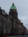 | |||
| 40-46 (Inclusive Nos) Charlotte Square And 143 George Street With Railings And Lamp Standards | 55°57′08″N 3°12′23″W / 55.952178°N 3.206446°W | Category A | 28507 |  | |||
| 1 North Charlotte Street With Railings And Boundary Walls | 55°57′10″N 3°12′24″W / 55.952787°N 3.206721°W | Category A | 28508 | Upload Photo | |||
| 15 South Charlotte Street With Railings And Lamp Standard | 55°57′04″N 3°12′21″W / 55.951195°N 3.205887°W | Category A | 28515 |  | |||
| 3-21 (Odd Numbers) Chester Street | 55°57′00″N 3°12′59″W / 55.95004°N 3.216485°W | Category B | 28517 | Upload Photo | |||
| 23-35 (Odd Numbers) Chester Street | 55°56′59″N 3°13′03″W / 55.949618°N 3.2174°W | Category B | 28518 | Upload Photo | |||
| Cheyne Street 1-31 (Odd Nos) And 43, 45, 47 Dean Street | 55°57′30″N 3°12′45″W / 55.958283°N 3.212466°W | Category B | 28520 | Upload Photo | |||
| 95 Canongate, 4 Reid' Court (Russell House) | 55°57′08″N 3°10′39″W / 55.952135°N 3.17749°W | Category B | 28430 | Upload Photo | |||
| 297 And 299 Canongate, 2 Jeffrey Street And 1 Cranston Street | 55°57′03″N 3°11′03″W / 55.950805°N 3.184047°W | Category B | 28439 |  | |||
| 82 And 84 Canongate, (Nisbet Of Dirleton's House) | 55°57′07″N 3°10′37″W / 55.951979°N 3.176893°W | Category B | 28441 |  | |||
| 174 Canongate, Moray House Including Gates, Gatepiers, Porters Lodge And Summerhouse | 55°57′04″N 3°10′50″W / 55.951019°N 3.180515°W | Category A | 28449 |  | |||
| Canongate, Moray House, Garden Gateway | 55°57′01″N 3°10′49″W / 55.950338°N 3.180286°W | Category B | 28450 |  | |||
| 176-184 (Even Nos) Canongate St John's Land | 55°57′03″N 3°10′52″W / 55.95095°N 3.181169°W | Category C(S) | 28451 | Upload Photo | |||
| Canongate, 3, 4, 5, 6 And 6B Chessel's Court (S Block) Including St Saviour's Child Garden | 55°57′01″N 3°10′59″W / 55.950374°N 3.183089°W | Category A | 28454 | %252C_Edinburgh.jpg) | |||
| Carlton Street 3-13 | 55°57′26″N 3°12′38″W / 55.957304°N 3.210626°W | Category A | 28457 | Upload Photo | |||
| 1 Carlton Terrace Including Railings And Boundary Walls | 55°57′22″N 3°10′25″W / 55.956189°N 3.173577°W | Category A | 28460 |  | |||
| 15-19 (Odd Nos) Castle Street With Railings | 55°57′06″N 3°12′10″W / 55.951648°N 3.202746°W | Category B | 28462 | Upload Photo | |||
| 21 And 21A Castle Street With Railings | 55°57′08″N 3°12′11″W / 55.952132°N 3.202921°W | Category B | 28463 | Upload Photo | |||
| 63-69 (Odd Nos) North Castle Street And 59 Queen Street With Railings | 55°57′13″N 3°12′14″W / 55.953722°N 3.203852°W | Category A | 28468 | Upload Photo | |||
| 8-12 (Inclusive Nos) Castle Terrace, Including Boundary Wall And Railings | 55°56′54″N 3°12′19″W / 55.94837°N 3.205367°W | Category B | 28483 | Upload Photo | |||
| Buccleuch Place 22, 22A | 55°56′33″N 3°11′16″W / 55.942467°N 3.187716°W | Category B | 28389 | Upload Photo | |||
| Buccleuch Place 23-25 | 55°56′33″N 3°11′16″W / 55.942457°N 3.187843°W | Category B | 28390 |  | |||
| 7-15 (Odd Numbers) Buccleuch Street | 55°56′36″N 3°11′04″W / 55.943432°N 3.184543°W | Category C(S) | 28393 | Upload Photo | |||
| 2,4 Buccleuch Street | 55°56′37″N 3°11′07″W / 55.943561°N 3.185219°W | Category B | 28397 | Upload Photo | |||
| 36-42 Buccleuch Street | 55°56′34″N 3°11′05″W / 55.942811°N 3.184684°W | Category B | 28399 | Upload Photo | |||
| 90,92 Buccleuch Street | 55°56′30″N 3°11′02″W / 55.941748°N 3.184027°W | Category B | 28402 |  | |||
| 1-34 (Inclusive Numbers) Buckingham Terrace, Including Railings And Boundary Walls | 55°57′16″N 3°12′58″W / 55.954437°N 3.216174°W | Category B | 28405 |  | |||
| 35-40 (Inclusive Numbers) Buckingham Terrace, And 10A Belgrave Place, Including Railings | 55°57′17″N 3°13′14″W / 55.954707°N 3.220635°W | Category B | 28406 | Upload Photo | |||
| 24 Calton Hill Including Railings And Boundary Wall | 55°57′16″N 3°11′08″W / 55.95442°N 3.185599°W | Category B | 28409 | Upload Photo | |||
| Canon Street 8 | 55°57′43″N 3°11′55″W / 55.961977°N 3.198629°W | Category C(S) | 28423 | Upload Photo | |||
| 22 And 24 Blacket Place, Including Boundary Walls | 55°56′14″N 3°10′30″W / 55.937134°N 3.175098°W | Category B | 28314 | Upload Photo | |||
| 30 And 32 Blacket Place, Including Boundary Walls | 55°56′12″N 3°10′31″W / 55.936682°N 3.175356°W | Category B | 28316 | Upload Photo | |||
| 34 And 36 Blacket Place, Including Boundary Walls | 55°56′11″N 3°10′31″W / 55.936522°N 3.175207°W | Category B | 28317 | Upload Photo | |||
| 38, 40 And 42 Blacket Place, Including Boundary Walls | 55°56′11″N 3°10′30″W / 55.936442°N 3.175093°W | Category B | 28318 | Upload Photo | |||
| 44 Blacket Place, Including Boundary Walls | 55°56′10″N 3°10′29″W / 55.936211°N 3.174813°W | Category B | 28319 | Upload Photo | |||
| 5-9 (Odd Nos) Blackfriars Street | 55°57′01″N 3°11′10″W / 55.950157°N 3.186029°W | Category B | 28321 | Upload Photo | |||
| 17-25 (Odd Nos) Blair Street | 55°56′57″N 3°11′16″W / 55.949223°N 3.187874°W | Category B | 28331 | Upload Photo | |||
| 1-5 (Inclusive Nos) Blenheim Place Including Railings | 55°57′27″N 3°11′03″W / 55.957614°N 3.184239°W | Category A | 28334 | Upload Photo | |||
| 6-10 (Inclusive Nos) Blenheim Place And 2 And 3 Greenside End Including Railings And Boundary Walls | 55°57′27″N 3°10′59″W / 55.957418°N 3.183144°W | Category A | 28335 | Upload Photo | |||
| Boswall Road St Columba's Hospice, Challenger Lodge (Original House, Garden Walls And Gatepiers) | 55°58′48″N 3°12′46″W / 55.980088°N 3.212796°W | Category B | 28340 | Upload Photo | |||
| Brandon Street 1-16 And 1-7A Eyre Place | 55°57′41″N 3°12′04″W / 55.961386°N 3.201174°W | Category B | 28341 | Upload Photo | |||
| Brandon Terrace 11-28 | 55°57′43″N 3°12′01″W / 55.961987°N 3.200408°W | Category C(S) | 28344 | Upload Photo | |||
| 28-36 (Even Nos) Bread Street, Point Hotel (Former St Cuthbert's Co-Operative Association Ltd) | 55°56′44″N 3°12′13″W / 55.945619°N 3.203712°W | Category A | 28347 |  | |||
| 1-15 (Odd Nos) Broughton Place | 55°57′30″N 3°11′21″W / 55.958386°N 3.189068°W | Category B | 28353 | Upload Photo | |||
| 19 Broughton Place And 15-19 (Odd Nos) Hart Street | 55°57′31″N 3°11′17″W / 55.958602°N 3.18805°W | Category B | 28354 | Upload Photo | |||
| 4-12 (Even Nos) Broughton Place | 55°57′32″N 3°11′22″W / 55.958752°N 3.18932°W | Category A | 28355 | Upload Photo | |||
| 2 East Broughton Place Including Boundary Wall And Railings | 55°57′31″N 3°11′15″W / 55.95868°N 3.187395°W | Category B | 28356 | Upload Photo | |||
| 21-25 (Odd Nos) Broughton Street | 55°57′26″N 3°11′16″W / 55.957095°N 3.187827°W | Category B | 28359 | Upload Photo | |||
| 14-22A (Even Nos) Broughton Street, Including Boundary Wall | 55°57′26″N 3°11′19″W / 55.957159°N 3.188598°W | Category B | 28367 | Upload Photo | |||
| 7-17A (Odd Nos) Brunswick Street Including Railings | 55°57′32″N 3°10′47″W / 55.958845°N 3.179632°W | Category A | 28371 |  | |||
| 15 And 16 North Bank Street, Balustraded Terrace To Front, Including Lamp Standards And Gates | 55°57′00″N 3°11′40″W / 55.949887°N 3.194508°W | Category B | 28267 | Upload Photo | |||
| 9,11,13,15 Barnshot Road, With Boundary Wall And Gates | 55°54′21″N 3°15′21″W / 55.905967°N 3.255782°W | Category C(S) | 28272 | Upload Photo | |||
| 1-8 (Inclusive Nos) Baxter's Place Including Railings | 55°57′27″N 3°11′04″W / 55.957459°N 3.184491°W | Category A | 28279 |  | |||
| 1-21 (Inclusive Numbers) Belgrave Crescent, Including Railings | 55°57′14″N 3°13′01″W / 55.953927°N 3.216847°W | Category B | 28281 | Upload Photo | |||
| 22-25 (Inclusive Numbers) Belgrave Crescent, Including Railings | 55°57′13″N 3°13′11″W / 55.953691°N 3.21985°W | Category B | 28282 | Upload Photo | |||
| 1-10 (Inclusive Numbers) Belgrave Place | 55°57′15″N 3°13′12″W / 55.954174°N 3.220026°W | Category C(S) | 28283 | Upload Photo | |||
| 1-11 (Inclusive Nos) Bellevue Crescent, Including Railings | 55°57′36″N 3°11′34″W / 55.960011°N 3.192898°W | Category A | 28285 | Upload Photo | |||
| 15-27 (Inclusive Nos) Bellevue Crescent, And 5-9 (Odd Nos) Cornwallis Place, Including Railings | 55°57′39″N 3°11′40″W / 55.96077°N 3.194315°W | Category A | 28286 | Upload Photo | |||
| 1-5 (Odd Nos) Bellevue Place Including Boundary Walls And Railings | 55°57′38″N 3°11′32″W / 55.960619°N 3.192308°W | Category B | 28287 | Upload Photo | |||
| 21-35 (Odd Nos) Bellevue Place Including Boundary Walls | 55°57′40″N 3°11′29″W / 55.961058°N 3.191457°W | Category B | 28290 | Upload Photo | |||
| 1-3 (Inclusive Nos) Bellevue Terrace | 55°57′41″N 3°11′35″W / 55.961285°N 3.193098°W | Category A | 28291 | Upload Photo | |||
| 17 Bell's Brae, Hawthornbank Lane, Bell's Brae House | 55°57′08″N 3°13′00″W / 55.95215°N 3.216615°W | Category B | 28294 | Upload Photo | |||
| 6-22 (Even Nos) Barony Street, And 2 Barony Place | 55°57′30″N 3°11′25″W / 55.958337°N 3.19038°W | Category B | 28295 | Upload Photo | |||
| 23 And 25 Blacket Place, Including Boundary Walls | 55°56′08″N 3°10′24″W / 55.935551°N 3.173385°W | Category A | 28306 | Upload Photo | |||
| 6 And 8 Blacket Place, Including Boundary Walls | 55°56′15″N 3°10′25″W / 55.937589°N 3.17359°W | Category B | 28309 | Upload Photo | |||
| 1-11 (Inclusive Nos) Albyn Place, Including Railings, With 2-4 (Inclusive Nos) Wemyss Place Mews | 55°57′13″N 3°12′25″W / 55.953693°N 3.206814°W | Category A | 28234 | Upload Photo | |||
| 6-26 (Even Numbers) Alva Street, Including Railings | 55°57′02″N 3°12′37″W / 55.950694°N 3.210275°W | Category A | 28239 | Upload Photo | |||
| Ann Street 49-51 | 55°57′20″N 3°12′45″W / 55.955687°N 3.212401°W | Category B | 28245 | Upload Photo | |||
| Ann Street 4-14 | 55°57′25″N 3°12′48″W / 55.956899°N 3.213384°W | Category A | 28246 | Upload Photo | |||
| Ann Street 16-42 | 55°57′23″N 3°12′45″W / 55.956423°N 3.21252°W | Category A | 28247 |  | |||
| Ann Street 46-48 | 55°57′22″N 3°12′44″W / 55.956023°N 3.212091°W | Category A | 28249 | Upload Photo | |||
| 1-19 (Inclusive Nos) Annfield | 55°58′47″N 3°11′21″W / 55.979698°N 3.189129°W | Category C(S) | 28256 | Upload Photo | |||
| 7-10 (Inclusive Nos) Antigua Street | 55°57′30″N 3°11′06″W / 55.958236°N 3.184995°W | Category B | 28258 | Upload Photo | |||
| 1-22 (Inclusive Nos) Atholl Crescent, Including Railings, Lamp Standards And 9, 10, 13, 15, 18 And 20 Atholl Crescent Lane | 55°56′52″N 3°12′42″W / 55.947904°N 3.21171°W | Category A | 28260 |  | |||
| 1-13 (Inclusive Nos) Atholl Place And 1 Torphichen Street, Including Railings | 55°56′51″N 3°12′50″W / 55.947369°N 3.213983°W | Category A | 28261 | Upload Photo | |||
| 9 And 10 Swanston Village | 55°53′32″N 3°13′01″W / 55.892312°N 3.216932°W | Category B | 28204 |  | |||
| Abbey Strand, Eastern Building, 'Abbey Sanctuary' | 55°57′10″N 3°10′26″W / 55.952861°N 3.173892°W | Category A | 28207 |  | |||
| 8 And 8A-20 (Inclusive Nos) Abercromby Place, And 1 And 3 Nelson Street, Including Railings And Lamps With Northumberland Place Lane And Dublin Meuse | 55°57′24″N 3°11′45″W / 55.956792°N 3.195874°W | Category A | 28211 | Upload Photo | |||
| 21-34 (Inclusive Nos) Abercromby Place, And 2 Nelson Street And 1 And 1A Dundas Street, Including Coach House(1 Northumberland Street South East Lane), Railings And Lamps With Northumberland Street South East Lane | 55°57′22″N 3°11′54″W / 55.956175°N 3.19837°W | Category A | 28212 | Upload Photo | |||
| 1-15B (Inclusive Nos) Ainslie Place, Including Railings | 55°57′11″N 3°12′40″W / 55.95303°N 3.211229°W | Category A | 28213 | Upload Photo | |||
| 16-20 (Inclusive Nos) Ainslie Place, And 13-14 Glenfinlas Street, Including Railings And Lamps | 55°57′10″N 3°12′37″W / 55.952699°N 3.21021°W | Category A | 28214 | 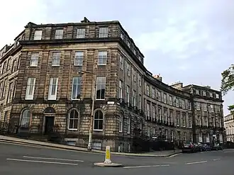 | |||
| 6, 6B Albany Street, Including Railings | 55°57′26″N 3°11′35″W / 55.957106°N 3.193113°W | Category B | 28228 | Upload Photo | |||
| 18-40 (Even Nos) Albany Street, Including Ancillary Structures And Railings | 55°57′26″N 3°11′31″W / 55.957308°N 3.191822°W | Category A | 28230 | Upload Photo | |||
| 42-44 (Even Nos) Albany Street, Including Railings | 55°57′27″N 3°11′26″W / 55.957537°N 3.190436°W | Category A | 28231 | Upload Photo | |||
| 46-54 (Even Nos) Albany Street, Including Railings | 55°57′27″N 3°11′25″W / 55.957584°N 3.190229°W | Category B | 28232 | Upload Photo | |||
| St Catherine's 41, Howdenhall Road | 55°54′12″N 3°09′53″W / 55.90326°N 3.164604°W | Category B | 28121 | Upload Photo | |||
| Howdenhall Road, St Catherine's Gatelodge And Gatepiers | 55°54′08″N 3°09′53″W / 55.902109°N 3.164713°W | Category C(S) | 28123 | Upload Photo | |||
| Gilmerton, The Drum, Steading, Including Cottages, Dovecot, Screen Walls And Gamekeeper's Cottage | 55°54′24″N 3°07′11″W / 55.906597°N 3.119675°W | Category B | 28136 | Upload Photo | |||
| Drylaw House, Wester Drylaw Place And Ferry Road, Dovecot | 55°57′59″N 3°15′08″W / 55.966277°N 3.252336°W | Category C(S) | 28137 | Upload Photo | |||
| Gilmerton Road, Inch Dovecot | 55°55′23″N 3°09′52″W / 55.923001°N 3.164556°W | Category A | 28140 | Upload Photo | |||
| 1 Bell's Mill, Belford Road, Former Bell's Mills Miller's House | 55°57′00″N 3°13′23″W / 55.950048°N 3.222922°W | Category B | 28148 | Upload Photo | |||
| Burdiehouse Limekilns, Near Burdiehouse Mains Farm | 55°53′35″N 3°09′21″W / 55.893072°N 3.155856°W | Category B | 28159 | Upload Photo | |||
| 2, 4 Peffermill Road, Cameron Bank, Including Outbuildings And Boundary Walls | 55°55′47″N 3°09′35″W / 55.929616°N 3.159697°W | Category B | 28163 | Upload Photo | |||
| Liberton Drive, Tower House Stables, With Outbuildings, Gatepiers And Walls | 55°54′52″N 3°10′37″W / 55.914546°N 3.176862°W | Category B | 28187 | Upload Photo | |||
| 5 Caroline Park, Caroline Park House Including Royston House | 55°58′54″N 3°14′28″W / 55.981701°N 3.241151°W | Category A | 28040 | Upload Photo | |||
| Colinton Road, Merchiston Castle School, | 55°54′43″N 3°15′20″W / 55.911962°N 3.255576°W | Category A | 28042 | Upload Photo | |||
| 9 Loaning Road, Craigentinny House Including Boundary Walls With Pavilion End, Gatepiers And Garden Houses | 55°57′36″N 3°08′48″W / 55.960073°N 3.14656°W | Category B | 28047 | Upload Photo | |||
| 35 And 37 Fernielaw Avenue, Fernielaw House With Washhouse, Privy, Boundary Walls And Gatepiers | 55°54′02″N 3°15′51″W / 55.900419°N 3.264079°W | Category B | 28072 | Upload Photo | |||
| Corstorphine High Street, And 1A Orchardfield Avenue, Dower House Including Boundary Walls, Gatepiers And Gates | 55°56′25″N 3°17′02″W / 55.940237°N 3.283772°W | Category B | 28073 | Upload Photo | |||
| Gilmerton, 89 Ravenscroft Street, Gazebo In Gardens | 55°54′06″N 3°08′08″W / 55.901663°N 3.135447°W | Category B | 28075 | Upload Photo | |||
| Inch House - Sundial Glenallan Drive Old Dalkeith Road And Gilmerton Road | 55°55′31″N 3°09′30″W / 55.925144°N 3.158443°W | Category B | 28080 | Upload Photo | |||
| 60 Dreghorn Loan With Outbuilding And Arched Link-Wall | 55°54′10″N 3°15′04″W / 55.902735°N 3.251103°W | Category B | 28085 | Upload Photo | |||
| 5 And 7 Regent Road, Former Royal High School, Including Lodge, Classroom Block, Retaining/ Boundary Walls, Gateposts And Railings | 55°57′12″N 3°10′52″W / 55.953332°N 3.181066°W | Category A | 27987 |  | |||
| Drummond Street, University Of Edinburgh, Geography Department, (Former Surgical Hospital), Including Railings And Lamp Standards | 55°56′54″N 3°11′02″W / 55.94821°N 3.183856°W | Category B | 28000 |  |
Key
The scheme for classifying buildings in Scotland is:
- Category A: "buildings of national or international importance, either architectural or historic; or fine, little-altered examples of some particular period, style or building type."[1]
- Category B: "buildings of regional or more than local importance; or major examples of some particular period, style or building type, which may have been altered."[1]
- Category C: "buildings of local importance; lesser examples of any period, style, or building type, as originally constructed or moderately altered; and simple traditional buildings which group well with other listed buildings."[1]
In March 2016 there were 47,288 listed buildings in Scotland. Of these, 8% were Category A, and 50% were Category B, with the remaining 42% being Category C.[2]
See also
Notes
- ^ Sometimes known as OSGB36, the grid reference (where provided) is based on the British national grid reference system used by the Ordnance Survey.
• "Guide to National Grid". Ordnance Survey. Retrieved 12 December 2007.
• "Get-a-map". Ordnance Survey. Retrieved 17 December 2007. - ^ Historic Environment Scotland assign a unique alphanumeric identifier to each designated site in Scotland, for listed buildings this always begins with "LB", for example "LB12345".
References
- All entries, addresses and coordinates are based on data from Historic Scotland. This data falls under the Open Government Licence
- ^ a b c "What is Listing?". Historic Environment Scotland. Retrieved 29 May 2018.
- ^ Scotland's Historic Environment Audit 2016 (PDF). Historic Environment Scotland and the Built Environment Forum Scotland. pp. 15–16. Retrieved 29 May 2018.