List of listed buildings in Edinburgh/5
This is a list of listed buildings in Edinburgh, Scotland.
List
| Name | Location | Date Listed | Grid Ref. [note 1] | Geo-coordinates | Notes | LB Number [note 2] | Image |
|---|---|---|---|---|---|---|---|
| University Of Edinburgh Former George Watson's Ladies College George Square Excluding 4-Storey Eastern Addition Of 1902 | 55°56′40″N 3°11′19″W / 55.94457°N 3.188661°W | Category B | 28002 |  Upload Photo | |||
| Heriot Place And Vennel, Bastion Of Flodden Wall, And Telfer Wall (Section) | 55°56′46″N 3°11′49″W / 55.946214°N 3.196989°W | Category A | 28006 |  | |||
| Colinton Road, Redford Cavalry Barracks With Officer's Mess, Balaclava House, Guard House, Gates, Gatepiers, Sergeant's Mess, Former Band Block, Education Block, Former Stables, Stores And Other Ancillary Buildings | 55°54′50″N 3°14′25″W / 55.913967°N 3.240361°W | Category B | 28009 | Upload Photo | |||
| Edinburgh Castle, Batteries, Including Argyle, Dury's, Forewall, Half-Moon, And Western Defences | 55°56′54″N 3°11′56″W / 55.948307°N 3.198944°W | Category A | 28010 | Upload Photo | |||
| Edinburgh Castle, 2 K6 Telephone Kiosks At Gatehouse | 55°56′54″N 3°11′56″W / 55.948425°N 3.198867°W | Category B | 28012 | Upload Photo | |||
| Craigmillar Castle Road Craigmillar Castle Dairy | 55°55′33″N 3°08′20″W / 55.92583°N 3.138762°W | Category B | 28017 | Upload Photo | |||
| Liberton Drive, Liberton Tower | 55°54′52″N 3°10′39″W / 55.914577°N 3.177407°W | Category A | 28021 | Upload Photo | |||
| Holyroodhouse, Palace Of Holyroodhouse Including Gates, Gatepiers, Boundary Walls And Railings | 55°57′10″N 3°10′20″W / 55.952715°N 3.172286°W | Category A | 28022 | 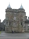 | |||
| Holyroodhouse, Gatehouse And Former Guard Rooms | 55°57′09″N 3°10′26″W / 55.952628°N 3.173821°W | Category B | 28025 |  | |||
| 31, 33 Brunstane Road South, Brunstane House | 55°56′24″N 3°05′38″W / 55.940075°N 3.093825°W | Category A | 28034 | Upload Photo | |||
| Greenbank Crescent, Braidburn Valley Gatepiers Including Gates And Railings | 55°55′09″N 3°12′47″W / 55.919108°N 3.213179°W | Category C(S) | 27918 | Upload Photo | |||
| 1, 2 And 3 Wellington Place And Railings | 55°58′16″N 3°10′11″W / 55.971005°N 3.169843°W | Category B | 27921 | Upload Photo | |||
| 8-11 (Inclusive Nos) Wellington Place With Boundary Walls And Railings | 55°58′17″N 3°10′10″W / 55.971397°N 3.16931°W | Category B | 27923 | Upload Photo | |||
| Dalkeith Road, Newington (Echobank) Cemetery, Including 222 Dalkeith Road (Lodge), Vaults, Gates, Gatepiers And Boundary Walls | 55°55′56″N 3°09′59″W / 55.932157°N 3.166511°W | Category B | 27933 | Upload Photo | |||
| Brae Park Road, Cramond Old Bridge | 55°57′55″N 3°18′58″W / 55.965164°N 3.315982°W | Category A | 27940 | Upload Photo | |||
| George Iv Bridge With Railings | 55°56′54″N 3°11′31″W / 55.948195°N 3.191942°W | Category A | 27942 | Upload Photo | |||
| 73 Belford Road, Dean Gallery, (Former Dean Orphanage), Including Lodges, Terrace, Boundary Walls, Steps And Gates | 55°57′07″N 3°13′27″W / 55.951815°N 3.224195°W | Category A | 27969 | %252C_73_Belford_Road%252C_Edinburgh_(side_view).jpg) | |||
| Edinburgh Academy 48 Henderson Row | 55°57′39″N 3°12′16″W / 55.960788°N 3.204455°W | Category A | 27973 |  | |||
| Lauriston Place, George Heriot's School, Examination Hall | 55°56′44″N 3°11′44″W / 55.945609°N 3.19553°W | Category B | 27978 | Upload Photo | |||
| Lauriston Place, George Heriot's School, Main Building | 55°56′45″N 3°11′41″W / 55.945913°N 3.194674°W | Category A | 27980 |  | |||
| Union Canal, Bridge No 18 (Near Clifton Hall) | 55°55′14″N 3°25′47″W / 55.92064°N 3.429705°W | Category B | 27827 | Upload Photo | |||
| 99 New Kirkgate, Trinity House With Boundary Walls, Gates, Gatepiers And Railings | 55°58′20″N 3°10′17″W / 55.972195°N 3.171353°W | Category A | 27834 | Upload Photo | |||
| 30 Pilrig House Close, Pilrig House | 55°58′10″N 3°10′53″W / 55.969432°N 3.181284°W | Category A | 27841 | Upload Photo | |||
| 3 And 5 Pilrig Street With Boundary Walls And Railings | 55°57′52″N 3°10′43″W / 55.964479°N 3.17865°W | Category B | 27845 | Upload Photo | |||
| 11 And 13 Pilrig Street With Boundary Walls And Railings | 55°57′53″N 3°10′45″W / 55.964825°N 3.179061°W | Category B | 27848 | Upload Photo | |||
| William Gladstone Memorial Coates Crescent And Shandwick Place | 55°56′55″N 3°12′44″W / 55.948536°N 3.21229°W | Category A | 27856 |  | |||
| West Princes Street Gardens, Thomas Guthrie Monument | 55°57′03″N 3°12′10″W / 55.950814°N 3.202656°W | Category B | 27858 |  | |||
| 61 Queen Charlotte Street With Boundary Walls, Gates And Railings | 55°58′24″N 3°09′57″W / 55.973425°N 3.16575°W | Category B | 27867 | Upload Photo | |||
| 28-42 (Even Nos) Queen Charlotte Street And 94 Constitution Street And 1 Queen Charlotte Lane | 55°58′25″N 3°10′07″W / 55.973659°N 3.16861°W | Category B | 27871 | Upload Photo | |||
| 46 Queen Charlotte Street | 55°58′24″N 3°10′04″W / 55.973398°N 3.167688°W | Category C(S) | 27875 | Upload Photo | |||
| Princes Street, Monument To Duke Of Wellington | 55°57′13″N 3°11′21″W / 55.953478°N 3.189174°W | Category A | 27879 |  | |||
| East Princes Street Gardens, John Wilson Monument | 55°57′07″N 3°11′42″W / 55.952073°N 3.195088°W | Category A | 27881 |  | |||
| Edinburgh Castle Esplanade, Duke Of York Statue | 55°56′56″N 3°11′52″W / 55.948901°N 3.197889°W | Category B | 27883 |  | |||
| 24-31 (Inclusive Nos) Shore, Former Ship Hotel | 55°58′36″N 3°10′09″W / 55.976609°N 3.169227°W | Category C(S) | 27889 | Upload Photo | |||
| St Bernard's Well, Off St Bernard's Bridge, Including Stair, Walls, Railings And Plaque | 55°57′19″N 3°12′41″W / 55.955282°N 3.211524°W | Category A | 27905 |  | |||
| 16 Tower Street | 55°58′36″N 3°09′59″W / 55.976689°N 3.166522°W | Category B | 27913 | Upload Photo | |||
| Ratho Village, 73 And 75 (Odd Nos) Main Street And Boundary Wall | 55°55′17″N 3°22′50″W / 55.921479°N 3.380576°W | Category C(S) | 27745 | Upload Photo | |||
| Regent Road, St Andrew's House Including Boundary Wall, Lamp Standards And Gates | 55°57′13″N 3°11′02″W / 55.953519°N 3.184002°W | Category A | 27756 |  | |||
| Ratho Village, 40 Main Street, Fernbank And Boundary Wall | 55°55′20″N 3°22′44″W / 55.922199°N 3.378873°W | Category C(S) | 27757 | Upload Photo | |||
| 7 West Brighton Crescent | 55°57′04″N 3°07′09″W / 55.951188°N 3.119056°W | Category B | 27758 | Upload Photo | |||
| 334, 336C-340 And 346A Leith Walk With Railings And Lamp Standards | 55°57′52″N 3°10′40″W / 55.964444°N 3.177655°W | Category C(S) | 27763 | Upload Photo | |||
| 6-9 (Inclusive Nos) Links Gardens And 1 Links Gardens Lane | 55°58′18″N 3°09′43″W / 55.9718°N 3.161808°W | Category B | 27771 | Upload Photo | |||
| Ratho Village, 58-60 (Even Nos), Main Street | 55°55′19″N 3°22′49″W / 55.921915°N 3.380143°W | Category B | 27777 | Upload Photo | |||
| 5 And 6 (Inclusive Nos) Maritime Street | 55°58′28″N 3°10′09″W / 55.974372°N 3.169176°W | Category B | 27791 | Upload Photo | |||
| Brass Founders' Pillar, Nicolson Square | 55°56′46″N 3°11′07″W / 55.946039°N 3.185391°W | Category B | 27797 |  | |||
| Regent Road, Burns Monument Including Boundary Wall And Railings | 55°57′12″N 3°10′42″W / 55.953457°N 3.178347°W | Category A | 27801 |  | |||
| Union Canal, Jawbridge, Bridge No 13 | 55°55′02″N 3°20′32″W / 55.917106°N 3.342098°W | Category B | 27810 | Upload Photo | |||
| 9-23 (Odd Nos) Nile Grove With Boundary Walls And Gatepiers | 55°55′35″N 3°12′24″W / 55.926522°N 3.206689°W | Category B | 27660 | Upload Photo | |||
| 26 Leith Walk With Boundary Walls And Railings | 55°58′13″N 3°10′22″W / 55.970188°N 3.172671°W | Category B | 27667 | Upload Photo | |||
| 29-39 (Odd Nos) Nile Grove With Boundary Walls And Gatepiers | 55°55′35″N 3°12′21″W / 55.926513°N 3.205792°W | Category B | 27668 | Upload Photo | |||
| Ratho Park Ice House | 55°55′29″N 3°21′40″W / 55.92467°N 3.3611°W | Category C(S) | 27670 | Upload Photo | |||
| 3 Rosefield Place | 55°57′06″N 3°07′03″W / 55.951796°N 3.117392°W | Category C(S) | 27681 | Upload Photo | |||
| Mound Place And Castlehill, New College And Assembly Hall, With Railings, Gates, Gatepiers And Lamp Standards | 55°56′58″N 3°11′43″W / 55.94944°N 3.195199°W | Category A | 27689 |  | |||
| 7 Rosefield Place | 55°57′07″N 3°07′03″W / 55.95192°N 3.117604°W | Category C(S) | 27691 | Upload Photo | |||
| 68-76 (Even Nos) Leith Walk | 55°58′10″N 3°10′23″W / 55.969527°N 3.173179°W | Category B | 27692 | Upload Photo | |||
| 234-242 (Even Nos) Leith Walk, Former Victoria India Rubber Mills Buildings | 55°58′00″N 3°10′32″W / 55.966656°N 3.175544°W | Category B | 27712 | Upload Photo | |||
| Ratho Village, 18 Baird Road, Clearence Cottage And Boundary Wall | 55°55′23″N 3°22′41″W / 55.922972°N 3.378004°W | Category B | 27725 | Upload Photo | |||
| 3 Morningside Place | 55°55′50″N 3°12′38″W / 55.930618°N 3.210546°W | Category C(S) | 27728 | Upload Photo | |||
| Craig House, Napier University, Craighouse Road And Morningside Drive | 55°55′17″N 3°13′36″W / 55.921463°N 3.226743°W | Category A | 27736 | Upload Photo | |||
| 26-40 (Even Nos) Kirk Street | 55°58′15″N 3°10′27″W / 55.970768°N 3.174034°W | Category C(S) | 27580 | Upload Photo | |||
| 10, 12, 14 Morningside Road And 3-19 (Odd Nos) Colinton Road | 55°56′02″N 3°12′38″W / 55.933836°N 3.210438°W | Category B | 27581 | Upload Photo | |||
| 44 And 46 Kirk Street | 55°58′13″N 3°10′28″W / 55.970414°N 3.174392°W | Category B | 27585 | Upload Photo | |||
| 18 Morningside Road, Morningside Baptist Church (Former Free Church) With Church Halls And Offices | 55°56′01″N 3°12′38″W / 55.933584°N 3.210478°W | Category B | 27586 | Upload Photo | |||
| Newliston House, Dovecot | 55°56′47″N 3°25′25″W / 55.946402°N 3.423529°W | Category B | 27593 | Upload Photo | |||
| Leith Docks, Alexandra Dry Dock | 55°58′45″N 3°10′09″W / 55.979199°N 3.169049°W | Category B | 27595 | Upload Photo | |||
| Newliston House, East Lodge With Gatepiers And Walls | 55°56′45″N 3°24′54″W / 55.945726°N 3.415129°W | Category B | 27599 | Upload Photo | |||
| 24 Regent Street | 55°57′11″N 3°06′44″W / 55.953002°N 3.112206°W | Category C(S) | 27600 | Upload Photo | |||
| Leith Docks, Alexandra Dry Dock Hydraulic Station | 55°58′45″N 3°10′11″W / 55.979085°N 3.169639°W | Category B | 27601 | Upload Photo | |||
| Leith Docks, Edinburgh Dock And Swing Bridge | 55°58′42″N 3°09′45″W / 55.978381°N 3.162438°W | Category B | 27606 | Upload Photo | |||
| Newliston House, Inner Lodge | 55°56′46″N 3°25′21″W / 55.946019°N 3.422458°W | Category C(S) | 27609 | Upload Photo | |||
| 30 And 31 Chambers Street, Former Edinburgh Dental Hospital And School | 55°56′51″N 3°11′28″W / 55.947387°N 3.190989°W | Category B | 27622 | .jpg) | |||
| Newbattle Terrace, Police Box | 55°55′51″N 3°12′33″W / 55.930864°N 3.209257°W | Category B | 27630 | Upload Photo | |||
| Ransfield Road, Trefoil Centre (Formerly Kirklands Lodge) With Garden Walls Gateway And Freestanding Column | 55°55′17″N 3°20′07″W / 55.921333°N 3.335155°W | Category B | 27642 | Upload Photo | |||
| Leith Docks, Victoria Swing Bridge | 55°58′44″N 3°10′12″W / 55.978776°N 3.170046°W | Category B | 27644 | Upload Photo | |||
| 18 Newbattle Terrace, Dominion Cinema | 55°55′50″N 3°12′31″W / 55.930681°N 3.208675°W | Category B | 27650 | Upload Photo | |||
| 1, 1A Nile Grove, Morningside Braid Church (C Of S) With Church Halls | 55°55′36″N 3°12′30″W / 55.926596°N 3.208308°W | Category B | 27655 | Upload Photo | |||
| 100-118 Great Junction Street (Formerly John Crabbie And Co) | 55°58′22″N 3°10′28″W / 55.972823°N 3.174321°W | Category B | 27501 | Upload Photo | |||
| York Place And 8 Broughton Street, St Paul's And St George's (Scottish Episcopal) Church, Including Lamp And Railings | 55°57′24″N 3°11′19″W / 55.9567°N 3.188712°W | Category A | 27509 |  | |||
| 61-79 (Odd Nos) Morningside Park | 55°55′46″N 3°12′49″W / 55.92942°N 3.213613°W | Category B | 27518 | Upload Photo | |||
| Ferry Road, St Serf's Church (Church Of Scotland), With Boundary Wall, Gates And Gatepiers | 55°58′19″N 3°12′19″W / 55.972002°N 3.205349°W | Category B | 27522 |  | |||
| Kirkliston Village, Newliston Road, Breast Mill House, Outbuildings And Boundary Walls | 55°56′55″N 3°24′22″W / 55.948704°N 3.406174°W | Category B | 27523 | Upload Photo | |||
| 22 John's Lane | 55°58′23″N 3°10′03″W / 55.972924°N 3.167418°W | Category C(S) | 27530 | Upload Photo | |||
| Morningside Road, Bore Stone | 55°55′52″N 3°12′35″W / 55.931227°N 3.20986°W | Category C(S) | 27536 | Upload Photo | |||
| 3-10 (Inclusive Nos) John's Place With Boundary Walls And Railings | 55°58′23″N 3°10′01″W / 55.973056°N 3.166845°W | Category B | 27540 | Upload Photo | |||
| 33A-39 (Odd Nos) Morningside Road | 55°55′57″N 3°12′35″W / 55.932405°N 3.209737°W | Category B | 27551 | Upload Photo | |||
| Lin's Mill And House | 55°55′17″N 3°25′57″W / 55.921398°N 3.432502°W | Category C(S) | 27553 | Upload Photo | |||
| Archers' Hall, Buccleuch Street | 55°56′32″N 3°11′04″W / 55.942157°N 3.184536°W | Category B | 27562 | Upload Photo | |||
| 43 And 45 Regent Street | 55°57′13″N 3°06′39″W / 55.953572°N 3.110781°W | Category C(S) | 27564 | Upload Photo | |||
| 8-20 (Even Nos) Kirk Street | 55°58′15″N 3°10′23″W / 55.97075°N 3.17312°W | Category C(S) | 27577 | Upload Photo | |||
| Kirkliston Village, High Street, Kirkliston Parish Church With Watch House And Graveyard, Walls And Gatepiers | 55°57′16″N 3°24′12″W / 55.954434°N 3.403227°W | Category A | 27457 |  | |||
| 8, 9 And 10 Jordan Lane | 55°55′38″N 3°12′26″W / 55.927137°N 3.20722°W | Category C(S) | 27465 | Upload Photo | |||
| 5A-5C Kirkgate, St Mary's (South Leith Parish) Church (C Of S) With Graveyard, Walls, Gates And Railings | 55°58′19″N 3°10′14″W / 55.972059°N 3.170548°W | Category A | 27466 |  | |||
| 164-172 (Even Nos) Portobello High Street | 55°57′10″N 3°06′50″W / 55.952808°N 3.11377°W | Category C(S) | 27472 | Upload Photo | |||
| 125-143 (Odd Nos) Great Junction Street | 55°58′21″N 3°10′31″W / 55.972543°N 3.175402°W | Category C(S) | 27478 | Upload Photo | |||
| Kirkliston Village, 15 High Street | 55°57′15″N 3°24′04″W / 55.95417°N 3.401151°W | Category C(S) | 27481 | Upload Photo | |||
| 210-240 (Even Nos) Portobello High Street And 1 Marlborough Street | 55°57′09″N 3°06′44″W / 55.9524°N 3.112237°W | Category C(S) | 27486 | Upload Photo | |||
| 15 Jordan Lane | 55°55′38″N 3°12′21″W / 55.927213°N 3.205894°W | Category B | 27488 | Upload Photo | |||
| 242-252 (Even Nos) Portobello High Street; 2-6 (Even Nos) Marlborough Street | 55°57′08″N 3°06′39″W / 55.952089°N 3.110835°W | Category B | 27491 | Upload Photo | |||
| Kirkliston Village, 21 And 23 (Odd Nos), High Street | 55°57′15″N 3°24′06″W / 55.954037°N 3.401803°W | Category C(S) | 27494 | Upload Photo | |||
| 254-284 (Even Nos) Portobello High Street, 1A Bellfield Lane | 55°57′07″N 3°06′34″W / 55.951822°N 3.109562°W | Category C(S) | 27495 | Upload Photo | |||
| 48, 50 Great Junction Street And 2 Henderson Street | 55°58′17″N 3°10′23″W / 55.971478°N 3.173062°W | Category B | 27496 | Upload Photo | |||
| 5 South Gray's Close, St Patrick's Roman Catholic Church | 55°56′59″N 3°11′04″W / 55.949821°N 3.184578°W | Category B | 27498 | Upload Photo | |||
| 125 Moira Terrace, Portobello Road | 55°57′27″N 3°07′47″W / 55.957363°N 3.12971°W | Category C(S) | 27378 | Upload Photo | |||
| High Street And Parliament Square, St Giles (High) Kirk | 55°56′58″N 3°11′27″W / 55.94958°N 3.190912°W | Category A | 27381 | .jpg) | |||
| 127 Moira Terrace, Portobello Road, Wilson Memorial Church (Portobello United Free Church) | 55°57′26″N 3°07′45″W / 55.957241°N 3.129226°W | Category B | 27385 | Upload Photo | |||
| 134-138 (Even Nos) Constitution Street | 55°58′20″N 3°10′10″W / 55.972347°N 3.169531°W | Category B | 27386 | Upload Photo | |||
| 1-5 (Odd Nos) Duke Street And 1 And 2 Newkirkgate | 55°58′15″N 3°10′18″W / 55.970863°N 3.17157°W | Category C(S) | 27399 | Upload Photo | |||
| 5, 5A, 7 And 7A South Fort Street With Front Steps And Railings; Eh6 4Dl | 55°58′28″N 3°11′00″W / 55.97449°N 3.183217°W | Category B | 27408 | Upload Photo | |||
| 195 And 197 Portobello High Street | 55°57′08″N 3°06′49″W / 55.952334°N 3.113596°W | Category C(S) | 27411 | Upload Photo | |||
| 203 And 205 Portobello High Street | 55°57′08″N 3°06′48″W / 55.952274°N 3.113242°W | Category B | 27424 | Upload Photo | |||
| Castle Terrace, St Mark's Church (Unitarian), Including Railings And Lamp Standards | 55°56′55″N 3°12′20″W / 55.948503°N 3.205515°W | Category B | 27434 | Upload Photo | |||
| Polwarth Crescent And Yeaman Place Walker Bridge | 55°56′19″N 3°13′06″W / 55.9387°N 3.218306°W | Category C(S) | 27293 |  | |||
| 2 Gillsland Road South | 55°55′49″N 3°13′14″W / 55.93041°N 3.220671°W | Category B | 27296 | Upload Photo | |||
| St John's Road And 1 Kaimes Road, St Anne's Parish Church, Including Boundary Walls, Postbox, Gatepiers, Gates, Railings And Street Light | 55°56′32″N 3°16′24″W / 55.942177°N 3.273445°W | Category A | 27297 |  | |||
| Gogar Station Road, Kellerstain House | 55°55′43″N 3°19′59″W / 55.928517°N 3.333097°W | Category B | 27299 | Upload Photo | |||
| 29-35 Odd Nos Polwarth Crescent And 3 Temple Park Crescent | 55°56′17″N 3°13′06″W / 55.938054°N 3.218238°W | Category C(S) | 27300 | Upload Photo | |||
| 143 Grange Loan Astley Ainslie Hospital, Canaan House | 55°55′47″N 3°11′56″W / 55.929806°N 3.198916°W | Category B | 27303 | Upload Photo | |||
| St Bernard's Church (C Of S) Saxe - Coburg (Formerly West Claremont) Street | 55°57′37″N 3°12′24″W / 55.960415°N 3.206767°W | Category B | 27311 | Upload Photo | |||
| Gogar Station Road, Millburn Policies, South Lodge Walls And Gatepiers | 55°55′45″N 3°19′33″W / 55.929107°N 3.325883°W | Category B | 27313 | Upload Photo | |||
| Hatton Estate, S Terrace Wall With Pavilions And Bath-House | 55°54′15″N 3°23′43″W / 55.904105°N 3.39533°W | Category A | 27334 | Upload Photo | |||
| 16-22 (Even Nos) Marlborough Street | 55°57′10″N 3°06′38″W / 55.95265°N 3.110418°W | Category B | 27336 | Upload Photo | |||
| 86-90 (Even Nos) Constitution Street | 55°58′26″N 3°10′05″W / 55.973995°N 3.168187°W | Category B | 27337 | Upload Photo | |||
| Hatton Estate, East Avenue Gates | 55°54′22″N 3°22′43″W / 55.906108°N 3.378638°W | Category A | 27341 | Upload Photo | |||
| 39 And 39A Portland Street With Front Walls, Steps And Railings; Eh6 4Bb | 55°58′38″N 3°10′57″W / 55.977158°N 3.182369°W | Category C(S) | 27347 | Upload Photo | |||
| 28 And 28A Polwarth Terrace | 55°56′06″N 3°13′22″W / 55.934908°N 3.222846°W | Category C(S) | 27349 | Upload Photo | |||
| 28-30A (Even Nos) Marlborough Street | 55°57′11″N 3°06′36″W / 55.95295°N 3.110027°W | Category B | 27350 | Upload Photo | |||
| 96 -104 (Even Nos) Constitution Street And 3, 3A Queen Charlotte Lane | 55°58′24″N 3°10′06″W / 55.973311°N 3.168359°W | Category B | 27351 | Upload Photo | |||
| 41 (Bf & Gf) And 43 Portland Street With Front Walls, Steps And Railings; Eh6 4Bb | 55°58′38″N 3°10′57″W / 55.977094°N 3.182447°W | Category C(S) | 27354 | Upload Photo | |||
| 44 Polwarth Terrace With Boundary Wall And Gatepiers | 55°56′00″N 3°13′27″W / 55.933421°N 3.224207°W | Category B | 27356 |  | |||
| 12 Palmerston Place, Palmerston Place Church Including Wall And Railings | 55°56′51″N 3°12′58″W / 55.947491°N 3.216196°W | Category B | 27220 |  | |||
| 16 And 18 Pittville Street | 55°57′09″N 3°06′20″W / 55.952442°N 3.10556°W | Category C(S) | 27223 | Upload Photo | |||
| 7 And 8 East Brighton Crescent | 55°57′02″N 3°06′57″W / 55.950597°N 3.115852°W | Category B | 27225 | Upload Photo | |||
| 87 And 89 Colinton Road | 55°55′48″N 3°13′20″W / 55.92998°N 3.222354°W | Category C(S) | 27227 | Upload Photo | |||
| 9 And 10 East Brighton Crescent | 55°57′02″N 3°06′59″W / 55.95062°N 3.116286°W | Category B | 27232 | Upload Photo | |||
| 93 And 95 Colinton Road, Brizlee, With Boundary Walls And Gatepiers | 55°55′47″N 3°13′23″W / 55.929776°N 3.223036°W | Category B | 27234 | Upload Photo | |||
| 287 Portobello High Street And St Mark's Place, St Mark's Episcopal Church, Including Gates, Gatepiers And Boundary Walls | 55°57′04″N 3°06′31″W / 55.950985°N 3.108673°W | Category B | 27245 | Upload Photo | |||
| 8 Eden Lane, Harmony House, With Boundary Walls | 55°55′49″N 3°12′15″W / 55.930159°N 3.204209°W | Category B | 27249 | Upload Photo | |||
| 7 Restalrig Road South, Restalrig Parish Church, Church Of Scotland, Including St Triduana's Aisle, Graveyard, Gatehouse And Boundary Walls | 55°57′28″N 3°08′58″W / 55.957863°N 3.149441°W | Category A | 27250 |  | |||
| 11 And 12 Glasgow Road, Middle Norton | 55°56′16″N 3°22′08″W / 55.937702°N 3.368938°W | Category C(S) | 27260 | Upload Photo | |||
| 44 Newhaven Main Street | 55°58′50″N 3°11′48″W / 55.980542°N 3.196655°W | Category C(S) | 27275 | Upload Photo | |||
| 10 Napier Road Lammerburn With Boundary Wall And Gatepiers | 55°56′00″N 3°12′58″W / 55.933347°N 3.216217°W | Category A | 27279 | Upload Photo | |||
| 2 And 2A Forbes Road, The Lodge, With Former Gig House And Cosvhmsn's House, Boundary Walls And Gatepiers | 55°56′05″N 3°12′28″W / 55.934625°N 3.207885°W | Category B | 27282 | Upload Photo | |||
| 46 And 48 Brighton Place, 1A West Brighton Crescent | 55°57′03″N 3°07′06″W / 55.950818°N 3.118197°W | Category B | 27154 | Upload Photo | |||
| 45-53 (Odd Nos) Constitution Street | 55°58′29″N 3°10′00″W / 55.974835°N 3.16677°W | Category B | 27155 | Upload Photo | |||
| Malleny Estate, Scott Burial Vault | 55°53′11″N 3°20′06″W / 55.886354°N 3.334913°W | Category C(S) | 27162 | Upload Photo | |||
| 55 Constitution Street With Boundary Walls And Railings | 55°58′28″N 3°10′01″W / 55.974528°N 3.166985°W | Category B | 27164 | Upload Photo | |||
| 21-33 (Odd Nos) Colinton Road | 55°56′01″N 3°12′40″W / 55.933641°N 3.21104°W | Category B | 27165 | Upload Photo | |||
| 7, 7A And 9 (Odd Nos) Craighall Road, Newhaven Church Of Scotland Including Hall, Vestry, Gatepiers And Railings And 7 Craighall Road, Old Schoolhouse | 55°58′47″N 3°11′49″W / 55.97982°N 3.197018°W | Category B | 27167 | Upload Photo | |||
| Malleny House With Walled Garden, Bothy, Ironwork, Gates, Gatepiers, Green Cottage And Stables | 55°53′09″N 3°20′15″W / 55.88584°N 3.337565°W | Category A | 27172 | Upload Photo | |||
| 29 Pittville Street | 55°57′08″N 3°06′24″W / 55.952164°N 3.106545°W | Category C(S) | 27179 | Upload Photo |
Key
The scheme for classifying buildings in Scotland is:
- Category A: "buildings of national or international importance, either architectural or historic; or fine, little-altered examples of some particular period, style or building type."[1]
- Category B: "buildings of regional or more than local importance; or major examples of some particular period, style or building type, which may have been altered."[1]
- Category C: "buildings of local importance; lesser examples of any period, style, or building type, as originally constructed or moderately altered; and simple traditional buildings which group well with other listed buildings."[1]
In March 2016 there were 47,288 listed buildings in Scotland. Of these, 8% were Category A, and 50% were Category B, with the remaining 42% being Category C.[2]
See also
Notes
- ^ Sometimes known as OSGB36, the grid reference (where provided) is based on the British national grid reference system used by the Ordnance Survey.
• "Guide to National Grid". Ordnance Survey. Retrieved 12 December 2007.
• "Get-a-map". Ordnance Survey. Retrieved 17 December 2007. - ^ Historic Environment Scotland assign a unique alphanumeric identifier to each designated site in Scotland, for listed buildings this always begins with "LB", for example "LB12345".
References
- All entries, addresses and coordinates are based on data from Historic Scotland. This data falls under the Open Government Licence
- ^ a b c "What is Listing?". Historic Environment Scotland. Retrieved 29 May 2018.
- ^ Scotland's Historic Environment Audit 2016 (PDF). Historic Environment Scotland and the Built Environment Forum Scotland. pp. 15–16. Retrieved 29 May 2018.