Nantouillet
Nantouillet | |
|---|---|
 The town hall of Nantouillet | |
.svg.png) Coat of arms | |
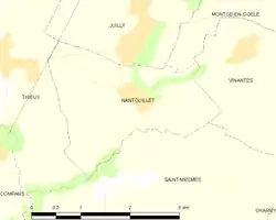 | |
Location of Nantouillet | |
 Nantouillet  Nantouillet | |
| Coordinates: 49°00′08″N 2°42′13″E / 49.0022°N 2.7035°E | |
| Country | France |
| Region | Île-de-France |
| Department | Seine-et-Marne |
| Arrondissement | Meaux |
| Canton | Mitry-Mory |
| Intercommunality | CC Plaines et Monts de France |
| Government | |
| • Mayor (2020–2026) | Yannik Urbaniak[1] |
Area 1 | 5.15 km2 (1.99 sq mi) |
| Population (2022)[2] | 303 |
| • Density | 59/km2 (150/sq mi) |
| Time zone | UTC+01:00 (CET) |
| • Summer (DST) | UTC+02:00 (CEST) |
| INSEE/Postal code | 77332 /77230 |
| Elevation | 63–118 m (207–387 ft) |
| 1 French Land Register data, which excludes lakes, ponds, glaciers > 1 km2 (0.386 sq mi or 247 acres) and river estuaries. | |
Nantouillet (French pronunciation: [nɑ̃tujɛ] ⓘ) is a commune in the Seine-et-Marne department in the Île-de-France region in north-central France.
Demographics
The inhabitants are called the Nantolétains.
See also
References
- ^ "Répertoire national des élus: les maires" (in French). data.gouv.fr, Plateforme ouverte des données publiques françaises. 13 September 2022.
- ^ "Populations de référence 2022" (in French). The National Institute of Statistics and Economic Studies. 19 December 2024.
External links
Wikimedia Commons has media related to Nantouillet.
- 1999 Land Use, from IAURIF (Institute for Urban Planning and Development of the Paris-Île-de-France région) (in English)
- Base Mérimée: Search for heritage in the commune, Ministère français de la Culture. (in French)