Pen y Boncyn Trefeilw
| Pen y Boncyn Trefeilw | |
|---|---|
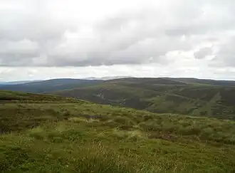 Pen y Boncyn Trefeilw from Foel y Geifr | |
| Highest point | |
| Elevation | 646 m (2,119 ft) |
| Prominence | 57 m (187 ft) |
| Listing | Hewitt, Nuttall |
| Naming | |
| Language of name | Welsh |
| Geography | |
| Location | Gwynedd, Wales |
| Parent range | Berwyn range |
| OS grid | SH 96255 28339 |
| Topo map | OS Landranger 125 |
| Name | Grid ref | Height | Status |
|---|---|---|---|
| Stac Rhos | SJ085335 | 630 metres (2,067 ft) | sub Hewitt, Nuttall |
Pen y Boncyn Trefeilw is a subsidiary summit of Cyrniau Nod in north east Wales. It forms a part of the Berwyn range called the Hirnantau. It has two tops: Stac Rhos and Pen y Cerrig Duon. Pen y Cerrig Duon is now listed as a deleted Nuttall due to re-surveying.
The views from the summit are extensive, if unremarkable due to the featureless, flat moorland surroundings. The summit is marked by a small cairn, is which located only a few metres from a track road that continues on to the pass between Cyrniau Nod and Y Groes Fagl.[1]
References
52°50′33″N 3°32′30″W / 52.84250°N 3.54167°W