Saint Privat en Périgord
Saint Privat en Périgord | |
|---|---|
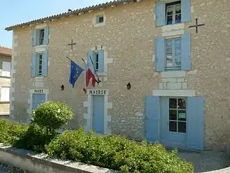 The town hall in Saint Privat en Périgord | |
Location of Saint Privat en Périgord | |
 Saint Privat en Périgord  Saint Privat en Périgord | |
| Coordinates: 45°13′34″N 0°12′58″E / 45.226°N 0.216°E | |
| Country | France |
| Region | Nouvelle-Aquitaine |
| Department | Dordogne |
| Arrondissement | Périgueux |
| Canton | Montpon-Ménestérol |
| Intercommunality | Pays de Saint-Aulaye |
| Government | |
| • Mayor (2020–2026) | Pascale Roussie-Nadal[1] |
Area 1 | 44.04 km2 (17.00 sq mi) |
| Population (2022)[2] | 1,127 |
| • Density | 26/km2 (66/sq mi) |
| Time zone | UTC+01:00 (CET) |
| • Summer (DST) | UTC+02:00 (CEST) |
| INSEE/Postal code | 24490 /24410 |
| 1 French Land Register data, which excludes lakes, ponds, glaciers > 1 km2 (0.386 sq mi or 247 acres) and river estuaries. | |
Saint Privat en Périgord (French pronunciation: [sɛ̃ pʁiva ɑ̃ peʁiɡɔʁ], literally Saint Privat in Périgord; Occitan: Sent Privat de Perigòrd) is a commune in the department of Dordogne, southwestern France. The municipality was established on 1 January 2017 by merger of the former communes of Saint-Privat-des-Prés (the seat), Festalemps and Saint-Antoine-Cumond.[3]
See also
References
Wikimedia Commons has media related to Saint Privat en Périgord.
- ^ "Répertoire national des élus: les maires" (in French). data.gouv.fr, Plateforme ouverte des données publiques françaises. 13 September 2022.
- ^ "Populations de référence 2022" (in French). The National Institute of Statistics and Economic Studies. 19 December 2024.
- ^ Arrêté préfectoral 26 September 2016 (in French)