Xinshe District
24°15′51.5″N 120°48′1.2″E / 24.264306°N 120.800333°E
Xinshe 新社區 | |
|---|---|
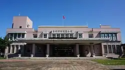
| Xinshe District | |
 Location in the city | |
| Country | Taiwan |
| Special municipality | Taichung |
| Established (District) | 2010 |
| Area | |
• Total | 68.8874 km2 (26.5976 sq mi) |
| Population (February 2023) | |
• Total | 23,256 |
| • Density | 340/km2 (870/sq mi) |
| Time zone | UTC+8 (CST) |
| Website | www |

Xinshe District (Chinese: 新社區; pinyin: Xīnshè Qū) is a rural district in Taichung, Taiwan.[1] It is also called "Taichung's back garden". The city is home to many military bases. However, the district's hillside houses were destroyed by 1999 Chi-Chi earthquake.
Administrative divisions
Danan, Yuehu, Zhongzheng, Zhonghe, Zhongxing, Yongyuan, Dongxing, Xiecheng, Kunshan, Xinshe, Fuxing, Fusheng and Qixi Village.
Education
Senior High School
- Taichung Municipal Xinshe Senior High School [1]
Native products
Xinshe township fruits: Citrus, Grape, Carambola, Gaojie Pears, Loquats, Mushrooms, Sugar-apple, flowers, Bonsais
Tourist attractions
Transport
- Provincial Highway No.21
- County Road 129 (Shigang - Xinshe - Beitun - Taiping, Taichung City)
Climate
| Climate data for Xinshe District, elevation 470 m (1,540 ft), (1991–2010 normals, extremes 1995–present) | |||||||||||||
|---|---|---|---|---|---|---|---|---|---|---|---|---|---|
| Month | Jan | Feb | Mar | Apr | May | Jun | Jul | Aug | Sep | Oct | Nov | Dec | Year |
| Record high °C (°F) | 27.7 (81.9) | 31.1 (88.0) | 31.2 (88.2) | 33.7 (92.7) | 34.3 (93.7) | 33.5 (92.3) | 36.0 (96.8) | 33.8 (92.8) | 34.3 (93.7) | 32.4 (90.3) | 31.0 (87.8) | 29.3 (84.7) | 36.0 (96.8) |
| Mean daily maximum °C (°F) | 19.3 (66.7) | 19.9 (67.8) | 22.1 (71.8) | 24.9 (76.8) | 27.3 (81.1) | 28.7 (83.7) | 30.0 (86.0) | 29.6 (85.3) | 28.8 (83.8) | 26.9 (80.4) | 24.3 (75.7) | 20.9 (69.6) | 25.2 (77.4) |
| Daily mean °C (°F) | 14.2 (57.6) | 15.2 (59.4) | 17.7 (63.9) | 21.0 (69.8) | 23.7 (74.7) | 25.3 (77.5) | 26.2 (79.2) | 25.9 (78.6) | 24.9 (76.8) | 22.6 (72.7) | 19.6 (67.3) | 15.9 (60.6) | 21.0 (69.8) |
| Mean daily minimum °C (°F) | 10.3 (50.5) | 11.6 (52.9) | 14.1 (57.4) | 17.9 (64.2) | 20.7 (69.3) | 22.6 (72.7) | 23.3 (73.9) | 23.1 (73.6) | 21.9 (71.4) | 19.1 (66.4) | 15.6 (60.1) | 11.7 (53.1) | 17.7 (63.8) |
| Record low °C (°F) | −0.5 (31.1) | 1.5 (34.7) | 1.0 (33.8) | 5.8 (42.4) | 13.6 (56.5) | 16.0 (60.8) | 18.8 (65.8) | 19.0 (66.2) | 17.1 (62.8) | 10.1 (50.2) | 5.9 (42.6) | 0.0 (32.0) | −0.5 (31.1) |
| Average precipitation mm (inches) | 36.2 (1.43) | 91.3 (3.59) | 105.0 (4.13) | 147.0 (5.79) | 297.5 (11.71) | 420.4 (16.55) | 365.3 (14.38) | 448.2 (17.65) | 179.1 (7.05) | 46.4 (1.83) | 28.5 (1.12) | 34.0 (1.34) | 2,198.9 (86.57) |
| Average relative humidity (%) | 77.1 | 78.1 | 78.4 | 81.6 | 79.8 | 80.2 | 80.3 | 80.5 | 78.7 | 76.2 | 75.3 | 75.0 | 78.4 |
| Mean monthly sunshine hours | 167.7 | 141.1 | 140.8 | 125.3 | 151.4 | 146.3 | 188.1 | 165.4 | 158.0 | 184.7 | 169.6 | 175.0 | 1,913.4 |
| Source: Central Weather Administration (precipitation 1991–2015)[2] | |||||||||||||
References
Wikimedia Commons has media related to Xinshe District, Taichung.
- ^ Wu, C.; Huang, W. (2014). The Glory of Whampoa: The 90th Anniversary of Whampoa Military Academy. Military History and Translation Division, Administration Office, Ministry of National Defense. p. 193. ISBN 978-986-04-1422-6. Retrieved 17 April 2019.
The 10" Army helped remote mountain elementary schools in Xinshe District, Taichung City, including Dalin, Fumin, Xiecheng, Dongxin and Kunshan, with afterclass counseling.
- ^ "農業氣象觀測網監測系統 : 種苗繁殖(K2F750)". Central Weather Administration. Retrieved 30 September 2024.
External links
- Official website
 (in Chinese)
| Administrative divisions | |||||||||||||
|---|---|---|---|---|---|---|---|---|---|---|---|---|---|
| Tourist attractions |
| ||||||||||||
| Places of worship |
| ||||||||||||
| Skyscrapers |
| ||||||||||||
| Sports venues | |||||||||||||
| Transport |
| ||||||||||||
| Universities | |||||||||||||
| |||||||||||||