Statzendorf
Statzendorf | |
|---|---|
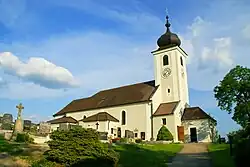 Statzendorf parish church | |
 Coat of arms | |
 Statzendorf Location within Austria | |
| Coordinates: 48°18′29″N 15°38′27″E / 48.30806°N 15.64083°E | |
| Country | Austria |
| State | Lower Austria |
| District | Sankt Pölten-Land |
| Government | |
| • Mayor | Gerhard Reithmayr (SPÖ) |
| Area | |
• Total | 12.46 km2 (4.81 sq mi) |
| Elevation | 295 m (968 ft) |
| Population (2018-01-01)[2] | |
• Total | 1,362 |
| • Density | 110/km2 (280/sq mi) |
| Time zone | UTC+1 (CET) |
| • Summer (DST) | UTC+2 (CEST) |
| Postal code | 3125 |
| Area code | 02786 |
| Vehicle registration | PL |
| Website | www.statzendorf.at |
Statzendorf is a municipality in the district of Sankt Pölten-Land in Lower Austria, Austria. It consists of the following towns:
- Absdorf (1,17 km²)
- Kuffern (5,07 km²)
- Rottersdorf (2,70 km²)
- Statzendorf (2,91 km²)
- Weidling (0,61 km²)
Population
| Year | Pop. | ±% |
|---|---|---|
| 1951 | 1,012 | — |
| 1961 | 115 | −88.6% |
| 1971 | 1,188 | +933.0% |
| 1981 | 1,219 | +2.6% |
| 1991 | 1,247 | +2.3% |
| 2001 | 1,420 | +13.9% |
| 2012 | 1,367 | −3.7% |
References
- ^ "Dauersiedlungsraum der Gemeinden Politischen Bezirke und Bundesländer - Gebietsstand 1.1.2018". Statistics Austria. Retrieved 10 March 2019.
- ^ "Einwohnerzahl 1.1.2018 nach Gemeinden mit Status, Gebietsstand 1.1.2018". Statistics Austria. Retrieved 9 March 2019.