Villefranche-d'Astarac
Villefranche-d'Astarac | |
|---|---|
 A view within Villefranche | |
.svg.png) Coat of arms | |
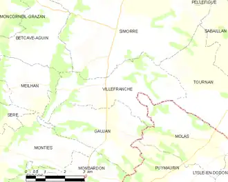
Location of Villefranche-d'Astarac | |
 Villefranche-d'Astarac  Villefranche-d'Astarac | |
| Coordinates: 43°25′28″N 0°43′41″E / 43.4244°N 0.7281°E | |
| Country | France |
| Region | Occitania |
| Department | Gers |
| Arrondissement | Auch |
| Canton | Val de Save |
| Government | |
| • Mayor (2020–2026) | Bernard Monlibos[1] |
Area 1 | 12.62 km2 (4.87 sq mi) |
| Population (2022)[2] | 168 |
| • Density | 13/km2 (34/sq mi) |
| Time zone | UTC+01:00 (CET) |
| • Summer (DST) | UTC+02:00 (CEST) |
| INSEE/Postal code | 32465 /32420 |
| Elevation | 202–311 m (663–1,020 ft) (avg. 200 m or 660 ft) |
| 1 French Land Register data, which excludes lakes, ponds, glaciers > 1 km2 (0.386 sq mi or 247 acres) and river estuaries. | |
Villefranche-d'Astarac (French pronunciation: [vilfʁɑ̃ʃ dastaʁak]; before 2023: Villefranche; Gascon: Vilafranca d'Astarac) is a commune in the Gers department in southwestern France.
Geography
Population
| Year | Pop. | ±% |
|---|---|---|
| 1962 | 246 | — |
| 1968 | 213 | −13.4% |
| 1975 | 180 | −15.5% |
| 1982 | 154 | −14.4% |
| 1990 | 153 | −0.6% |
| 1999 | 138 | −9.8% |
| 2008 | 163 | +18.1% |
See also
References
- ^ "Répertoire national des élus: les maires". data.gouv.fr, Plateforme ouverte des données publiques françaises (in French). 9 August 2021.
- ^ "Populations de référence 2022" (in French). The National Institute of Statistics and Economic Studies. 19 December 2024.
Wikimedia Commons has media related to Villefranche-d'Astarac.