Cangxi County
Cangxi County 苍溪县 | |
|---|---|
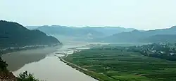 Jialing River scenery | |
 Cangxi Location in Sichuan | |
| Coordinates: 31°55′13″N 106°02′35″E / 31.9203°N 106.043°E | |
| Country | China |
| Province | Sichuan |
| Prefecture-level city | Guangyuan |
| Township-level divisions | 25 towns 6 townships |
| County seat | Lingjiang (陵江镇) |
| Area | |
• County | 2,334 km2 (901 sq mi) |
| Elevation | 390 m (1,280 ft) |
| Population | |
• County | 512,617 |
| • Density | 220/km2 (570/sq mi) |
| • Urban | 168,843 |
| • Rural | 343,774 |
| Time zone | UTC+8 (China Standard) |
| Website | www |
Cangxi County (simplified Chinese: 苍溪县; traditional Chinese: 蒼溪縣; pinyin: Cāngxī Xiàn) is a county of northeastern Sichuan Province, China, located along the upper reaches of the Jialing River. It is under the administration of Guangyuan City. The population in 2020 was 512,617.[1]
Cangxi produces red kiwifruit, a protected geographic origin product.[2][3] It also produces rice, pomelo, and several pear varieties.[4]
Administrative divisions
Cangxi administers 25 towns and 6 townships:[5][1]
| English | Chinese | Population (2020 census) |
|---|---|---|
| Lingjiang Town* | 陵江镇 | 143446 |
| Yunfeng Town | 云峰镇 | 15383 |
| Dongqing Town | 东青镇 | 15010 |
| Baiqiao Zhen | 白桥镇 | 10123 |
| Wulong Town | 五龙镇 | 10537 |
| Yongning Town | 永宁镇 | 6918 |
| Yuanxi Town | 鸳溪镇 | 7314 |
| Sanchuan Town | 三川镇 | 10250 |
| Longwangzhen | 龙王镇 | 17677 |
| Yuanba Town | 元坝镇 | 35444 |
| Huanma Zhen | 唤马镇 | 7670 |
| Qiping Town | 歧坪镇 | 22064 |
| Baiyi Town | 白驿镇 | 14535 |
| Lijiang Town | 漓江镇 | 11833 |
| Wenchang Town | 文昌镇 | 13286 |
| Yuedong Zhen | 岳东镇 | 14421 |
| Shima Zhen | 石马镇 | 11055 |
| Yunshan Town | 运山镇 | 7342 |
| Dongxi Town | 东溪镇 | 23830 |
| Gaopo Zhen | 高坡镇 | 13869 |
| Longshan Town | 龙山镇 | 24001 |
| Tingzi Zhen | 亭子镇 | 5928 |
| Baili Town | 百利镇 | 8479 |
| Huangmaoya Town | 黄猫垭镇 | 8698 |
| Hedi Town | 河地镇 | 11620 |
| Baihe Township | 白鹤乡 | 7688 |
| Zheshui Town | 浙水乡 | 5721 |
| Yueshan Township | 月山乡 | 11288 |
| Baishan Township | 白山乡 | 6296 |
| Pengdian Xiang | 彭店乡 | 5498 |
| Qiaoxi Township | 桥溪乡 | 5393 |
*county seat
Climate
| Climate data for Cangxi, elevation 460 m (1,510 ft), (1991–2020 normals, extremes 1981–present) | |||||||||||||
|---|---|---|---|---|---|---|---|---|---|---|---|---|---|
| Month | Jan | Feb | Mar | Apr | May | Jun | Jul | Aug | Sep | Oct | Nov | Dec | Year |
| Record high °C (°F) | 19.3 (66.7) | 23.9 (75.0) | 32.0 (89.6) | 34.0 (93.2) | 36.4 (97.5) | 37.4 (99.3) | 39.8 (103.6) | 41.0 (105.8) | 37.8 (100.0) | 31.0 (87.8) | 26.8 (80.2) | 20.0 (68.0) | 41.0 (105.8) |
| Mean daily maximum °C (°F) | 9.6 (49.3) | 12.5 (54.5) | 17.5 (63.5) | 23.3 (73.9) | 27.0 (80.6) | 29.4 (84.9) | 31.7 (89.1) | 31.9 (89.4) | 26.4 (79.5) | 21.2 (70.2) | 16.2 (61.2) | 10.7 (51.3) | 21.5 (70.6) |
| Daily mean °C (°F) | 5.9 (42.6) | 8.4 (47.1) | 12.5 (54.5) | 17.6 (63.7) | 21.5 (70.7) | 24.5 (76.1) | 26.7 (80.1) | 26.5 (79.7) | 21.9 (71.4) | 17.1 (62.8) | 12.3 (54.1) | 7.3 (45.1) | 16.9 (62.3) |
| Mean daily minimum °C (°F) | 3.2 (37.8) | 5.4 (41.7) | 8.8 (47.8) | 13.4 (56.1) | 17.3 (63.1) | 20.7 (69.3) | 23.1 (73.6) | 22.7 (72.9) | 19.0 (66.2) | 14.5 (58.1) | 9.6 (49.3) | 4.8 (40.6) | 13.5 (56.4) |
| Record low °C (°F) | −3.3 (26.1) | −1.2 (29.8) | −1.4 (29.5) | 3.6 (38.5) | 8.7 (47.7) | 13.5 (56.3) | 16.9 (62.4) | 15.8 (60.4) | 12.5 (54.5) | 2.7 (36.9) | 0.4 (32.7) | −4.2 (24.4) | −4.2 (24.4) |
| Average precipitation mm (inches) | 13.3 (0.52) | 14.7 (0.58) | 30.5 (1.20) | 59.0 (2.32) | 114.3 (4.50) | 150.0 (5.91) | 207.2 (8.16) | 156.5 (6.16) | 155.9 (6.14) | 67.8 (2.67) | 28.1 (1.11) | 10.2 (0.40) | 1,007.5 (39.67) |
| Average precipitation days (≥ 0.1 mm) | 7.2 | 6.9 | 9.6 | 10.5 | 12.3 | 13.2 | 13.4 | 11.3 | 13.5 | 13.3 | 8.1 | 6.2 | 125.5 |
| Average snowy days | 1.7 | 0.6 | 0.1 | 0 | 0 | 0 | 0 | 0 | 0 | 0 | 0.1 | 0.4 | 2.9 |
| Average relative humidity (%) | 76 | 74 | 71 | 71 | 70 | 77 | 79 | 77 | 82 | 82 | 79 | 78 | 76 |
| Mean monthly sunshine hours | 56.2 | 54.5 | 97.9 | 132.6 | 140.3 | 132.1 | 159.6 | 173.3 | 93.7 | 74.8 | 64.7 | 51.3 | 1,231 |
| Percentage possible sunshine | 17 | 17 | 26 | 34 | 33 | 31 | 37 | 43 | 26 | 21 | 21 | 16 | 27 |
| Source: China Meteorological Administration[6][7]all-time extreme temperature[8] | |||||||||||||
References
- ^ a b c "苍溪县第七次全国人口普查主要数据情况-苍溪县人民政府". cncx.gov.cn. Retrieved 2021-10-31.
- ^ "Introduction to GIs under the China-EU Agreement on Geographical Indications (7): Cangxi Red Kiwi Fruit". www.fmprc.gov.cn. Retrieved 2021-10-31.
- ^ "县情概况-苍溪县人民政府". cncx.gov.cn. Retrieved 2021-10-31.
- ^ "地方特产-苍溪县人民政府". cncx.gov.cn. Retrieved 2021-10-31.
- ^ 2023年统计用区划代码和城乡划分代码:苍溪县 (in Simplified Chinese). National Bureau of Statistics of China.
- ^ 中国气象数据网 – WeatherBk Data (in Simplified Chinese). China Meteorological Administration. Retrieved 14 April 2023.
- ^ 中国气象数据网 (in Simplified Chinese). China Meteorological Administration. Retrieved 14 April 2023.
- ^ "Extreme Temperatures Around the World". Retrieved 4 August 2025.
External links