East Karawang
East Karawang Karawang Timur Karawang Wetan | |
|---|---|
| Regional transcription(s) | |
| • Sundanese | ᮊᮛᮝᮀ ᮊᮥᮜᮧᮔ᮪ |
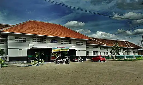 Karawang Station | |
| Coordinates: 6°17′53″S 107°17′56″E / 6.29806°S 107.29889°E | |
| Country | |
| Province | West Java |
| Regency | Karawang Regency |
| Area | |
• Total | 29.77 km2 (11.49 sq mi) |
| Elevation | 22 m (72 ft) |
| Population (mid 2023 estimate)[1] | |
• Total | 158,429 |
| • Density | 5,300/km2 (14,000/sq mi) |
| Time zone | UTC+7 (IWT) |
| Postal code | 4131x |
| Area code | (+62) 264 |
| Villages | 8 |
| Website | Official website |


East Karawang (Indonesian: Karawang Timur, Sundanese: ᮊᮛᮝᮀ ᮊᮥᮜᮧᮔ᮪; Karawang Wetan) is an administrative district (kecamatan) of Karawang Regency. It covers a land area of 29.77 km2, and had a population of 118,001 at the 2010 Census[2] and 146,326 at the 2020 Census;[3] the official estimate as at mid 2023 was 158,429 - comprising 80,142 males and 78,287 females.[1]
The district centre is at the town of East Adiarsa, and the district is sub-divided into four urban communities (kelurahan) and four rural villages (desa), all listed below with their areas and populations as at mid 2023,[1] together with their postcodes. The first four communities listed in the table are the kelurahan, while the last four are desa.
| Kode Wilayah | Name of kelurahan or desa | Area in km2 | Population mid 2023 estimate | Post code |
|---|---|---|---|---|
| 32.15.26.1001 | Karawang Wetan (East Karawang) | 3.20 | 36,154 | 41314 |
| 32.15.26.1002 | Adiarsa Timur (East Adiarsa) | 4.32 | 16,362 | 41314 |
| 32.15.26.1003 | Palambonsari | 4.02 | 32,345 | 41314 |
| 32.15.26.1004 | Plawad | 7.00 | 12,506 | 41314 |
| 32.15.26.2005 | Margasari | 2.76 | 12,821 | 41313 |
| 32.15.26.2006 | Warungbambu | 1.65 | 12,945 | 41313 |
| 32.15.26.2007 | Kondangjaya | 2.44 | 25,309 | 41313 |
| 32.15.26.2008 | Tegalsawah | 4.38 | 8,987 | 41314 |
| 32.15.26 | Totals | 29.77 | 158,429 |
Climate
Karawang has a tropical monsoon climate (Am) with moderate to little rainfall from May to October and heavy rainfall from November to April.
| Climate data for Karawang | |||||||||||||
|---|---|---|---|---|---|---|---|---|---|---|---|---|---|
| Month | Jan | Feb | Mar | Apr | May | Jun | Jul | Aug | Sep | Oct | Nov | Dec | Year |
| Mean daily maximum °C (°F) | 30.1 (86.2) | 30.2 (86.4) | 30.9 (87.6) | 31.7 (89.1) | 32.0 (89.6) | 32.1 (89.8) | 32.1 (89.8) | 32.7 (90.9) | 33.2 (91.8) | 33.2 (91.8) | 32.2 (90.0) | 31.2 (88.2) | 31.8 (89.3) |
| Daily mean °C (°F) | 26.4 (79.5) | 26.4 (79.5) | 26.8 (80.2) | 27.2 (81.0) | 27.3 (81.1) | 27.1 (80.8) | 26.8 (80.2) | 27.2 (81.0) | 27.6 (81.7) | 27.8 (82.0) | 27.4 (81.3) | 27.0 (80.6) | 27.1 (80.7) |
| Mean daily minimum °C (°F) | 22.7 (72.9) | 22.7 (72.9) | 22.7 (72.9) | 22.8 (73.0) | 22.7 (72.9) | 22.1 (71.8) | 21.6 (70.9) | 21.7 (71.1) | 22.0 (71.6) | 22.4 (72.3) | 22.7 (72.9) | 22.8 (73.0) | 22.4 (72.4) |
| Average rainfall mm (inches) | 279 (11.0) | 260 (10.2) | 214 (8.4) | 149 (5.9) | 124 (4.9) | 99 (3.9) | 65 (2.6) | 38 (1.5) | 59 (2.3) | 122 (4.8) | 203 (8.0) | 211 (8.3) | 1,823 (71.8) |
| Source: Climate-Data.org[4] | |||||||||||||