Gschnaidt
Gschnaidt | |
|---|---|
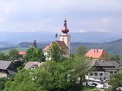 View of Sankt Pankrazen in Gschnaidt | |
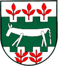 Coat of arms | |
 Location within Graz-Umgebung district | |
 Gschnaidt Location within Austria | |
| Coordinates: 47°08′12″N 15°11′8″E / 47.13667°N 15.18556°E | |
| Country | Austria |
| State | Styria |
| District | Graz-Umgebung |
| Area | |
• Total | 29.82 km2 (11.51 sq mi) |
| Elevation | 769 m (2,523 ft) |
| Population (1 January 2016)[1] | |
• Total | 341 |
| • Density | 11/km2 (30/sq mi) |
| Time zone | UTC+1 (CET) |
| • Summer (DST) | UTC+2 (CEST) |
| Postal code | 8153 |
| Area code | 03149 |
| Vehicle registration | GU |
Gschnaidt is a former municipality in the district of Graz-Umgebung in the Austrian state of Styria. Since the 2015 Styria municipal structural reform, it is part of the municipality Gratwein-Straßengel.[2]
Population
| Year | Pop. | ±% |
|---|---|---|
| 1869 | 818 | — |
| 1880 | 681 | −16.7% |
| 1890 | 688 | +1.0% |
| 1900 | 701 | +1.9% |
| 1910 | 674 | −3.9% |
| 1923 | 610 | −9.5% |
| 1934 | 636 | +4.3% |
| 1939 | 617 | −3.0% |
| 1951 | 585 | −5.2% |
| 1961 | 487 | −16.8% |
| 1971 | 443 | −9.0% |
| 1981 | 410 | −7.4% |
| 1991 | 370 | −9.8% |
| 2001 | 400 | +8.1% |
References