Javorník (Benešov District)
Javorník | |
|---|---|
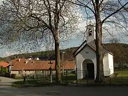 Chapel of Our Lady of the Seven Sorrows | |
 Flag  Coat of arms | |
 Javorník Location in the Czech Republic | |
| Coordinates: 49°41′12″N 15°1′36″E / 49.68667°N 15.02667°E | |
| Country | |
| Region | Central Bohemian |
| District | Benešov |
| First mentioned | 1295 |
| Area | |
• Total | 7.30 km2 (2.82 sq mi) |
| Elevation | 457 m (1,499 ft) |
| Population (2025-01-01)[1] | |
• Total | 147 |
| • Density | 20/km2 (52/sq mi) |
| Time zone | UTC+1 (CET) |
| • Summer (DST) | UTC+2 (CEST) |
| Postal code | 257 63 |
| Website | www |
Javorník is a municipality and village in Benešov District in the Central Bohemian Region of the Czech Republic. It has about 100 inhabitants.
Demographics
| Year | Pop. | ±% |
|---|---|---|
| 1869 | 226 | — |
| 1880 | 283 | +25.2% |
| 1890 | 289 | +2.1% |
| 1900 | 229 | −20.8% |
| 1910 | 238 | +3.9% |
| 1921 | 240 | +0.8% |
| 1930 | 208 | −13.3% |
| 1950 | 195 | −6.2% |
| 1961 | 174 | −10.8% |
| 1970 | 164 | −5.7% |
| 1980 | 160 | −2.4% |
| 1991 | 148 | −7.5% |
| 2001 | 136 | −8.1% |
| 2011 | 114 | −16.2% |
| 2021 | 110 | −3.5% |
| Source: Censuses[2][3] | ||
References
- ^ "Population of Municipalities – 1 January 2025". Czech Statistical Office. 2025-05-16.
- ^ "Historický lexikon obcí České republiky 1869–2011" (in Czech). Czech Statistical Office. 2015-12-21.
- ^ "Population Census 2021: Population by sex". Public Database. Czech Statistical Office. 2021-03-27.
External links
Wikimedia Commons has media related to Javorník (Benešov District).