Mexico City Metrobús Line 2
| Metrobús Line 2 | |||
|---|---|---|---|
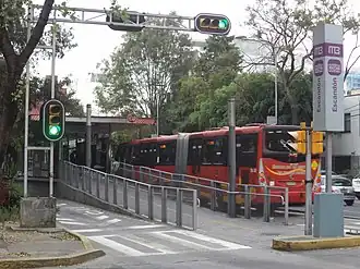 Bus at the Escandón station | |||
| Overview | |||
| Status | In service | ||
| Termini |
| ||
| Stations | 37 | ||
| Website | Línea 2 | ||
| Service | |||
| Type | Bus rapid transit | ||
| System | Mexico City Metrobus | ||
| Services | 4 | ||
| Operator(s) | See Operators | ||
| History | |||
| Opened | December 16, 2008 | ||
| Technical | |||
| Line length | 20 km (12.4 mi)[1] | ||
| Character | Exclusive right-of-way | ||
| |||
The Mexico City Metrobús Line 2 is a bus rapid transit line in the Mexico City Metrobus. It operates between Tepalcates, in Iztapalapa and Tacubaya in the Miguel Hidalgo municipality, in western Mexico City.
Line 2 has a total of 36 stations and a length of 20 kilometers and it runs from east to west through Eje 4 Sur.[1]
Construction of Line 2 started on September 4, 2007 and it was inaugurated on December 16, 2008 by Marcelo Ebrard, Head of Government of the Federal District from 2006 to 2012.[2][3]
Service description
Services
The line has six itineraries.[4]
| Tepalcates to Tacubaya
Tepalcates to Etiopía
Tepalcates to Colonia del Valle (Line 1)
| Tepalcates to Nápoles (Line 1)
Rojo Gómez to Doctor Gálvez (Line 1)
Río Frío to Colonia del Valle (Line 1)
|
Line 2 services the Iztapalapa, Iztacalco, Benito Juárez, Cuauhtémoc, and Miguel Hidalgo and Álvaro Obregón boroughs.
Station list
| Denotes a Metrobús transfer | |
| Denotes a connection with the Centro de transferencia modal (CETRAM) system | |
| Denotes a connection with the Ecobici system | |
| Denotes a connection with the Metro system | |
| Denotes a connection with the public bus system | |
| Denotes a connection with the Red de Transporte de Pasajeros (RTP) system | |
| Denotes a connection with the Trolleybus system |
Tepalcates–Tacubaya
| Stations[b] | Connections | Neighborhood(s) | Borough | Picture | Date opened |
|---|---|---|---|---|---|
| Tepalcates | | Unidad Habitacional Ejército Constitucionalista, Tepalcates | Iztapalapa |  | December 16, 2008[3] |
| Nicolás Bravo[c] | | Tepalcates | |||
| Canal de San Juan[c] | | ||||
| General Antonio de León[d] | |||||
| Constitución de Apatzingán | | ||||
| CCH Oriente[e] | | Unidad Habitacional Ejército Constitucionalista | |||
| Leyes de Reforma | Colonia Leyes de Reforma 3@ Sección | ||||
| Del Moral[d] | Colonia Cuchilla del Moral, Colonia Leyes de Reforma 3@ Sección | ||||
| Río Frío[c] | Colonia Cuchilla del Moral | ||||
| Rojo Gómez | Colonia Dr. Alfonso Díaz Tirado | ||||
| Río Mayo | |||||
| Río Tecolutla | Colonia Real del Moral | ||||
| El Rodeo | | Colonia Paseos de Churubusco, Colonia El Rodeo |  | ||
| UPIICSA | Colonia Granjas México, Colonia Ampliación Gabriel Ramos Millán | Iztacalco |  | ||
| Iztacalco | |  | |||
| Goma | | Colonia Granjas México, Colonia Gabriel Ramos Millán |  | ||
| Tlacotal |  | ||||
| Canela |  | ||||
| Metro Coyuya | | Coyuya, Granjas México, Barrio de los Reyes, Tlazintla | .jpg) | September 7, 2020[12] | |
| Coyuya | Santa Anita, Barrio Los Reyes | 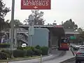 | December 16, 2008[3] | ||
| La Viga | | Nueva Santa Anita, Barrio San Francisco Xicaltongo | 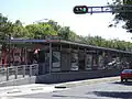 | ||
| Andrés Molina | Nueva Santa Anita, Barrio San Pedro |  | |||
| Las Américas | Colonia Moderna | Benito Juárez | 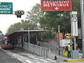 | ||
| Xola | | Colonia Álamos | 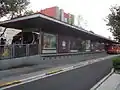 | ||
| Álamos | 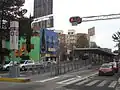 | ||||
| Centro SCOP | | Narvarte Oriente |  | ||
| Doctor Vértiz |  | ||||
| Etiopía / Plaza de la Transparencia | | Narvarte Poniente |  | ||
| Amores | Colonia del Valle Norte | _4.jpg) | |||
| Viaducto | | Colonia Roma Sur | Cuauhtémoc | .jpg) | |
| Nuevo León | | Hipódromo | .jpg) | ||
| Escandón | Hipódromo, Escandón | Cuauhtémoc, Miguel Hidalgo | _2.jpg) | ||
| Patriotismo | | _2.jpg) | |||
| De La Salle | | Hipódromo Condesa, Escandón | _2.jpg) | ||
| Parque Lira[d] | San Miguel Chapultepec | Miguel Hidalgo |  | ||
| Antonio Maceo[c] | Tacubaya | .jpg) | |||
| Tacubaya | | .jpg) |
Tepalcates–Doctor Gálvez branch
The route runs from Tepalcates to Viaducto normally. As soon as it reaches Avenida de los Insurgentes, the route detours towards Southern Mexico City sharing the same stations Line 1 uses. The branch originally ran from Tepalcates to Colonia del Valle stations, but since 31 October 2022, there is an additional service that runs from Rojo Gómez station to Doctor Gálvez station.[13]
| Stations[b] | Connections | Neighborhood(s) | Borough | Picture | Date opened |
|---|---|---|---|---|---|
| Viaducto | | Colonia Roma Sur | Cuauhtémoc | .JPG) | December 16, 2008 |
| Nuevo León (L1) | | Hipódromo, Roma Sur |  | June 19, 2005[14] | |
| La Piedad | Nápoles, Del Valle Norte | Benito Juárez |  | ||
| Poliforum | 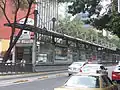 | ||||
| Nápoles | Nápoles, Del Valle Centro |  | |||
| Colonia del Valle | Nápoles, Insurgentes San Borja |  | |||
| Ciudad de los Deportes | | Ciudad de los Deportes, Insurgentes San Borja |  | ||
| Parque Hundido | | Noche Buena, Tlacoquemécatl |  | ||
| Félix Cuevas | | Extremadura Insurgentes, Tlacoquemécatl |  | ||
| Río Churubusco | | Insurgentes Mixcoac, Actipán | |||
| Teatro Insurgentes | San José Insurgentes, Crédito Constructor |  | |||
| José María Velasco | | Guadalupe Inn, Florida | Álvaro Obregón | .jpg) | |
| Francia |  | ||||
| Olivo |  | ||||
| Altavista | |  | |||
| La Bombilla | | San Ángel, Chimalistac |  | ||
| Dr. Gálvez | | Barrio Loreto, Chimalistac |  |
Río Frío/Del Moral–Juárez branch
The route starts at Río Frío station and runs normally to Doctor Vértiz. As it reaches Etiopía / Plaza de la Transparencia station, the route detours at Avenida Cuauhtémoc towards Northern Mexico City sharing the same stations Line 3 uses until Juárez station. Then the route returns following the same route and it ends at Del Moral station.[15]
| Stations[b] | Connections | Neighborhood(s) | Borough | Picture | Date opened |
|---|---|---|---|---|---|
| Etiopía / Plaza de la Transparencia (L3) | | Narvarte Poniente | Benito Juárez | February 8, 2011[16] | |
| Obrero Mundial | | Piedad Narvarte |  | ||
| Centro Médico | | Roma Sur, Doctores | Cuauhtémoc |  | |
| Dr. Márquez | |  | |||
| Hospital General | | Roma Norte, Doctores |  | ||
| Jardín Pushkin | | 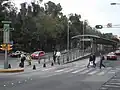 | |||
| Cuauhtémoc | |  | |||
| Balderas | | Centro |  | ||
| Juárez | |  |
Operators
Line 2 has five operators.[17]
- Corredor Oriente - Poniente, SA de CV (COP)
- Corredor Eje 4 - 17 de Marzo, SA de CV (CE4-17MSA)
- Transportes Sánchez Armas José Juan, SA de CV (TSA)
- Corredor Tacubaya - Tepalcates, SA de CV (CTT)
- Red de Transporte de Pasajeros del Distrito Federal
Notes
- ^ The following list was adapted from different websites and official maps.
- Metrobús (
 ) obtained from the Mexico City Metrobús system map.[5]
 - Centro de transferencia modal (CETRAM;
_%C3%93rgano_Regulador_de_Transporte_(CETRAM).svg.png) ) obtained from the official website of the Órgano Regulador de Transporte.[6]
) obtained from the official website of the Órgano Regulador de Transporte.[6] - Ecobici (
_EcoBici.svg.png) ) obtained from their official website.[7]
) obtained from their official website.[7] - Metro (
_version_2019.svg.png) ) connections obtained from the official Mexico City Metro system map.[8]
) connections obtained from the official Mexico City Metro system map.[8] - Public buses network (peseros) (
_Red_de_Autobuses_de_la_CDMX.svg.png) ) obtained from the official website of the Órgano Regulador de Transporte.[9]
) obtained from the official website of the Órgano Regulador de Transporte.[9] - Red de Transporte de Pasajeros (
 ) obtained from their official website.[10]
 - Trolleybuses (
 ) obtained from their official website.[11]
- Metrobús (
- ^ a b c All the stations are fully accessible to people with disabilities.
- ^ a b c d Accessible from Tacubaya to Tepalcates.
- ^ a b c Accessible from Tepalcates to Tacubaya.
- ^ Formerly named "Tezontle".
References
- ^ a b (in Spanish) "Eje 4 Sur", Metrobús website, archive of 2010-08-21
- ^ "Comienzan obras del segundo corredor del Metrobús, que irá sobre Eje 4 Sur". La Jornada (in Spanish). September 5, 2007. Retrieved June 5, 2018.
- ^ a b c "Arranca inconclusa la línea 2 del Metrobús". La Jornada (in Spanish). December 17, 2008. Retrieved June 5, 2018.
- ^ (in Spanish) "Mapa Línea 2" (Line 2 Map), Metrobús website
- ^ "Mapa del sistema" [System map] (in Spanish). Mexico City Metrobús. Retrieved 30 October 2021.
- ^ "Centros de Transferencia Modal (CETRAM)" [Modal Transfer Centers] (in Spanish). Órgano Regulador de Transporte. Retrieved 30 October 2021.
- ^ "Mapa de disponibilidad" [Disponibility map] (in Spanish). Ecobici. Retrieved 30 October 2021.
- ^ "Mi Mapa Metro 22032021" [My Metro Map 22032021] (PDF) (in Spanish). Sistema Transporte Colectivo Metro. 22 March 2021. Retrieved 30 October 2021.
- ^ "Red de corredores" [Route network]. Organismo Regulador de Transporte (in Spanish). Retrieved 30 October 2021.
- ^ "Red de Rutas" [Routes network] (in Spanish). Red de Transporte de Pasajeros. Retrieved 30 October 2021.
- ^ "Servicios" [Services] (in Spanish). Servicio de Transportes Eléctricos. Retrieved 30 October 2021.
- ^ "Inicia operaciones línea 5 del Metrobús en CDMX" (in Spanish). Noticieros Televisa. September 7, 2020. Retrieved September 7, 2020.
- ^ López, Jonás (26 October 2022). "Metrobús tendrá nueva ruta; conectará Doctor Gálvez con Rojo Gómez". Excélsior (in Spanish). Mexico City. Retrieved 3 November 2022.
- ^ (in Spanish) "Corredor Insurgentes", Metrobús website, archive of 2009-07-29
- ^ "Este lunes se estrena nueva ruta del Metrobús en CDMX: irá de Río Frío a Juárez". Expansión (in Spanish). 23 July 2023. Retrieved 24 July 2023.
- ^ "Inaugurarán mañana la Línea 3 del Metrobús". Excélsior (in Spanish). February 7, 2011. Retrieved July 20, 2018.
- ^ Padron Corredores Metrobus (in Spanish), Gobierno del Distrito Federal, retrieved June 5, 2018
| Others |
|
|---|---|
| Former | |