Phantom Peak
| Phantom Peak | |
|---|---|
 Phantom Peak Location in Washington  Phantom Peak Location in the United States | |
| Highest point | |
| Elevation | 8,000+ ft (2,440+ m)[1] |
| Prominence | 360 ft (110 m)[1] |
| Coordinates | 48°49′08″N 121°20′33″W / 48.81889°N 121.34250°W[2] |
| Geography | |
| Location | Whatcom County, Washington, U.S. |
| Parent range | Cascade Range |
| Topo map | USGS Mount Challenger |
| Climbing | |
| First ascent | 1940 Fred Beckey |
| Easiest route | Southwest Route Class 4 |
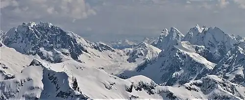
Phantom Peak (8,000+ ft (2,440+ m)) is in North Cascades National Park in the U.S. state of Washington.[3] Located in the northern section of the park, Phantom Peak is in the Picket Range and is 1 mi (1.6 km) northwest of Mount Fury, 1.5 mi (2.4 km) north of Mount Crowder, and .50 mi (0.80 km) south of Crooked Thumb Peak.
References
- ^ a b "Phantom Peak, Washington". Peakbagger.com. Retrieved July 20, 2013.
- ^ "Phantom Peak". Geographic Names Information System. United States Geological Survey, United States Department of the Interior. Retrieved July 20, 2013.
- ^ Mount Challenger, WA (Map). TopoQwest (United States Geological Survey Maps). Retrieved July 20, 2013.
External links
- Phantom Peak aerial photo: PBase