Saint-Ferréol-de-Comminges
Saint-Ferréol-de-Comminges | |
|---|---|
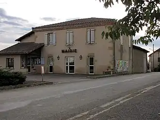 Town hall | |
Location of Saint-Ferréol-de-Comminges | |
 Saint-Ferréol-de-Comminges  Saint-Ferréol-de-Comminges | |
| Coordinates: 43°20′18″N 0°44′25″E / 43.3383°N 0.7403°E | |
| Country | France |
| Region | Occitania |
| Department | Haute-Garonne |
| Arrondissement | Saint-Gaudens |
| Canton | Saint-Gaudens |
| Government | |
| • Mayor (2020–2026) | Thierry Bouas[1] |
Area 1 | 5.88 km2 (2.27 sq mi) |
| Population (2022)[2] | 60 |
| • Density | 10/km2 (26/sq mi) |
| Time zone | UTC+01:00 (CET) |
| • Summer (DST) | UTC+02:00 (CEST) |
| INSEE/Postal code | 31479 /31250 |
| Elevation | 213–335 m (699–1,099 ft) (avg. 311 m or 1,020 ft) |
| 1 French Land Register data, which excludes lakes, ponds, glaciers > 1 km2 (0.386 sq mi or 247 acres) and river estuaries. | |
Saint-Ferréol-de-Comminges (Occitan: Sant Ferriòu, before 2003: Saint-Ferréol)[3] is a commune in the Haute-Garonne department in southwestern France.
Geography
The river Gesse forms part of the commune's northwestern border.
Population
| Year | Pop. | ±% |
|---|---|---|
| 1962 | 92 | — |
| 1968 | 85 | −7.6% |
| 1975 | 71 | −16.5% |
| 1982 | 67 | −5.6% |
| 1990 | 63 | −6.0% |
| 1999 | 53 | −15.9% |
| 2008 | 58 | +9.4% |
See also
References
- ^ "Répertoire national des élus: les maires". data.gouv.fr, Plateforme ouverte des données publiques françaises (in French). 9 August 2021.
- ^ "Populations de référence 2022" (in French). The National Institute of Statistics and Economic Studies. 19 December 2024.
- ^ Décret du 1 août 2003 portant changement de nom de communes, Légifrance.
Wikimedia Commons has media related to Saint-Ferréol-de-Comminges.