Tuparetama
Tuparetama | |
|---|---|
_visto_do_alto.jpg) Aerial view of Tuparetama | |
 Flag  Coat of arms | |
| Etymology: Derived from the Tupi–Guarani language, Tupã meaning "God" and retama meaning "region", "country", "place", or "house"[1] | |
| Motto(s): | |
 Location of Tuparetama in Pernambuco | |
 Tuparetama  Tuparetama | |
| Coordinates: 7°36′7″S 37°18′39″W / 7.60194°S 37.31083°W | |
| Country | |
| Region | Northeast |
| State | |
| Founded | 11 April 1962[1] |
| Government | |
| • Mayor | Diógenes Torres da Costa Patriota (PSDB) (2025-2028)[4][5] |
| • Vice Mayor | Maria Luciana Lima Pessôa (PODE) (2025-2028)[4][5] |
| Area | |
• Total | 188.428 km2 (72.752 sq mi) |
| Elevation | 560 m (1,840 ft) |
| Population (2022) | |
• Total | 8,005[3] |
| • Density | 42.24/km2 (109.4/sq mi) |
| Demonym | Tuparetamense (Brazilian Portuguese)[3] |
| Time zone | UTC-03:00 (Brasília Time) |
| Postal code | 56760-000, 56770-000[6] |
| HDI (2010) | 0.634 – medium[3] |
| Website | tuparetama.pe.gov.br |
Tuparetama is a city in the state of Pernambuco, Brazil. The population in 2020, according with IBGE was 8,256 inhabitants and the total area is 178.57 km².[7]
Geography
- State - Pernambuco
- Region - Sertão Pernambucano
- Boundaries - São José do Egito (N); Iguaraci (S); Paraíba state (E); Ingazeira and Iguaraci (W).
- Area - 185.54 km²
- Elevation - 560 m
- Hydrography - Pajeú River
- Vegetation - Caatinga hiperxerófila
- Climate - semi arid - (Sertão) hot
- Annual average temperature - 23.5 c
- Distance to Recife - 377.4 km
Economy
The main economic activities in Tuparetama are based in commerce and agribusiness, especially creation of sheep, cattle, pigss, goats, chickens; and plantations of beans and corn.
Economic Indicators
| Population [8] | GDP x(1000 R$).[9] | GDP pc (R$) | PE |
|---|---|---|---|
| 8.678 | 29.862 | 3.617 | 0.048% |
Economy by Sector 2006
| Primary sector | Secondary sector | Service sector |
|---|---|---|
| 13.31% | 10.16% | 76.53% |
Health Indicators
| HDI (2000) | Hospitals (2007) | Hospitals beds (2007) | Children's Mortality every 1000 (2005) |
|---|---|---|---|
| 0.662 | 1 | 39 | 19.4 |
Gallery
-
 Aerial view of Tuparetama
 -
 Aerial view of Tuparetama
 -
 Aerial view of Tuparetama
 -
.jpg) Aerial view of Tuparetama with the Lucena Chalega Stadium
Aerial view of Tuparetama with the Lucena Chalega Stadium -
 View of Tuparetama
 -
 View of Tuparetama
 -
 View of Tuparetama
 -
 View of Tuparetama at night
 -
 Entrance to Tuparetama
 -
 Alonso Rodrigues Plaza
 -
 Parish of the Sacred Heart of Jesus of Tuparetama church
 -
 City hall of Tuparetama, photo taken between 1992 to 1996
 -
 Parish of the Sacred Heart of Jesus of Tuparetama church
 -
 Parish of the Sacred Heart of Jesus of Tuparetama church
 -
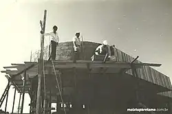 Construction of the bus station in Tuparetama
See also
References
- ^ a b "História & Fotos". Instituto Brasileiro de Geografia e Estatística (in Brazilian Portuguese). Instituto Brasileiro de Geografia e Estatística. Retrieved 27 March 2025.
- ^ "Descubra Tuparetama com o GuiaMais - Guia Mais Local". guia-mais.com (in Brazilian Portuguese). guia-mais.com. Retrieved 28 March 2025.
- ^ a b c "Tuparetama". Instituto Brasileiro de Geografia e Estatística (in Brazilian Portuguese). Instituto Brasileiro de Geografia e Estatística. Retrieved 28 March 2025.
- ^ a b "Eleições 2024: Diógenes Patriota (PSDB) | Candidato(a) a prefeito(a) de Tuparetama-PE". Folha de S.Paulo (in Brazilian Portuguese). Folha de S.Paulo. 30 November 2024. Retrieved 27 March 2025.
- ^ a b "Prefeito de Tuparetama (PE) toma posse nesta quarta (1º); veja lista de vereadores eleitos". G1 (in Brazilian Portuguese). Globo. 31 December 2024. Retrieved 27 March 2025.
- ^ "CEP Tuparetama/PE - Brasil". codigo-postal.org (in Brazilian Portuguese). codigo-postal.org. Retrieved 28 March 2025.
- ^ IBGE 2020
- ^ http://www.ibge.gov.br/home/estatistica/populacao/estimativa2009/POP2009_DOU.pdfIBGE Population Tuparetama 2009, page 35
- ^ Tuparetama 2007 GDP IBGE page 32 Archived 4 March 2016 at the Wayback Machine
- ^ PE State site - City by city profile
Capital: Recife | ||||||||||||||
| Mesoregion Agreste Pernambucano |
|  | ||||||||||||
| Mesoregion Mata Pernambucana |
| |||||||||||||
| Mesoregion Metropolitana de Recife |
| |||||||||||||
| Mesoregion Sao Francisco Pernambucano |
| |||||||||||||
| Mesoregion Sertão Pernambucano |
| |||||||||||||