Aktsyabrski
Aktsyabrski Акцябрскі (Belarusian) | |
|---|---|
 | |
 Flag  Seal | |
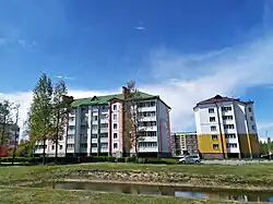
 Aktsyabrski | |
| Coordinates: 52°38′50″N 28°53′0″E / 52.64722°N 28.88333°E | |
| Country | Belarus |
| Region | Gomel Region |
| District | Aktsyabrski District |
| Created | 1954 |
| Population (2025)[1] | |
• Total | 7,167 |
| Time zone | UTC+3 (MSK) |
| Area code | +375-2357 |
Aktsyabrski (Belarusian: Акцябрскі, romanized: Akciabrski; Russian: Октябрьский, romanized: Oktyabrsky; Polish: Oktiabrski, Rudobiełka)[2] is an urban-type settlement in Gomel Region, in southern Belarus. It serves as the administrative center of Aktsyabrski District.[1] As of 2025, it has a population of 7,167.[1]
History
Rudobiełka was a royal village, administratively located in the Mozyrz County in the Mińsk Voivodeship of the Polish–Lithuanian Commonwealth.[2] In 1661, it was granted to Aleksander Hilary Połubiński in reward for his merits in defending Poland during the Swedish invasion, and later passed to the Łappa family.[2] Dominik Łappa drained the surrounding marshes with a new drainage system, raising the fertility of the soil.[2] Following the Second Partition of Poland in 1793, the village passed to Russia. In 1874, the Łapp family was forced to sell the estate to Baron Lilienfeld.[2]
It was established by a decree of August 31, 1954, by merging three adjacent settlements: Rudabelka (Belarusian: Рудабелка), Rudnya (Рудня), and Karpilawka (Карпілаўка), replacing Karpilawka as the administrative center.
Climate
| Climate data for Aktsyabrski (1991–2020) | |||||||||||||
|---|---|---|---|---|---|---|---|---|---|---|---|---|---|
| Month | Jan | Feb | Mar | Apr | May | Jun | Jul | Aug | Sep | Oct | Nov | Dec | Year |
| Record high °C (°F) | 5.1 (41.2) | 6.9 (44.4) | 14.7 (58.5) | 23.5 (74.3) | 28.5 (83.3) | 31.4 (88.5) | 32.3 (90.1) | 32.3 (90.1) | 27.0 (80.6) | 21.2 (70.2) | 12.5 (54.5) | 6.8 (44.2) | 32.3 (90.1) |
| Mean daily maximum °C (°F) | −1.5 (29.3) | 0.0 (32.0) | 5.6 (42.1) | 14.2 (57.6) | 20.3 (68.5) | 23.8 (74.8) | 25.6 (78.1) | 24.8 (76.6) | 18.8 (65.8) | 11.7 (53.1) | 4.3 (39.7) | −0.2 (31.6) | 12.3 (54.1) |
| Daily mean °C (°F) | −4.0 (24.8) | −3.2 (26.2) | 1.2 (34.2) | 8.3 (46.9) | 14.1 (57.4) | 17.8 (64.0) | 19.5 (67.1) | 18.4 (65.1) | 13.0 (55.4) | 7.1 (44.8) | 1.7 (35.1) | −2.5 (27.5) | 7.6 (45.7) |
| Mean daily minimum °C (°F) | −6.4 (20.5) | −6.1 (21.0) | −2.6 (27.3) | 2.9 (37.2) | 8.0 (46.4) | 11.7 (53.1) | 13.7 (56.7) | 12.4 (54.3) | 7.9 (46.2) | 3.3 (37.9) | −0.6 (30.9) | −4.8 (23.4) | 3.3 (37.9) |
| Record low °C (°F) | −20.4 (−4.7) | −18.1 (−0.6) | −11.6 (11.1) | −4.6 (23.7) | 0.3 (32.5) | 4.6 (40.3) | 8.3 (46.9) | 5.7 (42.3) | −0.3 (31.5) | −5.4 (22.3) | −10.3 (13.5) | −15.9 (3.4) | −20.4 (−4.7) |
| Average precipitation mm (inches) | 37.1 (1.46) | 37.5 (1.48) | 40.8 (1.61) | 38.5 (1.52) | 64.1 (2.52) | 73.2 (2.88) | 100.6 (3.96) | 60.8 (2.39) | 51.5 (2.03) | 53.9 (2.12) | 45.8 (1.80) | 44.1 (1.74) | 647.9 (25.51) |
| Average precipitation days (≥ 1.0 mm) | 10.1 | 9.3 | 8.9 | 7.5 | 9.7 | 9.8 | 10.8 | 7.7 | 8.3 | 8.5 | 9.1 | 10.4 | 110.1 |
| Source: NOAA[3] | |||||||||||||
References
- ^ a b c "Численность населения на 1 января 2025 г. и среднегодовая численность населения за 2024 год по Республике Беларусь в разрезе областей, районов, городов, поселков городского типа". belsat.gov.by. Archived from the original on 29 March 2025. Retrieved 8 May 2025.
- ^ a b c d e Słownik geograficzny Królestwa Polskiego i innych krajów słowiańskich (in Polish). Vol. IX. Warszawa. 1888. pp. 942–943.
{{cite book}}: CS1 maint: location missing publisher (link) - ^ "World Meteorological Organization Climate Normals for 1991-2020 — Aktsyabrski". National Oceanic and Atmospheric Administration. Retrieved January 12, 2024.