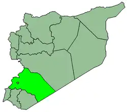
al-Tall District (Arabic: منطقة التل, romanized: manṭiqat al-Tall) is a district of the Rif Dimashq Governorate in southern Syria. The administrative centre is the city of al-Tall. At the 2004 census, the district had a population of 115,937.[1] As of July 2023, the population was estimated to be 275,252, of whom 188,263 were IDPS.[2]
Sub-districts
The district of al-Tall is divided into three sub-districts or nawāḥī (population as of 2004[1] and 2023[2]):
Localities in al-Tall District
According to the Central Bureau of Statistics (CBS), the following villages, towns and cities make up the district of al-Tall:[1]
| English Name | Arabic Name | Population | Subdistrict |
| al-Tall | التل | 44,597 | Al-Tall |
| Manin | منين | 17,521 | Al-Tall |
| Maaraba | معربا | 10,290 | Al-Tall |
| Rankous | رنكوس | 7,717 | Rankous |
| Badda | بدا | 6,564 | Saidnaya |
| Halboun | حلبون | 6,521 | Al-Tall |
| Saidnaya | صيدنايا | 5,194 | Saidnaya |
| Talfita | تلفيتا | 4,082 | Al-Tall |
| Hafeir al-Fouqa | حفير الفوقا | 3,441 | Saidnaya |
| Maarat Saidnaya | معرة صيدنايا | 3,084 | Saidnaya |
| Hosh Arab | حوش عرب | 2,073 | Rankous |
| al-Dreij | الدريج | 1,769 | Al-Tall |
| Maarounah | معرونة | 1,153 | Al-Tall |
| al-Fayadiyah | الفياضية | 785 | Rankous |
| Akoubar | عكوبر | 563 | Saidnaya |
| al-Jarniyah | الجرنية | 271 | Rankous |
| al-Mahabah | المحبة | 100 | Rankous |
| Sabnah | سبنة | 94 | Rankous |
| Ayn Dara | عين دره | 63 | Rankous |
| al-Nour | النور | 55 | Rankous |
References
|
|---|
|
|---|
Kiswah
Subdistrict | |
|---|
Babbila
Subdistrict | |
|---|
Jaramana
Subdistrict | |
|---|
Malihah
Subdistrict | |
|---|
Kafr Batna
Subdistrict | |
|---|
Arbin
Subdistrict | |
|---|
|
| |
|
|---|
Douma
Subdistrict | |
|---|
Harasta
Subdistrict | |
|---|
Sabe Biyar
Subdistrict | |
|---|
Dumayr
Subdistrict | |
|---|
Nashabiyeh
Subdistrict | |
|---|
Ghazlaniyeh
Subdistrict | |
|---|
Harran al-Awamid
Subdistrict | |
|---|
|
|
|
|---|
Qutayfah
Subdistrict | |
|---|
Jayrud
Subdistrict | |
|---|
Maloula
Subdistrict | |
|---|
Raheiba
Subdistrict | |
|---|
|
|
|
|---|
Al-Tall
Subdistrict | |
|---|
Sednaya
Subdistrict | |
|---|
Rankous
Subdistrict | |
|---|
|
|
|
|---|
Yabroud
Subdistrict | |
|---|
Assal al-Ward
Subdistrict | |
|---|
|
|
|
|---|
An-Nabek
Subdistrict | |
|---|
Deir Atiyeh
Subdistrict | |
|---|
Qara
Subdistrict | |
|---|
|
|
|
|---|
Al-Zabadani
Subdistrict | |
|---|
Madaya
Subdistrict | |
|---|
Serghaya
Subdistrict | |
|---|
|
|
|
|---|
Qatana
Subdistrict | |
|---|
Beit Jann
Subdistrict | |
|---|
Sa'sa
Subdistrict | |
|---|
|
|
|
|---|
Darayya
Subdistrict | |
|---|
Sahnaya
Subdistrict | |
|---|
Hajar al-Aswad
Subdistrict | |
|---|
|
|
|
|---|
Qudsaya
Subdistrict | |
|---|
ad-Dimas
Subdistrict | |
|---|
Ein al-Fijeh
Subdistrict | |
|---|
|
|