Allondrelle-la-Malmaison
Allondrelle-la-Malmaison | |
|---|---|
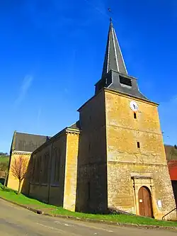 The church in Allondrelle | |
.svg.png) Coat of arms | |
Location of Allondrelle-la-Malmaison | |
 Allondrelle-la-Malmaison  Allondrelle-la-Malmaison | |
| Coordinates: 49°30′39″N 5°33′50″E / 49.5108°N 5.5639°E | |
| Country | France |
| Region | Grand Est |
| Department | Meurthe-et-Moselle |
| Arrondissement | Val-de-Briey |
| Canton | Mont-Saint-Martin |
| Government | |
| • Mayor (2020–2026) | Jean-François Mariemberg[1] |
Area 1 | 13.61 km2 (5.25 sq mi) |
| Population (2022)[2] | 634 |
| • Density | 47/km2 (120/sq mi) |
| Time zone | UTC+01:00 (CET) |
| • Summer (DST) | UTC+02:00 (CEST) |
| INSEE/Postal code | 54011 /54260 |
| Elevation | 230–396 m (755–1,299 ft) (avg. 340 m or 1,120 ft) |
| 1 French Land Register data, which excludes lakes, ponds, glaciers > 1 km2 (0.386 sq mi or 247 acres) and river estuaries. | |
Allondrelle-la-Malmaison (French pronunciation: [alɔ̃dʁɛl la malmɛzɔ̃]) is a commune in the Meurthe-et-Moselle department in northeastern France.
Population
| Year | Pop. | ±% p.a. |
|---|---|---|
| 1968 | 560 | — |
| 1975 | 513 | −1.24% |
| 1982 | 483 | −0.86% |
| 1990 | 481 | −0.05% |
| 1999 | 519 | +0.85% |
| 2009 | 619 | +1.78% |
| 2014 | 626 | +0.23% |
| 2020 | 647 | +0.55% |
| Source: INSEE[3] | ||
See also
References
- ^ "Répertoire national des élus: les maires". data.gouv.fr, Plateforme ouverte des données publiques françaises (in French). 2 December 2020.
- ^ "Populations de référence 2022" (in French). The National Institute of Statistics and Economic Studies. 19 December 2024.
- ^ Population en historique depuis 1968, INSEE
Wikimedia Commons has media related to Allondrelle-la-Malmaison.