Aronda
Aronda | |
|---|---|
village | |
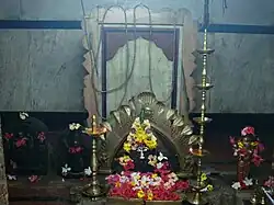 Shrine to the gramdevata of Aronda | |
 Aronda Location in Maharashtra, India  Aronda Aronda (India) | |
| Coordinates: 15°44′37.26″N 73°43′6.26″E / 15.7436833°N 73.7184056°E | |
| Country | India |
| State | Maharashtra |
| District | Sindhudurg |
| Government | |
| • Body | Gram Panchayat |
| Area | |
• Total | 4.95 km2 (1.91 sq mi) |
| Elevation | 20 m (70 ft) |
| Population (2011) | |
• Total | 2,465 |
| • Density | 500/km2 (1,300/sq mi) |
| Languages | |
| • Official | Marathi |
| Time zone | UTC+5:30 (IST) |
| Vehicle registration | MH-07 |
| Nearest city | Sawantwadi, Vengurla, Pernem, Mapusa |
| Lok Sabha constituency | Ratnagiri Sindhudurg. |
| Civic agency | Gram Panchayat |
Aronda is a village in the Sindhudurg district, Maharashtra state, India. It is a port on the boundary of Goa and Maharashtra, next to Terekhol River. As of 2011, the village had a population of 2,465.[1]
Geography
Aronda is located along the southern edge of Sindhudurg district, at an average elevation of 20 metres above the sea level.[2] It has a total land area of 495.48 hectares.[3]
Climate
Aronda has a Tropical monsoon climate (Am). It receives the most rainfall in July, with 874 mm of precipitation; and the least rainfall in January and February, with virtually no precipitation.
| Climate data for Aronda | |||||||||||||
|---|---|---|---|---|---|---|---|---|---|---|---|---|---|
| Month | Jan | Feb | Mar | Apr | May | Jun | Jul | Aug | Sep | Oct | Nov | Dec | Year |
| Mean daily maximum °C (°F) | 30.0 (86.0) | 30.4 (86.7) | 31.0 (87.8) | 32.0 (89.6) | 31.7 (89.1) | 28.1 (82.6) | 26.9 (80.4) | 26.8 (80.2) | 27.6 (81.7) | 29.3 (84.7) | 30.5 (86.9) | 30.5 (86.9) | 29.6 (85.2) |
| Daily mean °C (°F) | 25.7 (78.3) | 26.2 (79.2) | 27.3 (81.1) | 28.7 (83.7) | 28.9 (84.0) | 26.5 (79.7) | 25.5 (77.9) | 25.3 (77.5) | 25.8 (78.4) | 26.7 (80.1) | 26.9 (80.4) | 26.2 (79.2) | 26.6 (80.0) |
| Mean daily minimum °C (°F) | 21.4 (70.5) | 21.8 (71.2) | 23.5 (74.3) | 25.6 (78.1) | 26.5 (79.7) | 25.3 (77.5) | 24.6 (76.3) | 24.3 (75.7) | 24.2 (75.6) | 24.5 (76.1) | 23.6 (74.5) | 22.3 (72.1) | 24.0 (75.1) |
| Average rainfall mm (inches) | 0 (0) | 0 (0) | 5 (0.2) | 5 (0.2) | 72 (2.8) | 686 (27.0) | 874 (34.4) | 589 (23.2) | 284 (11.2) | 146 (5.7) | 28 (1.1) | 5 (0.2) | 2,694 (106) |
| Source: Climate-Data.org[4] | |||||||||||||
References
- ^ "Population finder 2011". Office of the Registrar General & Census Commissioner, India. Retrieved 13 October 2023.
- ^ "Aronda topographic map, elevation, terrain". Topographic maps. Retrieved 13 October 2023.
- ^ Census of India 2011 Maharashtra District Census Handbook Sindhudurg (PDF). Directorate of Census Operations, Maharashtra. p. 422. Retrieved 13 October 2023.
- ^ "Aronda climate: Temperature Aronda & Weather By Month - Climate-Data.org". en.climate-data.org. Retrieved 13 October 2023.