Avillers-Sainte-Croix
Avillers-Sainte-Croix | |
|---|---|
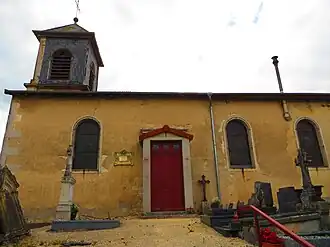 The church in Avillers-Sainte-Croix | |
Location of Avillers-Sainte-Croix | |
 Avillers-Sainte-Croix  Avillers-Sainte-Croix | |
| Coordinates: 49°01′57″N 5°42′02″E / 49.0325°N 5.7006°E | |
| Country | France |
| Region | Grand Est |
| Department | Meuse |
| Arrondissement | Verdun |
| Canton | Étain |
| Intercommunality | CC Territoire Fresnes-en-Woëvre |
| Government | |
| • Mayor (2020–2026) | François Jamin[1] |
Area 1 | 5.5 km2 (2.1 sq mi) |
| Population (2022)[2] | 80 |
| • Density | 15/km2 (38/sq mi) |
| Time zone | UTC+01:00 (CET) |
| • Summer (DST) | UTC+02:00 (CEST) |
| INSEE/Postal code | 55021 /55210 |
| Elevation | 212–239 m (696–784 ft) (avg. 203 m or 666 ft) |
| 1 French Land Register data, which excludes lakes, ponds, glaciers > 1 km2 (0.386 sq mi or 247 acres) and river estuaries. | |
Avillers-Sainte-Croix is a commune in the Meuse department in the Grand Est region in northeastern France.
Population
| Year | Pop. | ±% p.a. |
|---|---|---|
| 1968 | 78 | — |
| 1975 | 65 | −2.57% |
| 1982 | 57 | −1.86% |
| 1990 | 66 | +1.85% |
| 1999 | 70 | +0.66% |
| 2009 | 62 | −1.21% |
| 2014 | 64 | +0.64% |
| 2020 | 68 | +1.02% |
| Source: INSEE[3] | ||
See also
References
- ^ "Répertoire national des élus: les maires". data.gouv.fr, Plateforme ouverte des données publiques françaises (in French). 2 December 2020.
- ^ "Populations de référence 2022" (in French). The National Institute of Statistics and Economic Studies. 19 December 2024.
- ^ Population en historique depuis 1968, INSEE
Wikimedia Commons has media related to Avillers-Sainte-Croix.