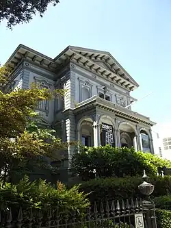
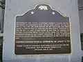
Image [ 1] Landmark name Location City or town Summary Adams and Company Building 607 Adams and Company Building Old Sacramento Historic District , 1014 2nd St.38°34′57″N 121°30′16″W / 38.5826°N 121.5044°W / 38.5826; -121.5044 (Adams and Company Building ) Sacramento African Methodist Episcopal Church 1013 African Methodist Episcopal Church 715 Seventh St. 38°35′03″N 121°29′46″W / 38.584217°N 121.496033°W / 38.584217; -121.496033 (African Methodist Episcopal Church ) Sacramento B.F. Hastings Building 606 B.F. Hastings Building Old Sacramento State Historic Park , 1000 2nd St.38°34′59″N 121°30′15″W / 38.5831°N 121.504183°W / 38.5831; -121.504183 (B.F. Hastings Building ) Sacramento Booth Company 596 Booth Company 1015-17 Front St. 38°35′00″N 121°30′20″W / 38.583267°N 121.505483°W / 38.583267; -121.505483 (Booth Company ) Sacramento California Almond Growers exchange process facility 967 California Almond Growers exchange process facility 1809 C St. 38°35′06″N 121°28′43″W / 38.585°N 121.478667°W / 38.585; -121.478667 (California Almond Growers exchange process facility ) Sacramento California’s First Passenger Railroad 526 California’s First Passenger Railroad 3rd and R Sts. 38°34′26″N 121°30′24″W / 38.574°N 121.506767°W / 38.574; -121.506767 (California’s First Passenger Railroad ) Sacramento California State Capitol 872 California State Capitol 10th St and Capitol Mall 38°34′36″N 121°29′36″W / 38.576572°N 121.493411°W / 38.576572; -121.493411 (California State Capitol ) Sacramento Camp Union, Sutterville 666 Camp Union, Sutterville Sutterville and Land Park Dr. 38°32′16″N 121°30′15″W / 38.53785°N 121.50405°W / 38.53785; -121.50405 (Camp Union, Sutterville ) Sacramento Chevra Kaddisha Cemetery 654 Chevra Kaddisha Cemetery 3230 J St. 38°34′18″N 121°27′50″W / 38.5717°N 121.4639°W / 38.5717; -121.4639 (Chevra Kaddisha Cemetery ) Sacramento China Slough 594 China Slough Sacramento Station 38°35′02″N 121°30′00″W / 38.584°N 121.500°W / 38.584; -121.500 (China Slough ) Sacramento Coloma Road - Nimbus Dam 746 Coloma Road - Nimbus Dam Folsom Lake State Recreation Area 38°38′03″N 121°13′01″W / 38.6343°N 121.217°W / 38.6343; -121.217 (Coloma Road - Nimbus Dam ) Granite Bay Coloma Road - Sutter's Fort 745 Coloma Road - Sutter's Fort 28th and L Sts. Sutter's Fort State Historic Park 38°34′19″N 121°28′13″W / 38.57185°N 121.4704°W / 38.57185; -121.4704 (Coloma Road - Sutter's Fort ) Sacramento D.O. Mills Bank Building 609 D.O. Mills Bank Building Old Sacramento State Historic Park , 2nd and J Sts38°34′58″N 121°30′15″W / 38.5827°N 121.5042°W / 38.5827; -121.5042 (D.O. Mills Bank Building ) Sacramento E.B. Crocker Art Gallery 599 E.B. Crocker Art Gallery 216 O St. 38°34′37″N 121°30′18″W / 38.576944°N 121.505°W / 38.576944; -121.505 (E.B. Crocker Art Gallery ) Sacramento Eagle Theatre (Sacramento, California) 595 Eagle Theatre (Sacramento, California) Old Sacramento State Historic Park , 925 Front St38°35′01″N 121°30′19″W / 38.58369°N 121.50514°W / 38.58369; -121.50514 (Eagle Theatre (Sacramento, California) ) Sacramento First and second state capitols 869 First and second state capitols 7th and I Sts. 38°34′57″N 121°29′49″W / 38.582617°N 121.497067°W / 38.582617; -121.497067 (First and second state capitols ) Sacramento Ebner's Hotel 602 Ebner's Hotel 116 1/2 K St. Sacramento Elk Grove Free Library 817 Elk Grove Free Library 9125 Elk Grove Blvd. 38°24′33″N 121°21′41″W / 38.409083°N 121.361467°W / 38.409083; -121.361467 (Elk Grove Free Library ) Elk Grove Fifteen Mile House - Overland Pony Express Route 698 Fifteen Mile House - Overland Pony Express Route White Rock & Gold Valley Rds. 38°35′20″N 121°15′43″W / 38.589°N 121.262°W / 38.589; -121.262 (Fifteen Mile House - Overland Pony Express Route ) Rancho Cordova [ 2] First Jewish Synagogue owned by a congregation on the west coast 654 First Jewish Synagogue owned by a congregation on the west coast 7th St between Capitol and L 38°34′41″N 121°29′57″W / 38.57795°N 121.499117°W / 38.57795; -121.499117 (First Jewish Synagogue owned by a congregation on the west coast ) Sacramento Five Mile House - Overland Pony Express Route 697 Five Mile House - Overland Pony Express Route California State University, 6000 "J" St., left on State University Drive East to Guy West Bridge over-crossing and plaza. Plaque located in plaza. 38°33′42″N 121°25′20″W / 38.5616°N 121.4222°W / 38.5616; -121.4222 (Five Mile House - Overland Pony Express Route ) Sacramento [ 3] Folsom - Overland Pony Express Route 702 Folsom - Overland Pony Express Route 819 Sutter St. 38°40′34″N 121°10′41″W / 38.676°N 121.178°W / 38.676; -121.178 (Folsom - Overland Pony Express Route ) Folsom Pony Express in Folsom[ 4] Folsom Terminal 558 Folsom Terminal Leidesdorff Plaza 38°40′33″N 121°10′49″W / 38.675817°N 121.1802°W / 38.675817; -121.1802 (Folsom Terminal ) Folsom Folsom Powerhouse 633 Folsom Powerhouse Folsom Powerhouse State Historic Park 38°40′50″N 121°10′32″W / 38.680556°N 121.175556°W / 38.680556; -121.175556 (Folsom Powerhouse ) Folsom Governor's Mansion 823 Governor's Mansion Governor's Mansion State Historic Park 38°34′49″N 121°29′01″W / 38.580144°N 121.483681°W / 38.580144; -121.483681 (Governor's Mansion ) Sacramento Grave of Alexander Hamilton Willard 657 Grave of Alexander Hamilton Willard Franklin Cemetery 38°22′37″N 121°27′22″W / 38.376867°N 121.4562°W / 38.376867; -121.4562 (Grave of Alexander Hamilton Willard ) Franklin Grave of Elitha Cumi Donner Wilder 719 Grave of Elitha Cumi Donner Wilder Elk Grove Masonic Cemetery, Row C, Lot 2 38°24′31″N 121°23′07″W / 38.408633°N 121.385367°W / 38.408633; -121.385367 (Grave of Elitha Cumi Donner Wilder ) Elk Grove Donner Party survivor Lady Adams Building 603 Lady Adams Building Old Sacramento Historic District , 117-19 K St.38°34′57″N 121°30′19″W / 38.582367°N 121.505267°W / 38.582367; -121.505267 (Lady Adams Building ) Sacramento Leland Stanford Mansion State Historic Park 614 Leland Stanford Mansion State Historic Park 800 N St. 38°34′34″N 121°29′52″W / 38.576172°N 121.497883°W / 38.576172; -121.497883 (Leland Stanford Mansion State Historic Park ) Sacramento Michigan Bar 468 Michigan Bar State Hwy 16. 38°29′10″N 121°03′11″W / 38.4862°N 121.052967°W / 38.4862; -121.052967 (Michigan Bar ) Rancho Murieta Murphy's Corral 680 Murphy's Corral Grant Line Rd and Hwy 99 38°22′29″N 121°21′43″W / 38.374617°N 121.36185°W / 38.374617; -121.36185 (Murphy's Corral ) Elk Grove Also called Murphy's Ranch New Helvetia Cemetery 592 New Helvetia Cemetery Alhambra Blvd. and J St. 38°34′22″N 121°27′54″W / 38.572883°N 121.465017°W / 38.572883; -121.465017 (New Helvetia Cemetery ) Sacramento Nisipowinan Village 900 Nisipowinan Village Sacramento Discovery Park Sacramento Old Folsom Powerhouse Station 633 Old Folsom Powerhouse Station NE corner of 6th and H Sts 38°35′02″N 121°29′52″W / 38.583967°N 121.497667°W / 38.583967; -121.497667 (Old Folsom Powerhouse Station ) Sacramento 633-2 subset of Folsom Powerhouse Old Sacramento 812 Old Sacramento Old Sacramento State Historic Park 38°34′58″N 121°30′12″W / 38.582778°N 121.503333°W / 38.582778; -121.503333 (Old Sacramento ) Sacramento Original Sacramento Bee building site 611 Original Sacramento Bee building site Under N-bound offramp of I-5, W side of 3rd St between J and K Sts 38°34′52″N 121°30′11″W / 38.581°N 121.503°W / 38.581; -121.503 (Original Sacramento Bee building site ) Sacramento Orleans Hotel 608 Orleans Hotel Old Sacramento Historic District , 1018 2nd St.38°34′58″N 121°30′16″W / 38.58266°N 121.50445°W / 38.58266; -121.50445 (Orleans Hotel ) Sacramento Overton Building 610 Overton Building Old Sacramento State Historic Park , 2nd and J Sts.38°34′55″N 121°30′11″W / 38.582°N 121.503°W / 38.582; -121.503 (Overton Building ) Sacramento Pioneer First Congregational Church 613 Pioneer First Congregational Church 915 6th St. 38°34′55″N 121°29′53″W / 38.582°N 121.498°W / 38.582; -121.498 (Pioneer First Congregational Church ) Sacramento Pioneer Mutual Volunteer Firehouse 612 Pioneer Mutual Volunteer Firehouse 200 ft NE of intersection of 3rd and J Sts 38°34′58″N 121°30′09″W / 38.5829°N 121.5024°W / 38.5829; -121.5024 (Pioneer Mutual Volunteer Firehouse ) Sacramento Prairie City 464 Prairie City Prairie City Rd, 500 ft N of State Hwy 50 38°38′37″N 121°09′26″W / 38.643717°N 121.1572°W / 38.643717; -121.1572 (Prairie City ) Folsom Pioneer Telegraph Station 366 Pioneer Telegraph Station 1015-2nd St, Old Sacramento 38°34′57″N 121°30′15″W / 38.582574°N 121.504095°W / 38.582574; -121.504095 (Pioneer Telegraph Station ) Sacramento Sacramento Assembly Center aka Camp Kohler 934 Sacramento Assembly Center aka Camp Kohler Walerga Park 38°40′06″N 121°21′05″W / 38.668333°N 121.351317°W / 38.668333; -121.351317 (Sacramento Assembly Center aka Camp Kohler ) Sacramento Sacramento Historic City Cemetery 566 Sacramento Historic City Cemetery Broadway and 10th Sts. 38°33′49″N 121°30′03″W / 38.5637°N 121.500783°W / 38.5637; -121.500783 (Sacramento Historic City Cemetery ) Sacramento Sacramento Union 605 Sacramento Union Old Sacramento Historic District , 121 J St.38°35′00″N 121°30′16″W / 38.5833°N 121.5045°W / 38.5833; -121.5045 (Sacramento Union Sacramento Sheldon Grist Mill 439 Sheldon Grist Mill Meiss Rd and Hwy 16 38°29′47″N 121°11′50″W / 38.496367°N 121.1973°W / 38.496367; -121.1973 (Sheldon Grist Mill ) Sloughhouse Site of Stage and Railroad 598 Site of Stage and Railroad Old Sacramento State Historic Park 38°34′55″N 121°30′22″W / 38.582°N 121.506°W / 38.582; -121.506 (Site of Stage and Railroad ) Sacramento Sam Brannan House 604 Sam Brannan House Old Sacramento Historic District , 112 J. St.38°35′00″N 121°30′19″W / 38.5834°N 121.5052°W / 38.5834; -121.5052 (Sam Brannan House ) Sacramento Sloughhouse 575 Sloughhouse Meiss St & Hwy 16. 38°29′47″N 121°11′47″W / 38.496383°N 121.196383°W / 38.496383; -121.196383 (Sloughhouse ) Sacramento State Indian Museum 991 State Indian Museum 2618 K St. 38°34′22″N 121°28′17″W / 38.57277°N 121.47138°W / 38.57277; -121.47138 (State Indian Museum ) Sacramento Sutterville 593 Sutterville Sutterville Rd, vicinity of Land Park Dr. 38°32′45″N 121°30′30″W / 38.545833°N 121.508333°W / 38.545833; -121.508333 (Sutterville ) Sacramento Sutter's Landing 591 Sutter's Landing 28th and C Sts. 38°34′53″N 121°27′57″W / 38.5815°N 121.465917°W / 38.5815; -121.465917 (Sutter's Landing ) Sacramento First Transcontinental Railroad 780 First Transcontinental Railroad Old Sacramento State Historic Park , California State Railroad Museum 38°35′04″N 121°30′14″W / 38.5844°N 121.5039°W / 38.5844; -121.5039 (First Transcontinental Railroad ) Sacramento 780.0 - January 8, 1863, Governor Leland Stanford turned the first spade of earth of Railroad.[ 5] First Transcontinental Railroad - Western base of Sierra Nevada 780 First Transcontinental Railroad - Western base of Sierra Nevada Haggin Oaks Municipal Golf Course, N side of clubhouse, 3645 Fulton Ave. 38°35′02″N 121°30′11″W / 38.584°N 121.503°W / 38.584; -121.503 (First Transcontinental Railroad - Western base of Sierra Nevada ) Sacramento 780.8 - Abraham Lincoln Railroad decreed[ 6] Western Hotel 601 Western Hotel Parking lot, 200 ft NE of intersection of 2nd and K Sts. 38°34′55″N 121°30′11″W / 38.582°N 121.503°W / 38.582; -121.503 (Western Hotel ) Sacramento What Cheer House 597 What Cheer House Front and K Sts. 38°34′55″N 121°30′18″W / 38.582°N 121.505°W / 38.582; -121.505 (What Cheer House ) Sacramento .png)


%252C_Sacramento_County%252C_CA_HABS_CAL%252C3-MICH%252C1-1.tif.jpg)


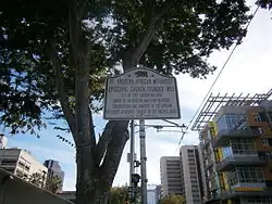
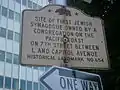
_Wiki.jpg)


_(9826790566).jpg)