Dammbach (Elsava)
| Dammbach | |
|---|---|
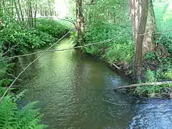 The Dammbach near Wintersbach | |
| Location | |
| Country | Germany |
| State | Bavaria |
| Physical characteristics | |
| Source | |
| • location | Libischbrunnen on the road to Rohrbrunn |
| • coordinates | 49°53′20.53″N 9°22′35.49″E / 49.8890361°N 9.3765250°E |
| • elevation | 360 m (1,180 ft) |
| Mouth | |
• location | at Neuhammer, into the Elsava |
• coordinates | 49°51′37″N 9°17′15″E / 49.8603°N 9.2875°E |
• elevation | 190 m (620 ft) |
| Length | 11.4 km (7.1 mi)[1] |
| Basin size | 43 km2 (17 sq mi)[1] |
| Basin features | |
| Progression | Elsava→ Main→ Rhine→ North Sea |
| Tributaries | |
| • left | Gößbach |
| • right | Winterbach |
The Dammbach is a river in Bavaria, Germany. It flows into the Elsava near the village Dammbach.
See also
References
- ^ a b Complete table of the Bavarian Waterbody Register by the Bavarian State Office for the Environment (xls, 10.3 MB)