Elliot, South Africa
Elliot | |
|---|---|
| Khowa | |
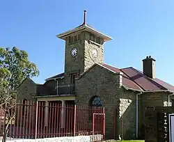 Town Hall in Elliot | |
 Elliot  Elliot  Elliot | |
| Coordinates: 31°20′S 27°51′E / 31.333°S 27.850°E | |
| Country | South Africa |
| Province | Eastern Cape |
| District | Chris Hani |
| Municipality | Sakhisizwe |
| Area | |
• Total | 28.85 km2 (11.14 sq mi) |
| Population (2011)[1] | |
• Total | 14,376 |
| • Density | 500/km2 (1,300/sq mi) |
| Racial makeup (2011) | |
| • Black African | 93.9% |
| • Coloured | 2.6% |
| • Indian/Asian | 0.4% |
| • White | 2.7% |
| • Other | 0.3% |
| First languages (2011) | |
| • Xhosa | 87.1% |
| • Afrikaans | 4.5% |
| • English | 4.5% |
| • Sign language | 1.7% |
| • Other | 2.3% |
| Time zone | UTC+2 (SAST) |
| Postal code (street) | 5460 |
| PO box | 5460 |
| Area code | 045 |
Elliot, also known as Khowa,[2] is a town in Chris Hani District Municipality in the Eastern Cape province of South Africa, and lies 80 km south-west of Maclear and 65 km south-east of Barkly East on the R56 road.[3]
History
Originally the village was established in 1885 and known as Slang River,[4] and in April 1894 was renamed Elliot, becoming a municipality in 1911. Named after Sir Henry George Elliot (1826–1912), Chief Magistrate of the Transkeian territories from 1891 to 1902. It was renamed Khowa in 2017.[5]
Notable people
- Mark Andrews, rugby player
- Binx, singer and musician
- Os du Randt, rugby player
Climate
| Climate data for Elliot, elevation 1,463 m (4,800 ft), (1991–2020 normals, extremes 2001–2023) | |||||||||||||
|---|---|---|---|---|---|---|---|---|---|---|---|---|---|
| Month | Jan | Feb | Mar | Apr | May | Jun | Jul | Aug | Sep | Oct | Nov | Dec | Year |
| Record high °C (°F) | 38.9 (102.0) | 34.2 (93.6) | 32.4 (90.3) | 31.2 (88.2) | 27.5 (81.5) | 25.3 (77.5) | 24.3 (75.7) | 27.9 (82.2) | 32.4 (90.3) | 33.6 (92.5) | 34.7 (94.5) | 35.3 (95.5) | 38.9 (102.0) |
| Mean daily maximum °C (°F) | 27.2 (81.0) | 27.1 (80.8) | 25.8 (78.4) | 22.8 (73.0) | 20.9 (69.6) | 17.8 (64.0) | 18.2 (64.8) | 20.4 (68.7) | 24.1 (75.4) | 24.9 (76.8) | 25.4 (77.7) | 26.4 (79.5) | 23.4 (74.1) |
| Daily mean °C (°F) | 20.1 (68.2) | 20.0 (68.0) | 18.6 (65.5) | 15.5 (59.9) | 13.0 (55.4) | 9.8 (49.6) | 9.7 (49.5) | 11.5 (52.7) | 14.6 (58.3) | 16.2 (61.2) | 17.5 (63.5) | 18.9 (66.0) | 15.5 (59.8) |
| Mean daily minimum °C (°F) | 13.0 (55.4) | 13.0 (55.4) | 11.4 (52.5) | 8.1 (46.6) | 5.3 (41.5) | 1.8 (35.2) | 1.1 (34.0) | 2.7 (36.9) | 5.2 (41.4) | 7.5 (45.5) | 9.6 (49.3) | 11.4 (52.5) | 7.5 (45.5) |
| Record low °C (°F) | 4.8 (40.6) | 4.2 (39.6) | 2.6 (36.7) | −3.5 (25.7) | −5.6 (21.9) | −10.4 (13.3) | −9.7 (14.5) | −8.3 (17.1) | −4.7 (23.5) | −2.5 (27.5) | −1.0 (30.2) | 2.3 (36.1) | −10.4 (13.3) |
| Average precipitation mm (inches) | 108.2 (4.26) | 110.1 (4.33) | 96.7 (3.81) | 50.4 (1.98) | 28.5 (1.12) | 15.0 (0.59) | 14.3 (0.56) | 19.6 (0.77) | 39.9 (1.57) | 61.6 (2.43) | 87.4 (3.44) | 93.2 (3.67) | 724.9 (28.53) |
| Average precipitation days (≥ 0.25 mm) | 8.5 | 8.8 | 7.4 | 4.7 | 2.5 | 1.6 | 1.7 | 2.2 | 4.0 | 6.6 | 7.0 | 6.7 | 61.7 |
| Source: Starlings Roost Weather (precipitation 1906–2023)[6][7] | |||||||||||||
References
- ^ a b c d "Main Place Elliot". Census 2011.
- ^ "85 towns hit with name changes in South Africa – and more are on the way". BusinessTech. 14 April 2024. Retrieved 26 September 2024.
- ^ "Elliot, Tembuland | South African History Online".
- ^ "Saexplorer.co.za".
- ^ Raper, P. E. (1989). Dictionary of Southern African Place Names. Jonathan Ball Publishers. p. 154. ISBN 978-0-947464-04-2 – via Internet Archive.
- ^ "ELLIOT, SF Climate: 1991–2020". Starlings Roost Weather. Retrieved 27 December 2024.
- ^ "ELLIOT, SF Climate: 1991–2020". Starlings Roost Weather. Retrieved 27 December 2024.
Wikimedia Commons has media related to Elliot, Eastern Cape.
Places adjacent to Elliot, South Africa | |
|---|---|
Municipalities and communities of Chris Hani District Municipality, Eastern Cape | ||
|---|---|---|
District seat: Queenstown (Komani) | ||
| Intsika Yethu | .svg.png) | |
| Enoch Mgijima | ||
| Engcobo |
| |
| Emalahleni |
| |
| Inxuba Yethemba | ||
| Sakhisizwe | ||