Espira-de-l'Agly
Espira-de-l'Agly Espirà de l'Aglí | |
|---|---|
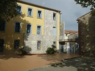 The town hall in Espira-de-l'Agly | |
 Coat of arms | |
Location of Espira-de-l'Agly | |
 Espira-de-l'Agly  Espira-de-l'Agly | |
| Coordinates: 42°46′41″N 2°50′11″E / 42.7781°N 2.8364°E | |
| Country | France |
| Region | Occitania |
| Department | Pyrénées-Orientales |
| Arrondissement | Perpignan |
| Canton | La Vallée de l'Agly |
| Intercommunality | Perpignan Méditerranée Métropole |
| Government | |
| • Mayor (2020–2026) | Philippe Fourcade[1] |
Area 1 | 26.77 km2 (10.34 sq mi) |
| Population (2022)[2] | 3,525 |
| • Density | 130/km2 (340/sq mi) |
| Time zone | UTC+01:00 (CET) |
| • Summer (DST) | UTC+02:00 (CEST) |
| INSEE/Postal code | 66069 /66600 |
| Elevation | 26–458 m (85–1,503 ft) (avg. 36 m or 118 ft) |
| 1 French Land Register data, which excludes lakes, ponds, glaciers > 1 km2 (0.386 sq mi or 247 acres) and river estuaries. | |
Espira-de-l'Agly (French pronunciation: [ɛspiʁa də laɡli] ⓘ, literally Espira of the Agly; Catalan: Espirà de l'Aglí) is a commune in the Pyrénées-Orientales department in southern France.
Geography
Localisation
Espira-de-l'Agly is located in the canton of La Vallée de l'Agly and in the arrondissement of Perpignan. Espira-de-l'Agly is situated approximately 12 km outside Perpignan.

Places adjacent to Espira-de-l'Agly | ||||||||||||||||
|---|---|---|---|---|---|---|---|---|---|---|---|---|---|---|---|---|
| ||||||||||||||||
Population
| Year | Pop. | ±% p.a. |
|---|---|---|
| 1968 | 1,685 | — |
| 1975 | 1,599 | −0.75% |
| 1982 | 1,723 | +1.07% |
| 1990 | 2,196 | +3.08% |
| 1999 | 2,463 | +1.28% |
| 2007 | 2,960 | +2.32% |
| 2012 | 3,304 | +2.22% |
| 2017 | 3,455 | +0.90% |
| Source: INSEE[3] | ||
See also
References
- ^ "Répertoire national des élus: les maires" (in French). data.gouv.fr, Plateforme ouverte des données publiques françaises. 13 September 2022.
- ^ "Populations de référence 2022" (in French). The National Institute of Statistics and Economic Studies. 19 December 2024.
- ^ Population en historique depuis 1968, INSEE
Wikimedia Commons has media related to Espira-de-l'Agly.