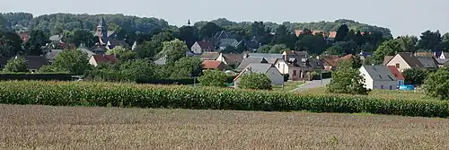
Frières-Faillouël
Frières-Faillouël | |
|---|---|
 The church of Frières-Faillouël | |
Location of Frières-Faillouël | |
 Frières-Faillouël  Frières-Faillouël | |
| Coordinates: 49°41′18″N 3°14′34″E / 49.6883°N 3.2428°E | |
| Country | France |
| Region | Hauts-de-France |
| Department | Aisne |
| Arrondissement | Laon |
| Canton | Chauny |
| Intercommunality | CA Chauny Tergnier La Fère |
| Government | |
| • Mayor (2020–2026) | Charles-Edouard Law de Lauriston[1] |
Area 1 | 15.26 km2 (5.89 sq mi) |
| Population (2022)[2] | 976 |
| • Density | 64/km2 (170/sq mi) |
| Time zone | UTC+01:00 (CET) |
| • Summer (DST) | UTC+02:00 (CEST) |
| INSEE/Postal code | 02336 /02700 |
| Elevation | 57–108 m (187–354 ft) (avg. 70 m or 230 ft) |
| 1 French Land Register data, which excludes lakes, ponds, glaciers > 1 km2 (0.386 sq mi or 247 acres) and river estuaries. | |
Frières-Faillouël (French pronunciation: [fʁijɛʁ fajwɛl]) is a commune in the Aisne department in Hauts-de-France in northern France.
Population
| Year | Pop. | ±% p.a. |
|---|---|---|
| 1968 | 660 | — |
| 1975 | 574 | −1.97% |
| 1982 | 635 | +1.45% |
| 1990 | 775 | +2.52% |
| 1999 | 774 | −0.01% |
| 2009 | 963 | +2.21% |
| 2014 | 1,010 | +0.96% |
| 2020 | 981 | −0.48% |
| Source: INSEE[3] | ||
See also
References
- ^ "Répertoire national des élus: les maires". data.gouv.fr, Plateforme ouverte des données publiques françaises (in French). 2 December 2020.
- ^ "Populations de référence 2022" (in French). The National Institute of Statistics and Economic Studies. 19 December 2024.
- ^ Population en historique depuis 1968, INSEE
Wikimedia Commons has media related to Frières-Faillouël.