Gharibjanyan
40°44′46″N 43°47′49″E / 40.74611°N 43.79694°E
Gharibjanyan Ղարիբջանյան | |
|---|---|
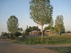 | |
 Gharibjanyan  Gharibjanyan | |
| Coordinates: 40°44′46″N 43°47′49″E / 40.74611°N 43.79694°E | |
| Country | Armenia |
| Province | Shirak |
| Municipality | Akhuryan |
| Elevation | 1,470 m (4,820 ft) |
| Population (2011) | |
• Total | 1,055[1] |
| Time zone | UTC+4 |
Gharibjanyan (Armenian: Ղարիբջանյան), known as Aleksandrovka until 1935, is a village in the Akhuryan Municipality of the Shirak Province of Armenia. The village was renamed in 1935 in honor of Bolshevik leader Bagrat Gharibjanyan, killed in 1920.[2]
Demographics
The population of the village since 1908 is as follows:
| Year | Pop. | ±% p.a. |
|---|---|---|
| 1908 | 202 | — |
| 1926 | 345 | +3.02% |
| 1939 | 539 | +3.49% |
| 1959 | 667 | +1.07% |
| 1970 | 674 | +0.09% |
| 1979 | 595 | −1.38% |
| 1989 | 954 | +4.83% |
| 2001 | 953 | −0.01% |
| 2011 | 1,055 | +1.02% |
| Source: [3] | ||
References
- ^ "Shirak (Armenia): Towns and Villages in Municipalities". www.citypopulation.de. Retrieved 2025-06-19.
- ^ Kiesling, Brady (June 2000). Rediscovering Armenia: An Archaeological/Touristic Gazetteer and Map Set for the Historical Monuments of Armenia (PDF). Archived (PDF) from the original on 6 November 2021.
- ^ Հայաստանի Հանրապետության բնակավայրերի բառարան [Republic of Armenia settlements dictionary] (PDF) (in Armenian). Yerevan: Cadastre Committee of the Republic of Armenia. 2008. Archived from the original (PDF) on 11 March 2018.
- Gharibjanyan at GEOnet Names Server
- Report of the results of the 2001 Armenian Census, Statistical Committee of Armenia
Capital: Gyumri | ||
| Urban settlements |  | |
| Akhuryan Municipality | ||
| Amasia Municipality | ||
| Ani Municipality | ||
| Artik Municipality | ||
| Ashotsk Municipality | ||