Hodikof Island
 | |
| Geography | |
|---|---|
| Coordinates | 52°52′20″N 173°17′40″E / 52.87222°N 173.29444°E |
| Archipelago | Near Islands group of the Aleutian Islands |
| Length | .1 mi (0.2 km) |
| Width | .1 mi (0.2 km) |
| Administration | |
United States | |
| State | Alaska |
| Census Area | Aleutians West Census Area |
| Demographics | |
| Population | 0 (2010) |
| Pop. density | 0/km2 (0/sq mi) |
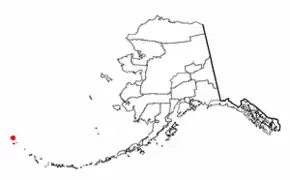
Hodikof Island (52°52'N 173°18'E) is a tiny 0.1-mile-long (160 m) satellite of Attu Island in the Near Islands at the extreme western end of the Aleutian Islands, Alaska.[1] Its name is derived from Hodikof Point, and it lies in Sarana Bay on the east side of Attu.[1] The seaward extension of Hodikof Island is known as Hodikof Reef.[1]
References
- ^ a b c "Hodikof Island". Alaska Guide. Retrieved 2023-02-01.