Houston Branch (Marshyhope Creek tributary)
| Houston Branch Tributary to Marshyhope Creek | |
|---|---|
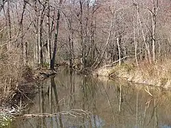 Houston Branch looking downstream towards Delaware Stateline from Handy Road | |
 Location of Houston Branch mouth  Houston Branch (Marshyhope Creek tributary) (the United States) | |
| Location | |
| Country | United States |
| State | Maryland Delaware |
| Counties | Caroline Sussex |
| Physical characteristics | |
| Source | divide between Houston Branch and Clear Brook (Nanticoke River) |
| • location | about 1 mile west of Atlanta, Delaware[2] |
| • coordinates | 38°42′27″N 075°41′07″W / 38.70750°N 75.68528°W[1] |
| • elevation | 40 ft (12 m)[2] |
| Mouth | Marshyhope Creek |
• location | about 3 miles northeast of Nichols, Maryland[2] |
• coordinates | 38°44′32″N 075°45′08″W / 38.74222°N 75.75222°W[1] |
• elevation | 10 ft (3.0 m)[2] |
| Length | 6.47 mi (10.41 km)[3] |
| Basin size | 10.26 square miles (26.6 km2)[4] |
| Discharge | |
| • location | Marshyhope Creek |
| • average | 12.12 cu ft/s (0.343 m3/s) at mouth with Marshyhope Creek[4] |
| Basin features | |
| Progression | Marshyhope Creek → Nanticoke River → Chesapeake Bay → Atlantic Ocean |
| River system | Nanticoke River |
| Tributaries | |
| • left | unnamed tributaries |
| • right | Brights Branch |
Houston Branch is a 10.26 mi (16.51 km) long tributary to Marshyhope Creek that rises in western Sussex County, Delaware and flows west into Caroline County, Maryland.
See also
References
- ^ a b "GNIS Detail - Houston Branch". geonames.usgs.gov. US Geological Survey. Retrieved 3 August 2019.
- ^ a b c d "Brights Branch Topo Map, Sussex County DE (Seaford West Area)". TopoZone. Locality, LLC. Retrieved 3 August 2019.
- ^ "ArcGIS Web Application". epa.maps.arcgis.com. US EPA. Retrieved 3 August 2019.
- ^ a b "Houston Branch Watershed Report". Waters Geoviewer. US EPA. Retrieved 3 August 2019.
Dover (capital) | |
| Topics |
|
| Society |
|
| Cities | |
| Towns |
|
| Counties | |