Kosihy nad Ipľom
Kosihy nad Ipľom Ipolykeszi | |
|---|---|
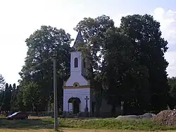 Church of Saint John of Nepomuk | |
 Flag | |
 Kosihy nad Ipľom Location of Kosihy nad Ipľom in the Banská Bystrica Region  Kosihy nad Ipľom Location of Kosihy nad Ipľom in Slovakia | |
| Coordinates: 48°05′N 19°11′E / 48.08°N 19.18°E | |
| Country | |
| Region | |
| District | Veľký Krtíš District |
| First mentioned | 1326 |
| Area | |
• Total | 6.83 km2 (2.64 sq mi) |
| Elevation | 138 m (453 ft) |
| Population (2021)[3] | |
• Total | 387 |
| Time zone | UTC+1 (CET) |
| • Summer (DST) | UTC+2 (CEST) |
| Postal code | 991 11[2] |
| Area code | +421 47[2] |
| Car plate | VK |
| Website | www |
Kosihy nad Ipľom (Hungarian: Ipolykeszi) is a village and municipality in the Veľký Krtíš District of the Banská Bystrica Region of southern Slovakia.
Etymology
The village was named after the Magyar tribe Keszi.[4]
Genealogical resources
The records for genealogical research are available at the state archive "Statny Archiv in Banska Bystrica, Nitra,
Slovakia"
- Roman Catholic church records (births/marriages/deaths): 1787-1900 (parish B)
- Lutheran church records (births/marriages/deaths): 1721-1862 (parish B)
See also
References
- ^ "Hustota obyvateľstva - obce [om7014rr_ukaz: Rozloha (Štvorcový meter)]". www.statistics.sk (in Slovak). Statistical Office of the Slovak Republic. 2022-03-31. Retrieved 2022-03-31.
- ^ a b c "Základná charakteristika". www.statistics.sk (in Slovak). Statistical Office of the Slovak Republic. 2015-04-17. Retrieved 2022-03-31.
- ^ "Počet obyvateľov podľa pohlavia - obce (ročne)". www.statistics.sk (in Slovak). Statistical Office of the Slovak Republic. 2022-03-31. Retrieved 2022-03-31.
- ^ Miloš, Marek (2011). Národnosti Uhroska [Nationalities of the Historical Kingdom of Hungary] (PDF) (in Slovak). Trnava: Filozofická fakulta Trnavskej univerzity v Trnave. p. 121. ISBN 978-80-8082-470-9. Archived from the original (PDF) on 2016-10-19.