Krenglbach
Krenglbach | |
|---|---|
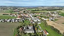 South view of Krenglbach | |
 Coat of arms | |
 Krenglbach Location within Austria | |
| Coordinates: 48°12′14″N 13°57′25″E / 48.20389°N 13.95694°E | |
| Country | Austria |
| State | Upper Austria |
| District | Wels-Land |
| Government | |
| • Mayor | Manfred Zeismann (SPÖ) |
| Area | |
• Total | 15.34 km2 (5.92 sq mi) |
| Elevation | 310 m (1,020 ft) |
| Population (2018-01-01)[2] | |
• Total | 3,158 |
| • Density | 210/km2 (530/sq mi) |
| Time zone | UTC+1 (CET) |
| • Summer (DST) | UTC+2 (CEST) |
| Postal code | 4631 |
| Area code | 07249 |
| Vehicle registration | WL |
| Website | www.krenglbach.at |
Krenglbach is a municipality in the district of Wels-Land in the Austrian state of Upper Austria.
Population
| Year | Pop. | ±% |
|---|---|---|
| 1991 | 2,384 | — |
| 2001 | 2,644 | +10.9% |
| 2007 | 3,073 | +16.2% |
References
- ^ "Dauersiedlungsraum der Gemeinden Politischen Bezirke und Bundesländer - Gebietsstand 1.1.2018". Statistics Austria. Retrieved 10 March 2019.
- ^ "Einwohnerzahl 1.1.2018 nach Gemeinden mit Status, Gebietsstand 1.1.2018". Statistics Austria. Retrieved 9 March 2019.
Wikimedia Commons has media related to Krenglbach.