Lanteuil
Lanteuil | |
|---|---|
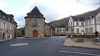 The church and school, in Lanteuil | |
.svg.png) Coat of arms | |
Location of Lanteuil | |
 Lanteuil  Lanteuil | |
| Coordinates: 45°07′43″N 1°39′39″E / 45.1286°N 1.6608°E | |
| Country | France |
| Region | Nouvelle-Aquitaine |
| Department | Corrèze |
| Arrondissement | Brive-la-Gaillarde |
| Canton | Midi Corrézien |
| Government | |
| • Mayor (2020–2026) | Christian Derachinois[1] |
Area 1 | 22.68 km2 (8.76 sq mi) |
| Population (2022)[2] | 504 |
| • Density | 22/km2 (58/sq mi) |
| Time zone | UTC+01:00 (CET) |
| • Summer (DST) | UTC+02:00 (CEST) |
| INSEE/Postal code | 19105 /19190 |
| 1 French Land Register data, which excludes lakes, ponds, glaciers > 1 km2 (0.386 sq mi or 247 acres) and river estuaries. | |
Lanteuil (French pronunciation: [lɑ̃tœj]; Occitan: Lantòl) is a commune in the Corrèze department in central France.
Population
| Year | Pop. | ±% |
|---|---|---|
| 1962 | 523 | — |
| 1968 | 469 | −10.3% |
| 1975 | 427 | −9.0% |
| 1982 | 406 | −4.9% |
| 1990 | 431 | +6.2% |
| 1999 | 478 | +10.9% |
| 2008 | 510 | +6.7% |
See also
References
- ^ "Répertoire national des élus: les maires". data.gouv.fr, Plateforme ouverte des données publiques françaises (in French). 2 December 2020.
- ^ "Populations de référence 2022" (in French). The National Institute of Statistics and Economic Studies. 19 December 2024.
Wikimedia Commons has media related to Lanteuil.