List of crossings of Accotink Creek
This is a complete list of current bridges and other crossings of Accotink Creek from its mouth at the Potomac River to its source.
Crossings
All locations are in Virginia. Pedestrian-only bridges are marked in italics.
| Image | Crossing | Opened | Coordinates | Notes |
|---|---|---|---|---|
| Fort Belvoir | ||||
| Beaver Pond Trail | ca. 2015[1] | Replaced older footbridge[1] | ||
| Poe Road | 1981[2] | |||
| 2015, 2016[2] | 38°42′28″N 77°10′08″W / 38.7079°N 77.1688°W | |||
| Farrar Drive | 2011[2] | |||
| Ehlers Road | 1975[2] | |||
| Newington | ||||
| 2001[2] | ||||
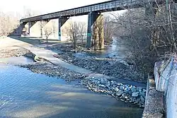
| CSX Transportation RF&P Subdivision | 38°43′22″N 77°12′15″W / 38.7228°N 77.2041°W | |||
 | 1993[2] | 38°43′30″N 77°12′14″W / 38.7249°N 77.2039°W | ||
 | 1950[2] | |||
| Fullerton Road | 1976, 1992[2] | |||
| Fort Belvoir North | ||||
_at_the_exit_for_Boudinot_Drive_in_Newington%252C_Fairfax_County%252C_Virginia.jpg) | 2010, 2011[2] | 38°44′44″N 77°11′50″W / 38.7456°N 77.1973°W | ||
 | Barta Road | 2010[2] | ||
| Springfield–West Springfield | ||||
| 1976[2] | ||||
 | 1989[2] | 38°45′43″N 77°12′30″W / 38.7619°N 77.2082°W | ||
 | Cross County Trail | |||
 | 1964[2] | |||
 | Cross County Trail | |||
 | Cross County Trail | |||
 | Norfolk Southern Railway Washington District | 38°47′34″N 77°13′08″W / 38.7927°N 77.2188°W | ||
| North Springfield–West Springfield | ||||
 | Accotink Loop Trail | |||
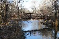
.jpg) | Lake Accotink dam | 38°47′36″N 77°13′07″W / 38.7933°N 77.2187°W | ||
 | Accotink Loop Trail | |||
 | 1972[2] | |||
| Annandale | ||||
 | Cross County Trail | 38°49′36″N 77°13′26″W / 38.8267°N 77.2239°W | ||
 | 1961, 2011, 2012[2] | 38°50′04″N 77°13′07″W / 38.8344°N 77.2186°W | ||
 | Cross County Trail | after 1995[3] | ||
 | Cross County Trail | after 1995[3] | ||
 | Cross County Trail | after 1995[3] | ||
 | King Arthur Road | 1964[2] | ||
 | Woodburn Road | 1990[2] | ||
| Mantua | ||||
| 1988[2] | ||||
| 1968[2] | ||||
 | Cross County Trail | after 1995[3] | ||
| Fairfax | ||||
 | 1983[4] | 38°51′41″N 77°16′12″W / 38.8615°N 77.2701°W | ||
 | Wilcoxon Park footbridge | |||
 | Wilcoxon Park footbridge | |||
 | Old Lee Highway | 1976[4] | ||
 | Wilcoxon Park footbridge | |||
 | 1978[4] | 38°51′49″N 77°16′59″W / 38.8637°N 77.2831°W | ||
 | Ranger Road Park footbridge | |||
 | 1978[4] | 38°51′46″N 77°17′23″W / 38.8628°N 77.2897°W | ||
 | Footbridge to Dale Drive | |||
 | Van Dyck Park footbridge | |||
 | University Drive | |||
 | Belle's Bird Sanctuary footbridge | 2014[4] | ||
 | 2014[4] | 38°51′03″N 77°18′28″W / 38.8508°N 77.3078°W | Replaced earlier bridge[5] | |
 | Meadow Bridge Lane | |||
_at_Railroad_Avenue_in_Fairfax%252C_Virginia.jpg) | 1971[4] | 38°50′53″N 77°18′44″W / 38.8481°N 77.3123°W | ||
 | Judicial Drive | |||
 | Fairfax Nursing Center footbridge | |||
 | Presbyterian Way | |||
 | Woodland Drive | |||
 | Poplar Street | |||
 | Hallman Street | |||
References
- ^ a b Sanford, Walter (March 28, 2016). "New suspension bridge over Accotink Creek". Walter Sanford's Photoblog. Retrieved December 31, 2020.
- ^ a b c d e f g h i j k l m n o p q r s "Fairfax County, Virginia". National Bridge Inventory. Retrieved December 31, 2020 – via BridgeReports.com.
- ^ a b c d "General Management Plan / Conceptual Development Plan and Project Implementation Plan: Eakin / Eakin (Mantua) / Accotink Stream Valley Park". Fairfax County Park Authority. June 1995. p. 2. Retrieved January 3, 2021.
- ^ a b c d e f g "Fairfax, Virginia". National Bridge Inventory. Retrieved December 31, 2020 – via BridgeReports.com.
- ^ "Chain Bridge Road (Route 123) Over Accotink Creek Bridge Replacement". City of Fairfax, VA. Retrieved December 31, 2020.