Aerial view of crossings in downtown Portland This is a list of bridges and other crossings of the Willamette River in the U.S. state of Oregon from the Columbia River upstream to the confluence of the Middle Fork Willamette River and Coast Fork Willamette River . This confluence, at 44°01′24″N 123°01′26″W / 44.023318°N 123.023897°W / 44.023318; -123.023897 (Willamette River source )
Sauvie Island
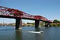
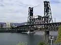
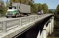
Portland Image Crossing Carries Location River mile Year built Coordinates St. Johns Bridge US 30 Byp. , sidewalks Portland 5.8 1931 45°35′07″N 122°45′52″W / 45.58528°N 122.76444°W / 45.58528; -122.76444 (St. Johns Bridge ) Burlington Northern Railroad Bridge 5.1 BNSF Railway Portland 7.0 1908/1989 45°34′36″N 122°44′51″W / 45.57667°N 122.74750°W / 45.57667; -122.74750 (Burlington Northern Railroad Bridge 5.1 ) West Side CSO Tunnel intercepted sewage overflow Portland 10.0 2003 45°33′0″N 122°41′52″W / 45.55000°N 122.69778°W / 45.55000; -122.69778 (West Side CSO Tunnel ) Fremont Bridge I-405 / US 30 Portland 11.1 1973 45°32′16″N 122°40′59″W / 45.53778°N 122.68306°W / 45.53778; -122.68306 (Fremont Bridge ) Broadway Bridge Broadway ; Portland Streetcar ;Portland 11.7 1913 45°31′55″N 122°40′27″W / 45.53194°N 122.67417°W / 45.53194; -122.67417 (Broadway Bridge ) Steel Bridge Union Pacific Railway Amtrak MAX Light Rail Eastbank Esplanade (lower level),Harbor Drive (former OR 99W ) Portland 12.1 1912 45°31′39″N 122°40′09″W / 45.52750°N 122.66917°W / 45.52750; -122.66917 (Steel Bridge ) Burnside Bridge Burnside Street , sidewalks Portland 12.4 1926 45°31′23″N 122°40′03″W / 45.52306°N 122.66750°W / 45.52306; -122.66750 (Burnside Bridge ) Morrison Bridge Morrison Street, sidewalks Portland 12.8 1958 45°31′04″N 122°40′11″W / 45.51778°N 122.66972°W / 45.51778; -122.66972 (Morrison Bridge ) Hawthorne Bridge Hawthorne Boulevard, sidewalks Portland 13.1 1910 45°30′47″N 122°40′14″W / 45.51306°N 122.67056°W / 45.51306; -122.67056 (Hawthorne Bridge ) Marquam Bridge I-5 Portland 13.5 1966 45°30′29″N 122°40′09″W / 45.50806°N 122.66917°W / 45.50806; -122.66917 (Marquam Bridge ) Tilikum Crossing TriMet MAX Orange Line and buses, Portland Streetcar , cycle lane , sidewalks Portland 13.8 2015 45°30′18″N 122°40′01″W / 45.5049°N 122.6670°W / 45.5049; -122.6670 (Tilikum Crossing ) Ross Island Bridge US 26 (Powell Boulevard), sidewalks Portland 14.0 1926 45°30′04″N 122°39′52″W / 45.50111°N 122.66444°W / 45.50111; -122.66444 (Ross Island Bridge ) Sellwood Bridge Tacoma Street, sidewalks Portland 16.5 2016 45°27′52″N 122°39′56″W / 45.46444°N 122.66556°W / 45.46444; -122.66556 (Sellwood Bridge )
Northern Willamette Valley
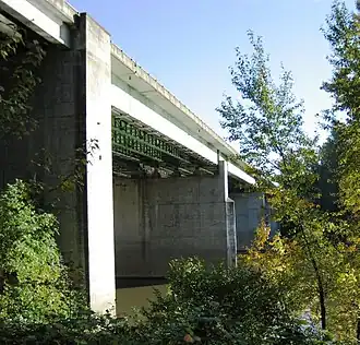
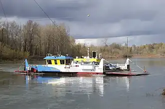
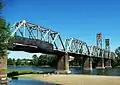
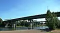
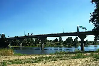
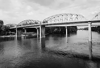
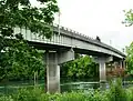
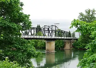
Middle Willamette Valley Image Crossing Carries Location River mile Year built Coordinates Wheatland Ferry Wheatland Road Wheatland 72.0 1844 45°05′25″N 123°02′42″W / 45.09028°N 123.04500°W / 45.09028; -123.04500 (Wheatland Ferry ) aerial electric power for the Wheatland Ferry Wheatland 45°05′24.28″N 123°02′43.61″W / 45.0900778°N 123.0454472°W / 45.0900778; -123.0454472 (aerial electric power for the Wheatland Ferry ) medium voltage line Wheatland 45°05′27.02″N 123°02′41.56″W / 45.0908389°N 123.0448778°W / 45.0908389; -123.0448778 (medium voltage line ) Union Street Railroad Bridge (formerly) Black Rock Rail Line, (currently) pedestrians, bicycles, emergency vehicles Salem 84.1 1913 44°56′50″N 123°02′30″W / 44.94722°N 123.04167°W / 44.94722; -123.04167 (Union Street Railroad Bridge ) Marion Street Bridge OR 22 west (Marion Street) Salem 84.4 1952 44°56′45″N 123°02′33″W / 44.94583°N 123.04250°W / 44.94583; -123.04250 (Marion Street Bridge ) Center Street Bridge OR 22 east (Center Street) Salem 84.5 1918 44°56′42″N 123°02′36″W / 44.94500°N 123.04333°W / 44.94500; -123.04333 (Center Street Bridge ) Independence Street Bridge River Road South, sidewalks Independence 97.1 1950 44°50′44″N 123°10′47″W / 44.84556°N 123.17972°W / 44.84556; -123.17972 (Independence Street Bridge ) Buena Vista Ferry Buena Vista Road Buena Vista 106.0 1851 44°46′12″N 123°08′45″W / 44.77000°N 123.14583°W / 44.77000; -123.14583 (Buena Vista Ferry ) aerial electric power for the Buena Vista Ferry Buena Vista 44°46′11.37″N 123°08′46.23″W / 44.7698250°N 123.1461750°W / 44.7698250; -123.1461750 (aerial electric power for the Buena Vista Ferry ) Toledo District Willamette Bridge (formerly) Oregon Pacific Railroad , Southern Pacific (currently) Portland and Western Railroad /Toledo District Albany 119.7 1887/1921 44°38′27″N 123°05′48″W / 44.64085°N 123.09677°W / 44.64085; -123.09677 (Toledo District Willamette Bridge ) Lyon Street Bridge US 20 north (Lyon Street), sidewalk Albany 120.0 1971 44°38′21″N 123°06′21″W / 44.63917°N 123.10587°W / 44.63917; -123.10587 (Lyon Street Bridge ) Ellsworth Street Bridge US 20 south (Ellsworth Street), sidewalks Albany 120.1 1925 44°38′21″N 123°06′24″W / 44.63924°N 123.10666°W / 44.63924; -123.10666 (Ellsworth Street Bridge ) Harrison Street Bridge OR 34 west (Harrison Street), bicycle lane, sidewalk Corvallis 131.5 1964 44°33′58″N 123°15′22″W / 44.5661°N 123.25622°W / 44.5661; -123.25622 (Harrison Street Bridge ) Van Buren Street Bridge OR 34 east (Van Buren Street), sidewalk Corvallis 131.5 1913 44°33′55″N 123°15′23″W / 44.56541°N 123.25652°W / 44.56541; -123.25652 (Van Buren Street Bridge ) Corvallis Bypass Bridge OR 34 Bypass Corvallis 132.95 1992 44°33′29″N 123°15′36″W / 44.55814°N 123.25987°W / 44.55814; -123.25987 (Corvallis Bypass Bridge )
Southern Willamette Valley
See also
Notes ^ a b Two former bridges over the Willamette River in Portland were named the Madison Street Bridge. Together, they were active from 1891 to 1909.[ 3] [ 4]
References ^ Edward Russo (September 15, 2009). "Popular river crossing renamed" . The Register-Guard ^ "Whilamut Passage Bridge Opens" . KEZI.com. August 8, 2013. Archived from the original on September 30, 2013. Retrieved November 30, 2014 .^ "Hawthorne Bridge: Spanning Willamette River on Hawthorne Boulevard, Portland, Multnomah County, Oregon" (PDF) . Historic American Engineering Record , National Park Service , United States Department of the Interior . p. 2. Archived (PDF) from the original on March 5, 2016. Retrieved August 18, 2016 .^ "Old Span Wrecked; Madison Bridge in Six Weeks Will Be Only Memory" . The Morning Oregonian . August 2, 1909. p. 14. Archived from the original on September 16, 2016. Retrieved August 18, 2016 .
External links

_(mulDA0073).jpg)


.jpg)


_-_2.jpg)


_bridge_-_Albany%252C_Oregon.jpg)


.jpg)


.jpg)