This is a list of listed buildings in the parish of Dingwall in Highland, Scotland.
List
| Name | Location | Date Listed | Grid Ref. [note 1] | Geo-coordinates | Notes | LB Number [note 2] | Image |
| The Castle and Roderick Maclennan Monument | Castle Street | | | 57°35′53″N 4°25′22″W / 57.597927°N 4.422662°W / 57.597927; -4.422662 (The Castle and Roderick Maclennan Monument) | Category B | 24499 | .jpg) Upload another image
|
| Caisteal Gòrach | By Tulloch Castle | | | 57°37′00″N 4°26′18″W / 57.616595°N 4.438339°W / 57.616595; -4.438339 (Caisteal Gòrach) | Category A | 24520 | .jpg) Upload another image
See more images |
| Free Church Of Scotland | High Street | | | 57°35′41″N 4°25′26″W / 57.594633°N 4.423899°W / 57.594633; -4.423899 (Free Church Of Scotland) | Category B | 24508 | .jpg) Upload another image
See more images |
| Royal Bank Of Scotland | High Street | | | 57°35′42″N 4°25′29″W / 57.594888°N 4.424635°W / 57.594888; -4.424635 (Royal Bank Of Scotland) | Category B | 24509 | .jpg) Upload another image
|
| Dingwall Railway Station. Down And Up Platform Ranges, Down Platform Staff Shelter | Station Road | | | 57°35′41″N 4°25′21″W / 57.594616°N 4.422442°W / 57.594616; -4.422442 (Dingwall Railway Station. Down And Up Platform Ranges, Down Platform Staff Shelter) | Category B | 24514 |  Upload another image
See more images |
| St Clements Church (Church of Scotland Parish Church), Gatepiers And Burial Ground | Tulloch Street | | | 57°35′49″N 4°25′44″W / 57.597009°N 4.428827°W / 57.597009; -4.428827 (St Clements Church (Church of Scotland Parish Church), Gatepiers And Burial Ground) | Category A | 24516 | .jpg) Upload another image
See more images |
| Former Seaforth Sanatorium And Lodge | Maryburgh | | | 57°34′39″N 4°27′00″W / 57.577426°N 4.449936°W / 57.577426; -4.449936 (Former Seaforth Sanatorium And Lodge) | Category B | 6360 |  Upload another image
|
| Hydro Board (now Highland Theological College) | High Street | | | 57°35′43″N 4°25′26″W / 57.595245°N 4.423822°W / 57.595245; -4.423822 (Hydro Board (now Highland Theological College)) | Category B | 24502 | .jpg) Upload another image
|
| 63, 64 High Street | High Street | | | 57°35′44″N 4°25′41″W / 57.595497°N 4.428023°W / 57.595497; -4.428023 (63, 64 High Street) | Category B | 24505 | 
Upload Photo |
| Tulloch Farm, Steading, Houses And Garden Wall | | | | 57°36′35″N 4°25′47″W / 57.609759°N 4.429828°W / 57.609759; -4.429828 (Tulloch Farm, Steading, Houses And Garden Wall) | Category B | 24519 |
Upload Photo |
| Dovecote | Castle Street | | | 57°35′50″N 4°25′24″W / 57.597187°N 4.423299°W / 57.597187; -4.423299 (Dovecote) | Category B | 24498 |  Upload another image
|
| Sheriff Court, Prison and Former Police Station | Ferry Road | | | 57°35′41″N 4°25′13″W / 57.594649°N 4.420252°W / 57.594649; -4.420252 (Sheriff Court, Prison and Former Police Station) | Category B | 24500 | .jpg) Upload another image
|
| 58, 59, 60 High Street and 1-2 Mcgregor's Court | | | | 57°35′44″N 4°25′37″W / 57.59543°N 4.426847°W / 57.59543; -4.426847 (58, 59, 60 High Street and 1-2 Mcgregor's Court) | Category C(S) | 24503 |
Upload Photo |
| Tulloch Castle and Arched Tunnel Entrance | | | | 57°36′32″N 4°25′58″W / 57.608963°N 4.432889°W / 57.608963; -4.432889 (Tulloch Castle and Arched Tunnel Entrance) | Category B | 24518 | .jpg) Upload another image
See more images |
| Greenhill Street Park Garage (Former Park Cottage) | Greenhill Street | | | 57°35′38″N 4°25′31″W / 57.593763°N 4.425196°W / 57.593763; -4.425196 (Greenhill Street Park Garage (Former Park Cottage)) | Category B | 24521 | .jpg) Upload another image
|
| Drynie | | | | 57°36′42″N 4°26′48″W / 57.611695°N 4.446801°W / 57.611695; -4.446801 (Drynie) | Category C(S) | 1822 |
Upload Photo |
| Humberston | | | | 57°35′05″N 4°26′06″W / 57.584821°N 4.435058°W / 57.584821; -4.435058 (Humberston) | Category C(S) | 1823 |
Upload Photo |
| St Ninians | Castle Street | | | 57°35′46″N 4°25′29″W / 57.596026°N 4.424828°W / 57.596026; -4.424828 (St Ninians) | Category B | 24497 |
Upload Photo |
| Ross Memorial Hospital | Ferry Road | | | 57°35′39″N 4°25′04″W / 57.59413°N 4.417757°W / 57.59413; -4.417757 (Ross Memorial Hospital) | Category B | 24501 | .jpg) Upload another image
See more images |
| Town Hall | High Street | | | 57°35′44″N 4°25′42″W / 57.595587°N 4.428464°W / 57.595587; -4.428464 (Town Hall) | Category B | 24506 | _Town_Hall_and_Tollbooth_in_Dingwall_Ross_%2526_Cromarty_Scotland_(2874092256).jpg) Upload another image
See more images |
| Clydesdale Bank, Park House | High Street | | | 57°35′42″N 4°25′30″W / 57.594927°N 4.424956°W / 57.594927; -4.424956 (Clydesdale Bank, Park House) | Category B | 24510 |
Upload Photo |
| Hector Macdonald Memorial | Mitchell Hill | | | 57°35′33″N 4°25′44″W / 57.592382°N 4.428819°W / 57.592382; -4.428819 (Hector Macdonald Memorial) | Category B | 24513 | 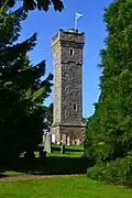 Upload another image
See more images |
| Caledonian Hotel | High Street | | | 57°35′44″N 4°25′39″W / 57.595675°N 4.427633°W / 57.595675; -4.427633 (Caledonian Hotel) | Category C(S) | 24504 | .jpg) Upload another image
|
| Mercat Cross | High Street | | | 57°35′44″N 4°25′42″W / 57.595462°N 4.428439°W / 57.595462; -4.428439 (Mercat Cross) | Category B | 24507 | .jpg) Upload another image
|
| The Retreat | High Street | | | 57°35′42″N 4°25′36″W / 57.595036°N 4.426737°W / 57.595036; -4.426737 (The Retreat) | Category B | 24511 |  Upload another image
|
| 9 Hill Street | Hill Street | | | 57°35′39″N 4°25′35″W / 57.594298°N 4.42637°W / 57.594298; -4.42637 (9 Hill Street) | Category B | 24512 |
Upload Photo |
| 14 High Street | High Street | | | 57°35′43″N 4°25′40″W / 57.595286°N 4.427791°W / 57.595286; -4.427791 (14 High Street) | Category C(S) | 51618 |
Upload Photo |
| Warehouse, Former Ben Wyvis Distillery | Station Road | | | 57°35′26″N 4°25′26″W / 57.590427°N 4.423937°W / 57.590427; -4.423937 (Warehouse, Former Ben Wyvis Distillery) | Category B | 24515 | .jpg) Upload another image
|
| Cromartie Memorial, Obelisk | Tulloch Street | | | 57°35′49″N 4°25′41″W / 57.596888°N 4.428099°W / 57.596888; -4.428099 (Cromartie Memorial, Obelisk) | Category B | 24517 |  Upload another image
See more images |
Key
The scheme for classifying buildings in Scotland is:
- Category A: "buildings of national or international importance, either architectural or historic; or fine, little-altered examples of some particular period, style or building type."[1]
- Category B: "buildings of regional or more than local importance; or major examples of some particular period, style or building type, which may have been altered."[1]
- Category C: "buildings of local importance; lesser examples of any period, style, or building type, as originally constructed or moderately altered; and simple traditional buildings which group well with other listed buildings."[1]
In March 2016 there were 47,288 listed buildings in Scotland. Of these, 8% were Category A, and 50% were Category B, with the remaining 42% being Category C.[2]
See also
Notes
References