Obora (Louny District)
Obora | |
|---|---|
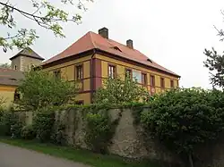 Rectory | |
.svg.png) Flag  Coat of arms | |
 Obora Location in the Czech Republic | |
| Coordinates: 50°22′24″N 13°51′47″E / 50.37333°N 13.86306°E | |
| Country | |
| Region | Ústí nad Labem |
| District | Louny |
| First mentioned | 1268 |
| Area | |
• Total | 5.29 km2 (2.04 sq mi) |
| Elevation | 175 m (574 ft) |
| Population (2025-01-01)[1] | |
• Total | 449 |
| • Density | 85/km2 (220/sq mi) |
| Time zone | UTC+1 (CET) |
| • Summer (DST) | UTC+2 (CEST) |
| Postal code | 440 01 |
| Website | www |
Obora is a municipality and village in Louny District in the Ústí nad Labem Region of the Czech Republic. It has about 400 inhabitants.
Obora lies approximately 6 kilometres (4 mi) east of Louny, 35 km (22 mi) south of Ústí nad Labem, and 50 km (31 mi) north-west of Prague.
Demographics
| Year | Pop. | ±% |
|---|---|---|
| 1869 | 247 | — |
| 1880 | 278 | +12.6% |
| 1890 | 245 | −11.9% |
| 1900 | 280 | +14.3% |
| 1910 | 344 | +22.9% |
| 1921 | 386 | +12.2% |
| 1930 | 399 | +3.4% |
| 1950 | 283 | −29.1% |
| 1961 | 278 | −1.8% |
| 1970 | 277 | −0.4% |
| 1980 | 243 | −12.3% |
| 1991 | 246 | +1.2% |
| 2001 | 299 | +21.5% |
| 2011 | 379 | +26.8% |
| 2021 | 434 | +14.5% |
| Source: Censuses[2][3] | ||
References
- ^ "Population of Municipalities – 1 January 2025". Czech Statistical Office. 2025-05-16.
- ^ "Historický lexikon obcí České republiky 1869–2011" (in Czech). Czech Statistical Office. 2015-12-21.
- ^ "Population Census 2021: Population by sex". Public Database. Czech Statistical Office. 2021-03-27.
External links
Wikimedia Commons has media related to Obora (Louny District).