Saint-Amant-de-Nouère
Saint-Amant-de-Nouère | |
|---|---|
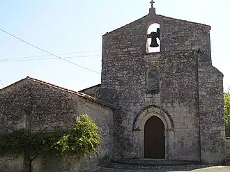 The church in Saint-Amant | |
Location of Saint-Amant-de-Nouère | |
 Saint-Amant-de-Nouère  Saint-Amant-de-Nouère | |
| Coordinates: 45°44′48″N 0°00′09″E / 45.7467°N 0.0025°E | |
| Country | France |
| Region | Nouvelle-Aquitaine |
| Department | Charente |
| Arrondissement | Cognac |
| Canton | Val de Nouère |
| Intercommunality | Rouillacais |
| Government | |
| • Mayor (2024–2026) | Laurent Baty[1] |
Area 1 | 11.15 km2 (4.31 sq mi) |
| Population (2022)[2] | 350 |
| • Density | 31/km2 (81/sq mi) |
| Time zone | UTC+01:00 (CET) |
| • Summer (DST) | UTC+02:00 (CEST) |
| INSEE/Postal code | 16298 /16170 |
| Elevation | 62–130 m (203–427 ft) (avg. 100 m or 330 ft) |
| 1 French Land Register data, which excludes lakes, ponds, glaciers > 1 km2 (0.386 sq mi or 247 acres) and river estuaries. | |
Saint-Amant-de-Nouère (French pronunciation: [sɛ̃.t‿amɑ̃ də nwɛʁ]) is a commune in the Charente department in southwestern France.
Population
| Year | Pop. | ±% p.a. |
|---|---|---|
| 1968 | 352 | — |
| 1975 | 331 | −0.87% |
| 1982 | 350 | +0.80% |
| 1990 | 372 | +0.76% |
| 1999 | 382 | +0.30% |
| 2009 | 408 | +0.66% |
| 2014 | 413 | +0.24% |
| 2020 | 357 | −2.40% |
| Source: INSEE[3] | ||
See also
References
- ^ "Répertoire national des élus: les maires" (in French). data.gouv.fr, Plateforme ouverte des données publiques françaises. 16 April 2024.
- ^ "Populations de référence 2022" (in French). The National Institute of Statistics and Economic Studies. 19 December 2024.
- ^ Population en historique depuis 1968, INSEE
Wikimedia Commons has media related to Saint-Amant-de-Nouère.