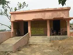
Satar Kataiya
Satar Kataiya | |
|---|---|
 Village of Hasa Hakpur within the Tehsil | |
 Satar Kataiya  Satar Kataiya | |
| Coordinates: 25°56′57″N 86°34′41″E / 25.94917°N 86.57806°E | |
| Country | |
| State | Bihar |
| Region | Mithila |
| District | Saharsa |
| Villages | 38 |
| Area | |
• Total | 160 km2 (60 sq mi) |
| Elevation | 45 m (148 ft) |
| Population (2011) | |
• Total | 151,060 |
| • Density | 940/km2 (2,400/sq mi) |
| Time zone | UTC+5:30 (IST) |
| PIN | 852124 |
Satar Kataiya (or Sattar Kataiya) is a block in Saharsa District, Bihar, India.[1] Its seat of government is located in the village of Sattar. As of the year 2011, its population is 151,060.[2]
Geography
Satar Kataiya is located on the east of the Kosi River, approximately 8 kilometres north of its district capital Saharsa. Its average elevation is at 45 metres above the sea level.[3]
Administrative divisions
As of 2011, there are a total of 38 villages within the boundary of Satar Kataiya. They are listed as follows:[4]
- Agwanpur
- Aran
- Baghi urf Bhaluasukhasan
- Baijnathpur
- Bara
- Barahser
- Bela
- Bijalpur
- Bishunpur
- Chauri Bijalpur
- Chinwari
- Dahaha Badh
- Gandaul
- Gangaura Behra
- Gobargarha urf jarsain
- Hasa Hakpur
- Itahri
- Kharik Badh
- Lachhminia
- Laukahi
- Makuna
- Matiari Badh
- Nandlali
- Pachgachhia
- Padumpur
- Panidaha
- Patori
- Pipra
- Purikh
- Rakeapatti
- Rohua Arazi
- Sadhua Badh
- Sattar
- Shahpur
- Sihaul
- Sisai
- Tuniahi
- Ukahi
Demographics
In 2011, there are 28,710 households within Satar Kataiya, with a total population of 151,060. Out of the total population, 79,332 are male and 71,728 are female. The total literacy rate is 52.36%, with 51.2% of the male residents and 32.26% of the female population being literate.[2]
See also
References
- ^ "Tehsil | Saharsa District | India". Retrieved 2023-03-26.
- ^ a b "Basic Population Figures of India, States, Districts, Sub-District and Village, 2011". censusindia.gov.in. Retrieved 2023-03-26.
- ^ "Satar Kataiya topographic map, elevation, terrain". Topographic maps. Retrieved 2023-03-26.
- ^ "Villages & Towns in Satar Kataiya Block of Saharsa, Bihar". www.census2011.co.in. Retrieved 2023-03-26.