Singye County
Sin'gye County 신계군 | |
|---|---|
| Korean transcription(s) | |
| • Hanja | 新溪郡 |
| • McCune-Reischauer | Sin’gye-kun |
| • Revised Romanization | Singye-gun |
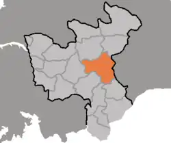 Map of North Hwanghae showing the location of Singye | |
| Country | North Korea |
| Province | North Hwanghae Province |
| Area | |
• Total | 725.7 km2 (280.2 sq mi) |
| Population (2008[1]) | |
• Total | 78,573 |
| • Density | 110/km2 (280/sq mi) |
Sin'gye County is a county in North Hwanghae province, North Korea. It is a mining district with abandoned molybdenum and copper mines.[2]
Climate
| Climate data for Singye (1991–2020) | |||||||||||||
|---|---|---|---|---|---|---|---|---|---|---|---|---|---|
| Month | Jan | Feb | Mar | Apr | May | Jun | Jul | Aug | Sep | Oct | Nov | Dec | Year |
| Mean daily maximum °C (°F) | 0.4 (32.7) | 3.5 (38.3) | 10.1 (50.2) | 17.5 (63.5) | 23.3 (73.9) | 27.3 (81.1) | 28.3 (82.9) | 29.2 (84.6) | 25.8 (78.4) | 19.7 (67.5) | 10.2 (50.4) | 2.1 (35.8) | 16.5 (61.7) |
| Daily mean °C (°F) | −5.2 (22.6) | −2.1 (28.2) | 3.9 (39.0) | 10.7 (51.3) | 16.7 (62.1) | 21.5 (70.7) | 24.0 (75.2) | 24.4 (75.9) | 19.6 (67.3) | 12.7 (54.9) | 4.5 (40.1) | −3.0 (26.6) | 10.6 (51.1) |
| Mean daily minimum °C (°F) | −10.4 (13.3) | −7.4 (18.7) | −1.7 (28.9) | 4.3 (39.7) | 10.7 (51.3) | 16.5 (61.7) | 20.5 (68.9) | 20.6 (69.1) | 14.5 (58.1) | 6.6 (43.9) | −0.5 (31.1) | −7.4 (18.7) | 5.5 (41.9) |
| Average precipitation mm (inches) | 10.3 (0.41) | 16.2 (0.64) | 23.3 (0.92) | 45.3 (1.78) | 87.7 (3.45) | 99.1 (3.90) | 314.6 (12.39) | 272.2 (10.72) | 89.9 (3.54) | 38.0 (1.50) | 39.8 (1.57) | 17.2 (0.68) | 1,053.6 (41.48) |
| Average precipitation days (≥ 0.1 mm) | 3.9 | 3.7 | 4.3 | 5.8 | 7.2 | 8.1 | 12.7 | 11.0 | 5.7 | 3.9 | 6.3 | 5.8 | 78.4 |
| Average snowy days | 3.9 | 3.0 | 1.3 | 0.2 | 0.0 | 0.0 | 0.0 | 0.0 | 0.0 | 0.0 | 1.3 | 4.2 | 13.9 |
| Average relative humidity (%) | 68.1 | 65.4 | 65.0 | 62.7 | 68.7 | 73.9 | 84.2 | 83.0 | 77.0 | 71.7 | 73.3 | 70.2 | 71.9 |
| Source: Korea Meteorological Administration[3] | |||||||||||||
Administrative divisions
Sin'gye county is divided into 1 ŭp (town) and 27 ri (villages):
|
|
Transport
Sin'gye county is served by three stations on the Ch'ŏngnyŏn Ich'ŏn line of the Korean State Railway.
References
- ^ North Korea: Administrative Division
- ^ "Kamuri Mining District, Singye County, North Hwanghae Province, North Korea". www.mindat.org.
- ^ "30 years report of Meteorological Observations in North Korea (1991 ~ 2020)" (PDF) (in Korean). Korea Meteorological Administration. pp. 221, 327, and 345. Archived (PDF) from the original on 29 January 2022. Retrieved 24 March 2022.
