Stutzheim-Offenheim
Stutzheim-Offenheim | |
|---|---|
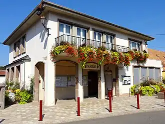 The town hall in Stutzheim | |
| Coat of arms | |
Location of Stutzheim-Offenheim | |
 Stutzheim-Offenheim  Stutzheim-Offenheim | |
| Coordinates: 48°37′53″N 7°37′10″E / 48.6314°N 7.6194°E | |
| Country | France |
| Region | Grand Est |
| Department | Bas-Rhin |
| Arrondissement | Saverne |
| Canton | Bouxwiller |
| Intercommunality | CC Kochersberg |
| Government | |
| • Mayor (2020–2026) | Jean-Charles Lambert[1] |
Area 1 | 7.14 km2 (2.76 sq mi) |
| Population (2022)[2] | 1,628 |
| • Density | 230/km2 (590/sq mi) |
| Time zone | UTC+01:00 (CET) |
| • Summer (DST) | UTC+02:00 (CEST) |
| INSEE/Postal code | 67485 /67370 |
| Elevation | 150–181 m (492–594 ft) |
| 1 French Land Register data, which excludes lakes, ponds, glaciers > 1 km2 (0.386 sq mi or 247 acres) and river estuaries. | |
Stutzheim-Offenheim (French pronunciation: [ʃtytsaim ɔfənaim]; German: Stützheim-Offenheim) is a commune in the Bas-Rhin department in Grand Est in north-eastern France.[3]
On 1 May 1972, Stutzheim-Offenheim was created as a fusion of Stutzheim and Offenheim.[4]
Landmarks
The church, Église Saint-Arbogast d'Offenheim, is a local registered Monument historique.
See also
References
- ^ "Répertoire national des élus: les maires". data.gouv.fr, Plateforme ouverte des données publiques françaises (in French). 2 December 2020.
- ^ "Populations de référence 2022" (in French). The National Institute of Statistics and Economic Studies. 19 December 2024.
- ^ INSEE commune file
- ^ Des villages de Cassini aux communes d'aujourd'hui: Commune data sheet Stutzheim-Offenheim, EHESS (in French).
External links
Wikimedia Commons has media related to Stutzheim-Offenheim.