Aranga
Concello de Aranga | |
|---|---|
Municipality | |
 | |
 Coat of arms | |
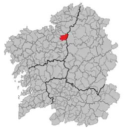 Situation of Aranga within Galicia | |
| Coordinates: 43°14′2″N 8°0′57″W / 43.23389°N 8.01583°W | |
| Country | |
| Area | |
• Total | 120.49 km2 (46.52 sq mi) |
| Population (2018)[1] | |
• Total | 1,894 |
| • Density | 16/km2 (41/sq mi) |
| Time zone | UTC+1 (CET) |
| • Summer (DST) | UTC+2 (CEST) |
Aranga is a municipality in the autonomous community of Galicia, Spain in the province of A Coruña with an area of 120.49 km2 (46.52 mi2), population of 2,181 inhabitants (INE, 2008). It is situated in the comarca of Betanzos.
Demography
| Year | Pop. | ±% |
|---|---|---|
| 1900 | 4,710 | — |
| 1930 | 4,980 | +5.7% |
| 1950 | 4,618 | −7.3% |
| 1981 | 2,723 | −41.0% |
| 2004 | 2,274 | −16.5% |
See also
List of municipalities in A Coruña
References
- ^ Municipal Register of Spain 2018. National Statistics Institute.